More Vivacity sensors for Dartford

Installation is part of UK’s Adept Live Labs trial for traffic management and better road design
By David Arminas February 7, 2022 Read time: 2 mins
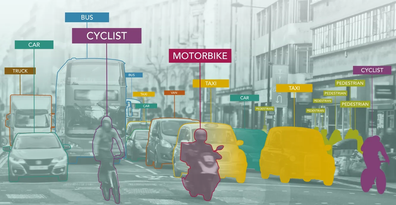
Transport planners have also used near-miss analysis between vehicles and other vehicles as well as with pedestrians and cyclists to better understand these conflicts (image courtesy Vivacity Labs)

Vivacity Labs is installing more traffic monitoring sensors in Dartford, England as part of a smart city initiative to improve urban road designs.

Working in collaboration with Kent County Council and its maintenance partner Amey, Vivacity is putting in an additional 18 sensors following the successful installation of 32 insight sensors in February last year.

Using the anonymous smart data collected from the original 32 sensors, transport planners have been able to understand how road users interact with transport infrastructure and each other.

The combination of real-time data and predictive algorithms is enabling authorities to identify areas for road layout or infrastructure improvements and ultimately design a better road user experience.

Transport planners have also used near-miss analysis between vehicles and vehicles, pedestrians and cyclists to better understand these conflicts along with the traffic conditions that preceded them. With this knowledge, planners can “design-out” inherent road layout risks.

“As well as helping to make safer communities, these sensors will play their part in delivering our strategic aim of having no deaths on our county’s roads by 2050,” David Brazier, Kent council member for highways and transport.

The latest sensors in Dartford will count and classify the modes of transport using the highways at any given time, as well as monitor the usage and speeds of cars, buses, bicycles and pedestrians.

“Having accurate and detailed data is the key success when it comes to implementing new road schemes and network changes,” said Mark Nicholson, Vivacity Labs co-founder.

The work is part of the Adept Smart Places Live Labs programme, a two-year €27.23 million project funded by the UK’s Department for Transport and supported by project partners SNC-Lavalin’s Atkins business, EY, Kier, 02, Ringway and WSP.

For more information on companies in this article

Related Content

  • Traffic management turns to machine vision
    June 1, 2016
    Traffic engineers can use the latest advances in vision technology to streamline and enhance traffic management. The idea of using one camera to perform all functions at an intersection is attractive to authorities for many reasons and camera supplier Gridsmart says it can make this happen. Its Bell Camera offers a horizon to horizon view that includes the centre of the intersection where vehicles, bicycles and pedestrians cross paths and it can be used for traffic light actuation, traffic data collection a
  • TfL wins international road safety award
    December 19, 2016
    Transport for London (TfL) has been recognised with the Prince Michael of Kent Road Safety Awards for its work to improve the safety of cyclists, pedestrians and motorcyclists in London. Analysis of police collision and travel demand data led TfL to put in place a range of initiatives which contributed to a three per cent drop in the number of people killed and seriously injured on London’s streets (2,092) in 2015, its lowest ever level. Projects included the launch of the Safer Lorry Scheme, the in
  • 3D perception at centre of Chattanooga safety case
    April 14, 2023
    Nearly 1.24 million people die every year in crashes, with 27% of all road traffic deaths attributed to pedestrians and cyclists on city streets, according to the World Health Organisation.
  • Iteris highlights local solutions in San Jose
    June 13, 2016
    Iteris is here at ITS America 2016 San Jose to highlight the company’s ITS solutions in the Bay Area. Santa Clara County leads the charge by using performance measurement systems at the arterial level with real-time Bluetooth data and turning movement count data. By aggregating the count data at intersections and utilising sophisticated algorithms for analysis, Iteris’ system provides speed, flow, and occupancy data for turning movement on the main corridors. Algorithms make short-term flow predictions t