PTV uses York as a model

Optima software is helping UK city's traffic controllers to test alternative road scenarios
By Adam Hill June 14, 2021 Read time: 2 mins
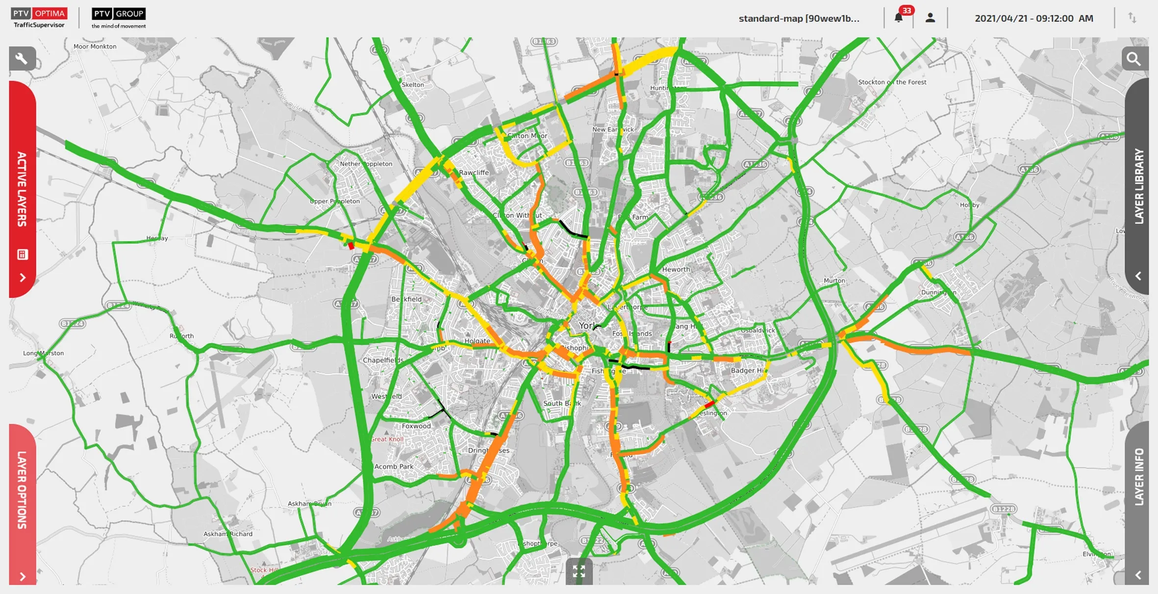
PTV's York Optima real-time model offers a rolling prediction of traffic conditions (image credit: PTV Group)

The northern English city of York has installed what it says is the first real-time transport model to be used for live traffic management in Great Britain.

PTV Group's predictive traffic modelling software Optima has been deployed as part of York’s Smarter Travel Evolution Programme (Step), which is funded by the UK government.

The York Optima real-time model offers a rolling prediction of traffic conditions, combining offline dynamic transport models with live traffic data, integrated with 100 live traffic flow sensors and more than 100 live signal controllers, with speed data across the network provided by TomTom.

The solution is designed to provide the control room with a view of what is happening across the network, not just in those places with sensors or CCTV.

Optima also enables the control room to test alternative scenarios for the next hour, day or weeks into the future, allowing planners to see how various changes would affect congestion.

Network monitoring operators - who manually implement new plans and signal changes to ease network issues - can now adopt a more proactive approach in monitoring and influencing the network, PTV says.

PTV UK technical director Michael Oliver says the "conflation of transport planning, traffic engineering and real-time data can deliver an impressive traffic management solution”.

Dave Atkinson, head of programmes and smart place at City of York Council, says: "We’re able to predict future traffic levels based on our live traffic behaviour and manage the flow of traffic better in busy periods by adjusting traffic lights to best suit traffic conditions.”

The project team, led by City of York Council, comprised consultancy firm Wood Group, PTV and independent strategic modelling experts RelativeGap.

For more information on companies in this article

Related Content

  • Making transportation systems safer and more sustainable with connectivity
    August 6, 2021
    Connectivity will make transportation systems safer and more sustainable as Anne-Lise Thieblemont of Qualcomm outlines
  • Cooperative systems - traffic management centres of the future?
    February 1, 2012
    What will the traffic management centre of the future see and do? TNO's Frans op de Beek, who was responsible for putting together the Cooperative Mobility Demonstrations which included the Traffic Management Centre at this year's Intertraffic exhibition in Amsterdam, offers some insights. The road tours and demonstrations which took place at this year's Intertraffic to mark the conclusion of COOPERS, CVIS and SAFESPOT, the European Commission's (EC's) three major cooperative mobility projects, gave visitor
  • Colorado DoT locates data-rich environment
    January 14, 2020
    Colorado DoT and Esri have been cooperating to unlock data’s potential. Jason Barnes finds out what that has to do with firing a howitzer at snowy mountains – and exactly why things that happened in the past point the way towards future proofing
  • Bridging the highway travel information gap
    March 14, 2012
    A new traffic management solution is attempting to bridge the gap in information available on freeways and arterial roadways. Andrew Bardin Williams reports. Agencies responsible for national networks of roads around the world have the ability to measure, analyse and disseminate accurate travel information to drivers. Millions of dollars go into data collection infrastructure to collect traffic congestion and travel time information on major freeways or highways. For example, a driver on the I-210 in the Lo