The northern English city of York has installed what it says is the first real-time transport model to be used for live traffic management in Great Britain.
PTV Group's predictive traffic modelling software Optima has been deployed as part of York’s Smarter Travel Evolution Programme (Step), which is funded by the UK government.
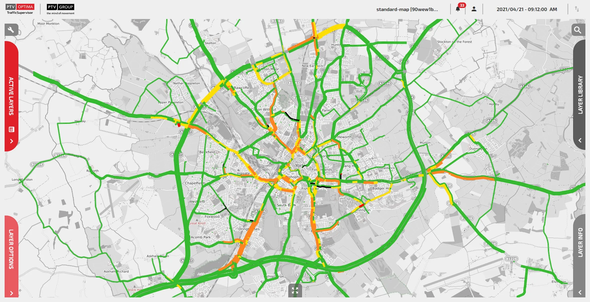
The York Optima real-time model offers a rolling prediction of traffic conditions, combining offline dynamic transport models with live traffic data, integrated with 100 live traffic flow sensors and more than 100 live signal controllers, with speed data across the network provided by TomTom.
The solution is designed to provide the control room with a view of what is happening across the network, not just in those places with sensors or CCTV.
Optima also enables the control room to test alternative scenarios for the next hour, day or weeks into the future, allowing planners to see how various changes would affect congestion.
Network monitoring operators - who manually implement new plans and signal changes to ease network issues - can now adopt a more proactive approach in monitoring and influencing the network, PTV says.
PTV UK technical director Michael Oliver says the "conflation of transport planning, traffic engineering and real-time data can deliver an impressive traffic management solution”.
Dave Atkinson, head of programmes and smart place at City of York Council, says: "We’re able to predict future traffic levels based on our live traffic behaviour and manage the flow of traffic better in busy periods by adjusting traffic lights to best suit traffic conditions.”
The project team, led by City of York Council, comprised consultancy firm Wood Group, PTV and independent strategic modelling experts RelativeGap.