Geotab ITS works at Altitude

Altitude is expected to help gov entities identify areas for traffic improvements
By Ben Spencer October 4, 2021 Read time: 1 min
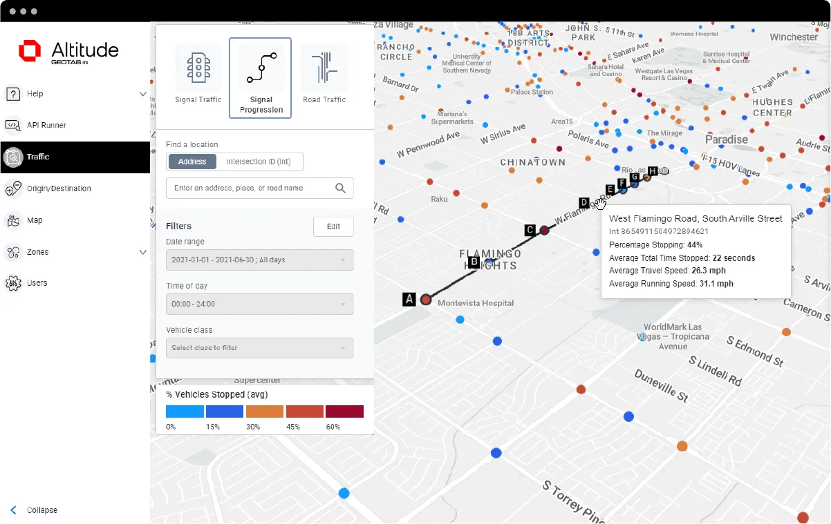
Geotab says transportation leaders gain extra layer of data to resolve mobility challenges (image credit: Geotab)

Geotab's ITS business has released an analytics platform designed to provide governments with insights that can be used to improve their transportation networks. 

Geotab ITS aggregates data from connected vehicles to produce actionable transportation insights and urban analytics for transportation leaders across the United States and Canada. These insights are provided in an open platform so that partners and customers can interact with the data and integrate it into internal systems, processes and workflows. 

The new Altitude platform is expected to allow government entities to identify areas for traffic improvements, model and predict the impact of specific interventions and monitor their effectiveness.

Geotab says Altitude combines sensors and other measurement tools with rich data analytics, and can help governments make improvement decisions to increase throughput and eliminate bottlenecks.

Mike Branch, vice president of data and analytics at Geotab, says: “With Altitude, transportation leaders gain an additional layer of perspective around traffic data to quickly identify and resolve mobility challenges like freight bottlenecks and struggles around last-mile delivery before they become a problem. 

“And for problems that already exist, Altitude shines a light onto the root causes of the problems by adding much needed context so that governments can adjust course as needed.”

For more information on companies in this article

Related Content

  • OPINION: ITS must be included in EU Green Deal
    September 14, 2022
    To reach the objectives of the European Green Deal, a classification system has been developed to identify environmentally-sustainable activities. However, Richard Lax of Kapsch TrafficCom is worried that it might not have the intended effect – and ITS could lose out as a result…
  • EnrouteQ joins UN Global Compact 
    May 11, 2021
    Transit as a Service specialist offers transport optimisation as part of United Nations initiative
  • Advanced ITS truck screening aids border control
    March 14, 2012
    State-of-the-art ITS technologies are being deployed for tracking of commercial vehicles at the US-Mexico border in Arizona, reports Pete Goldin. The border between the US and Mexico may be the epitome of America's wild west, but this remote desert frontier is being tamed by the Arizona Department of Transportation (ADOT) with a state-of-the-art ITS system. A comprehensive port-of-entry (POE) screening system is being deployed at the Mariposa Port of Entry – one of the busiest land ports in the nation – at