Geotab ITS works at Altitude

Altitude is expected to help gov entities identify areas for traffic improvements
By Ben Spencer October 4, 2021 Read time: 1 min
Geotab says transportation leaders gain extra layer of data to resolve mobility challenges (image credit: Geotab)

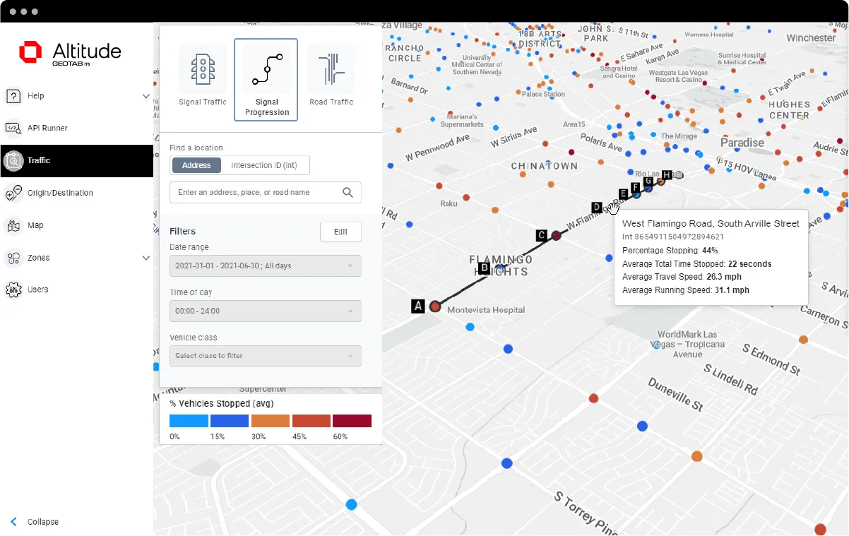
Geotab's ITS business has released an analytics platform designed to provide governments with insights that can be used to improve their transportation networks. 

Geotab ITS aggregates data from connected vehicles to produce actionable transportation insights and urban analytics for transportation leaders across the United States and Canada. These insights are provided in an open platform so that partners and customers can interact with the data and integrate it into internal systems, processes and workflows. 

The new Altitude platform is expected to allow government entities to identify areas for traffic improvements, model and predict the impact of specific interventions and monitor their effectiveness.

Geotab says Altitude combines sensors and other measurement tools with rich data analytics, and can help governments make improvement decisions to increase throughput and eliminate bottlenecks.

Mike Branch, vice president of data and analytics at Geotab, says: “With Altitude, transportation leaders gain an additional layer of perspective around traffic data to quickly identify and resolve mobility challenges like freight bottlenecks and struggles around last-mile delivery before they become a problem. 

“And for problems that already exist, Altitude shines a light onto the root causes of the problems by adding much needed context so that governments can adjust course as needed.”

For more information on companies in this article

Related Content

  • More openness - the simple answer to transport's data issues
    October 22, 2018
    Public transit agencies create a lot of data – but using it constructively to solve transportation issues has been a problem. Ben Winokur and Luke Segars think they have the answer: greater openness. Today, more people are connected through smartphones than ever before - and they’re using them for more than texting and calling. People are searching for jobs on their devices, dating, shopping and even managing their finances. But Forbes reports that only a select few companies leverage all the technology at
  • Lidar lets planners see big picture in Chattanooga
    April 14, 2025
    The city of Chattanooga, Tennessee, is attempting to make its streets safer by using the largest deployment of Lidar-based traffic detection in the US. Adam Hill reports…
  • Five ways data can reshape transit
    April 8, 2024
    Mass transit ridership is getting back onto its feet after the dent which Covid put into the use of public transport. Now we need to continue that momentum, says Miki Szikszai of Snapper Services – and the UK can learn from examples in the rest of the world
  • The Ray maps ROW solar hot spots 
    October 25, 2021
    Tool analyses how suitable ROW locations may be for solar placement