Geotab ITS works at Altitude

Altitude is expected to help gov entities identify areas for traffic improvements
By Ben Spencer October 4, 2021 Read time: 1 min
Geotab says transportation leaders gain extra layer of data to resolve mobility challenges (image credit: Geotab)

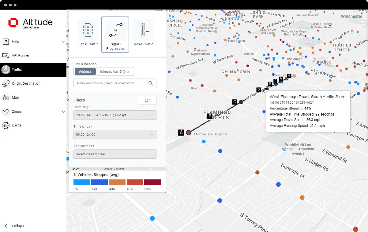
Geotab's ITS business has released an analytics platform designed to provide governments with insights that can be used to improve their transportation networks. 

Geotab ITS aggregates data from connected vehicles to produce actionable transportation insights and urban analytics for transportation leaders across the United States and Canada. These insights are provided in an open platform so that partners and customers can interact with the data and integrate it into internal systems, processes and workflows. 

The new Altitude platform is expected to allow government entities to identify areas for traffic improvements, model and predict the impact of specific interventions and monitor their effectiveness.

Geotab says Altitude combines sensors and other measurement tools with rich data analytics, and can help governments make improvement decisions to increase throughput and eliminate bottlenecks.

Mike Branch, vice president of data and analytics at Geotab, says: “With Altitude, transportation leaders gain an additional layer of perspective around traffic data to quickly identify and resolve mobility challenges like freight bottlenecks and struggles around last-mile delivery before they become a problem. 

“And for problems that already exist, Altitude shines a light onto the root causes of the problems by adding much needed context so that governments can adjust course as needed.”

For more information on companies in this article

Related Content

  • Development of cooperative driving applications for work zones
    July 17, 2012
    The German AKTIV project is researching several cooperative driving applications for use in work zones. PTV's Michael Ortgiese details progress. The steep increases in traffic volumes predicted back in the early 1990s have unfortunately been proven to be more than accurate. In Germany, the AKTIV project continues to look into cooperative technologies' potential to reduce the impact of those increased traffic volumes and keep traffic moving despite limitations in infrastructure capacity.
  • Saving the smartphone zombies from themselves
    October 15, 2020
    As roads – particularly in cities – become busier, companies are fielding a steady trickle of products to keep pedestrians safe and vehicles flowing
  • Simulating the effects of optimal mobility
    May 30, 2024
    Simulation-based optimisation is the foundation for real-time predictive analytics when it comes to optimal traffic signal programming, explain Sunny Chakravarty of Econolite and Lorenzo Meschini of PTV Group
  • Revealed: future of mobility in Hamburg
    October 7, 2021
    From 11-15 October, the ITS World Congress will present a myriad of innovations