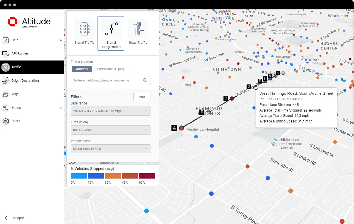
Geotab ITS works at Altitude

Altitude is expected to help gov entities identify areas for traffic improvements
By Ben Spencer October 4, 2021 Read time: 1 min
Geotab says transportation leaders gain extra layer of data to resolve mobility challenges (image credit: Geotab)

Geotab's ITS business has released an analytics platform designed to provide governments with insights that can be used to improve their transportation networks. 

Geotab ITS aggregates data from connected vehicles to produce actionable transportation insights and urban analytics for transportation leaders across the United States and Canada. These insights are provided in an open platform so that partners and customers can interact with the data and integrate it into internal systems, processes and workflows. 

The new Altitude platform is expected to allow government entities to identify areas for traffic improvements, model and predict the impact of specific interventions and monitor their effectiveness.

Geotab says Altitude combines sensors and other measurement tools with rich data analytics, and can help governments make improvement decisions to increase throughput and eliminate bottlenecks.

Mike Branch, vice president of data and analytics at Geotab, says: “With Altitude, transportation leaders gain an additional layer of perspective around traffic data to quickly identify and resolve mobility challenges like freight bottlenecks and struggles around last-mile delivery before they become a problem. 

“And for problems that already exist, Altitude shines a light onto the root causes of the problems by adding much needed context so that governments can adjust course as needed.”

For more information on companies in this article

Related Content

  • Why Netflix could overcome road pricing resistance
    October 28, 2019
    As the US moves towards a national road usage charging trial, education is paramount – and subscription services like Netflix might help people understand why the money is needed, writes Bill Cramer
  • From paved roads to data highways
    December 19, 2024
    The vehicles of the future are coming; and with them, so are the cities of the future. But only if cities are prepared to make the investment, suggests Yagil Tzur
  • Iteris explores intelligent infrastructure 
    April 30, 2021
    Iteris and Continental will utilise automotive sensors and I2V connectivity
  • Machine vision - cameras for intelligent traffic management
    January 25, 2012
    For some, machine vision is the coming technology. For others, it’s already here. Although it remains a relative newcomer to the ITS sector, its effects look set to be profound and far-reaching. Encapsulating in just a few short words the distinguishing features of complex technologies and their operating concepts can sometimes be difficult. Often, it is the most subtle of nuances which are both the most important and yet also the most easily lost. Happily, in the case of machine vision this isn’t the case: