Geotab ITS works at Altitude

Altitude is expected to help gov entities identify areas for traffic improvements
By Ben Spencer October 4, 2021 Read time: 1 min
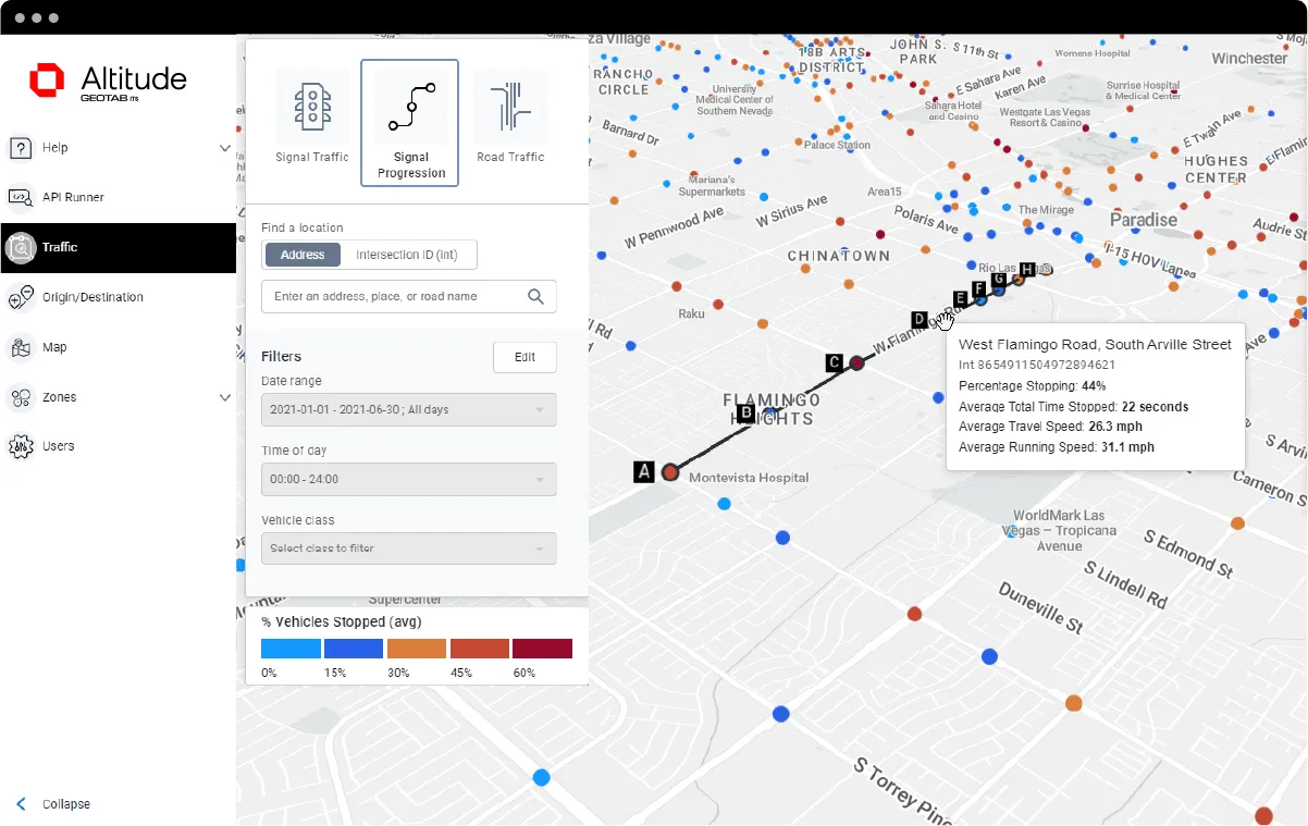
Geotab says transportation leaders gain extra layer of data to resolve mobility challenges (image credit: Geotab)

Geotab's ITS business has released an analytics platform designed to provide governments with insights that can be used to improve their transportation networks. 

Geotab ITS aggregates data from connected vehicles to produce actionable transportation insights and urban analytics for transportation leaders across the United States and Canada. These insights are provided in an open platform so that partners and customers can interact with the data and integrate it into internal systems, processes and workflows. 

The new Altitude platform is expected to allow government entities to identify areas for traffic improvements, model and predict the impact of specific interventions and monitor their effectiveness.

Geotab says Altitude combines sensors and other measurement tools with rich data analytics, and can help governments make improvement decisions to increase throughput and eliminate bottlenecks.

Mike Branch, vice president of data and analytics at Geotab, says: “With Altitude, transportation leaders gain an additional layer of perspective around traffic data to quickly identify and resolve mobility challenges like freight bottlenecks and struggles around last-mile delivery before they become a problem. 

“And for problems that already exist, Altitude shines a light onto the root causes of the problems by adding much needed context so that governments can adjust course as needed.”

For more information on companies in this article

Related Content

  • ITS need not reinvent machine vision
    October 29, 2014
    Machine vision techniques hold the potential to solve a multitude of challenges facing the transportation sector Optical Character Recognition (OCR), the base technology for number plate recognition, has been in industrial use for more than three decades. It is a prime example of how, instead of having to start from scratch, the transportation sector can leverage and adapt the machine vision expertise already used in industry in order to provide robust solutions with new capabilities. “The real val
  • Data goldmines offer rich pickings
    May 31, 2013
    Astronomical is not too grand a term to describe the current rate of growth in transportation-related data. Massive amounts of traffic related information, such as speed, volume, incidents and weather are being generated every second by road operators and users alike. Big data’ derives its name from the sheer amount and complexity of available raw data. Its potential value is starting to emerge among the intelligent transportation systems community. A gold rush is taking place to capture this value, with da
  • Here strengthens navigation with What3words
    November 4, 2020
    OEMs can integrate addressing service to customers via Here Search API
  • Ambarella puts AI tech into Motional AVs
    March 12, 2021
    Ambarella says AI processors work with autonomous vehicles' Lidar, camera and radar sensors