Russia solution digitises city traffic

Moscow-based Urbantech's mobile laboratories use machine vision and Lidars
By Eugene Gerden May 25, 2021 Read time: 2 mins
Digitisation of a 'standard' city takes two weeks, says Urbantech (© BiancoBlue | Dreamstime.com)

A new solution for the digitalisation of a city's roads and infrastructure has been officially presented in Russia.

Created by Moscow-based Urbantech, one of the leading Russian designers of ITS solutions, it was showcased at Intelligent  Transport Systems - Regions, the ITS exhibition recently held in the Kaluga region. 

According to the developers, the solution helps regional transport authorities gather up-to-date data on the condition of road facilities, to take prompt measures to restore damaged infrastructure, as well as to automatically prepare all the necessary documentation for the organisation of a reliable system of road traffic.

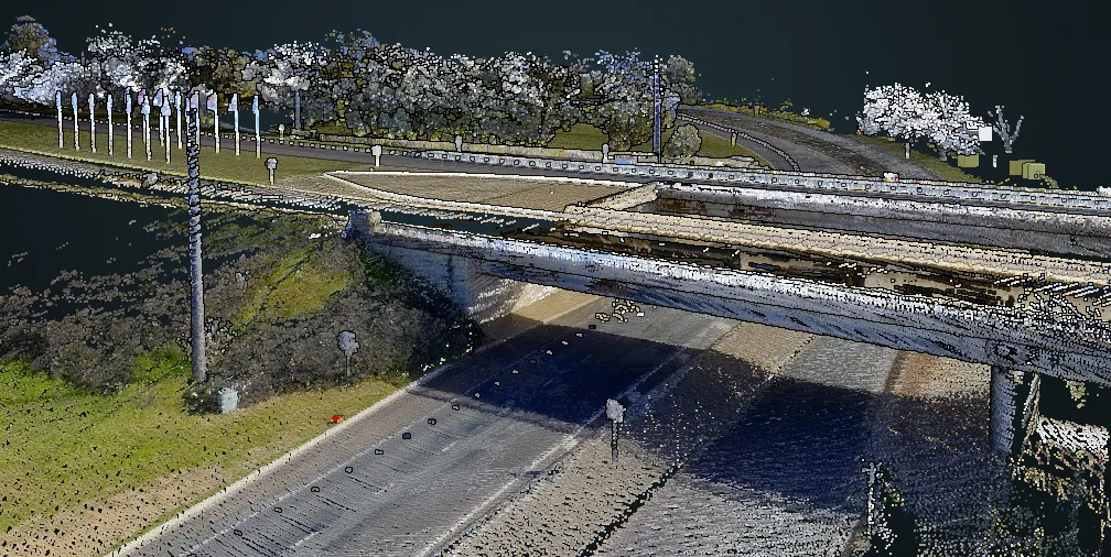
Mobile laboratories carry out automated digitisation of highways as they pass through a city to collect reliable information - with accurate measurements of coordinates and parameters of objects with panoramic photographs.

The system uses machine vision, neural network analysis and Lidars, allowing the online regime to identify and classify various road objects (traffic lights, road signs, road surface) and their current state with a positioning accuracy of 10cm.

The data is then supplied to transport authorities. 

One mobile laboratory can cover 150km per day, with photo panoramas and object passports provided the next day.

Digitisation of a 'standard' city (with a road network up to 1,000 km and mainly two-lane traffic in each direction) takes no more than two weeks. 

The system can be used not only for primary digitisation, i.e. the creation of a digital duplicate, but also for regular monitoring of road infrastructure.

The new data is placed on the existing duplicate, which allows weaknesses of road traffic to be identified in a particular city or a region, which means authorities can take necessary measures to prevent possible road accidents and congestion.

For more information on companies in this article

Related Content

  • Single system simplicity for smarter city transport
    February 23, 2017
    All encompassing, city-wide transport monitoring and control systems are beginning to make their way onto the market, as Colin Sowman hears. The futuristic vision of cities where everything is connected and operated with maximum efficiency by a gigantic computer remains a distant prospect but related sectors and services are beginning to coalesce: transport monitoring and control for instance.
  • Kenya WIM system cuts four days off journey times
    March 18, 2014
    Shem Oirere looks at how weigh-in-motion is helping to streamline the trucking industry in Kenya. Kenya, East Africa’s largest economy, is streamlining trucking operations on its section of the 8,800km Northern Corridor. It is both reducing the number of weighbridges and automating the remaining ones in an effort to improve efficiency and eliminate corruption.The Northern Corridor is a major gateway through Kenya to the landlocked countries of Uganda, Rwanda, Burundi, Democratic Republic of Congo and Sou
  • Browsing welcome in Here's Lidar library
    January 18, 2022
    Company says it hopes to decrease the costs associated with data collection surveys 
  • Parifex: collect data to help cities become smarter
    November 18, 2020
    Traffic data collection is a key topic for cities and mobility digitalisation. It is predicted that some 70 per cent of the world’s population will live in a city by 2050. That is why cities are hurrying up to optimise population flows and provide efficient means of transport.