Ansys and Velodyne are developing software models of automotive Lidar sensors to provide improved hazard identification capabilities for highly advanced autonomous vehicles (AV).
Ansys says one of the challenges facing many advanced driver assistance systems (ADAS) is the robustness of the system to dependably test and recognise potentially dangerous “edge case scenarios”.
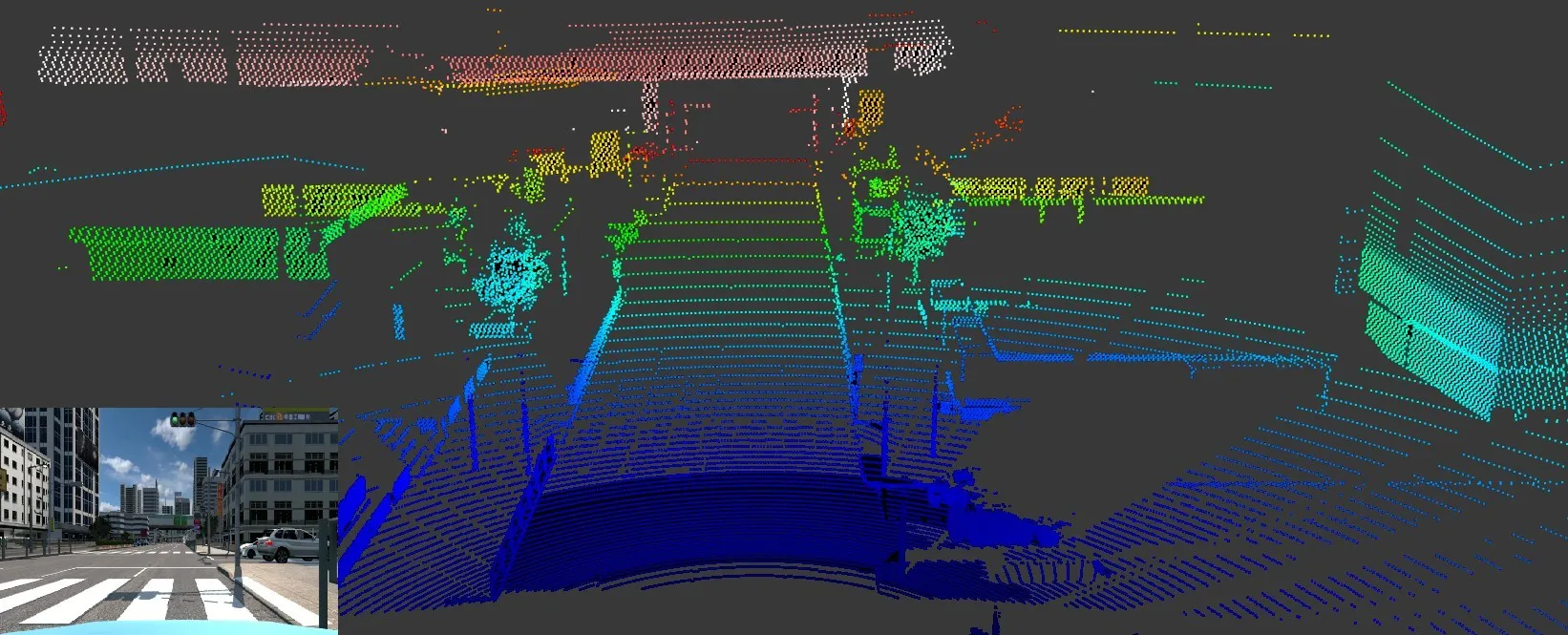
To manage these anomalies, the company points out that AVs require Lidar as a redundant detection technology that effectively locates and tracks objects across a wide range of operational situations.
However, Lidar sensors must perform “countless miles of exhaustive testing” to be validated as reliable, which “radically increases the development cost of the system”.
Velodyne is to integrate an encrypted 'black box' physics-based Lidar sensor model into Ansys VRxperience, a real-time interactive driving simulator that models, evaluates and validates lidar designs within a realistic virtual environment.
Ansys says this capability helps engineers model countless driving scenarios across millions of miles and substantially reduce physical tests.
VRxperience is expected to reduce development costs for OEMs integrating Velodyne into their ADAS portfolio by enabling by enhancing lidar placement within AVs and validating their performance.
Velodyne Lidar CEO Anand Gopalan says: “Our collaboration helps engineers virtually run their ADAS applications in challenging roadway conditions so they can build solutions that achieve safe navigation and collision avoidance."
Prith Banerjee, chief technology officer at Ansys, says: "Using VRxperience, OEMs will validate the Lidar's software stack and have full access to a validated sensor model, while preserving Velodyne's IP. This will enable Velodyne to rapidly and cost-effectively design trailblazing Lidar sensors and significantly speed delivery to market."