Swedish software company Klimator has partnered with Lulea University of Technology and the Swedish Transport Administration (Trafikverket) to model road friction on roads during winter.
Klimator, based in Gothenburg, Sweden, provides software for predictive and detective road weather systems.
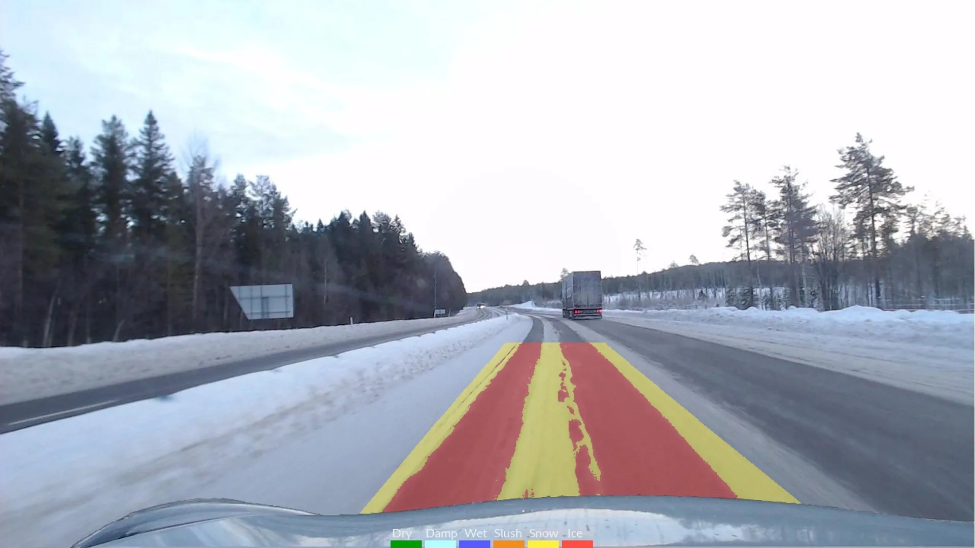
The project, with a contract value of around €120,000, will run for two and a half years using Klimator's Ahead, a sensor fusion software solution that combines a laser sensor and a camera to detect road conditions. Locally integrated, it can detect the road condition, in real-time, 25m ahead of the vehicle.
Ahead will combine with friction information from so-called floating car data (FCD) - typically, timestamped geo-localisation and speed data collected by moving vehicles.
For FCD collection, a participating vehicle acts as a moving sensor using an on-board GPS receiver or cellular phone.
The most common and widespread use of FCD is to determine traffic speed on the road network. Based on this data, traffic congestion can be identified, travel times calculated and traffic reports rapidly generated.
This is in contrast to stationary devices, such as traffic cameras, number plate recognition systems, and induction loops embedded in the roadway, since no additional hardware on the road network is necessary.
According to Klimator, the aim of the project is to address the problem with different frictions in different lanes over the same stretch of road, which mainly occurs during winter. As the difference in friction can be large over the same stretch of road, models need to be developed to enable the interpretation of FCD to demonstrate this.
This project is particularly important for the Swedish Transport Administration in order for the agency to monitor and follow-up winter road maintenance. The project's focus is, therefore, on developing a reliable interpretation of the friction estimate for each individual lane.
Ahead provides vehicle systems with information on prevailing road surface conditions, which increases the functionality, operability, and use of advanced driver support systems and autonomous driving technologies.
In June last year, Klimator signed a five-year agreement with Norwegian winter contractor Mesta, a government agency. The deal is for a step-by-step implementation of Klimator’s Road Status Information (RSI) software into Mesta's operations.
Klimator said at the time that the collaboration is part of Mesta’s plan to digitise and transform the company’s operations in winter road maintenance.
RSI is Software as a Service for winter maintenance contractors to help them make fact-based decisions. The platform on which RSI is built collects and processes data from a variety of different sources and integrates this with Klimator's advanced climate models to provide high-resolution road forecast forecasts.
These forecasts enable winter contractors to make critical decisions about when, where and how to take action for snow removal and de-icing. In winter road maintenance, there is a great focus on prevention.
Klimator says RSI provides highly-accurate forecasts with a very high degree of detail which makes it easier for winter contractors to plan and streamline their work - and that it can contribute to cost savings of up to 30%, a reduced climate footprint through reduced salting and safer roads to travel on.