StreetLight introduces Traffic Monitor

New tool can instantly pinpoint and visualise disruptions on traffic networks
By Adam Hill August 1, 2024 Read time: 2 mins
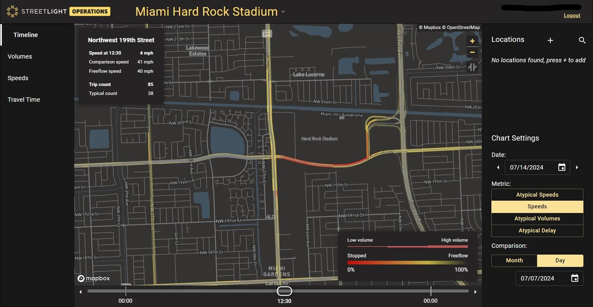
The delayed start to the Copa America Final in Miami created traffic issues

StreetLight Data, has introduced a real-time traffic disruption assessment product called Traffic Monitor.

The Jacobs subsidiary says it can instantly pinpoint and visualise disruptions - for example, with major sports events or climate-related problems on the network - as well as "their ripple effects throughout the network".

Laura Schewel, StreetLight CEO and VP of transportation software at Jacobs, says: "Customers can not only utilise comprehensive mobility information to manage and build infrastructure, they can also better operate that infrastructure in real-time, even in tough situations, all without ever installing physical sensors."

She adds: "Traffic is becoming more irregular – and traffic professionals have to cope with bigger disruptions ranging from storms to major events like the Copa America Final and World Cup.” 

Customers can view recent and ongoing traffic disruptions to understand the severity and duration, allowing rapid response, StreetLight says. This can include adjusting messaging to road users.

As it also shows the performance of traffic over time, Traffic Monitor also means it can help determine whether a certain event’s traffic was managed successfully, and can point to areas for improvement in the future.

Features include:

•    Daily route-based travel times
o    Improve detour planning by measuring travel times and observing routes that drivers take during unusual situations


•    Daily network-wide timeline view
o    Respond to residents with data-driven insights about actual conditions in disrupted locations


•    Daily average speeds
o    Show when speeds fall well below typical, enabling proactive identification and addressing of speeding hotspots in the disruption location to ensure safety


•    Real-time speeds and incidents
o    Dynamically adjust traffic assessment controls with Active Traffic Management


•    Historical volume & speed
o    Highlight times when volumes exceed threshold for lane closure, speeding up project completion with seasonally adjusted, optimised road and lane closure window

Related Content

  • August 18, 2015
    Preparing for unpredictable precipitation
    ITS solutions are helping streamline winter road maintenance for Delaware and Illinois, two states that must deal with dynamic weather and varying snowfall totals. Andrew Bardin Williams reports. Wilmington and Newark (pronounced new-ark) are two vastly different cities that sit on opposite ends of Delaware. Newark is a sleepy university town of roughly 30,000 residents abutting the state’s western border with Maryland and Pennsylvania, and often gets confused with its larger namesake in New Jersey.
  • June 17, 2016
    Less travel aggravation to blunt Aggieland fans’ motivation
    Returning travel times to normal within two hours of the end of a major football game was the challenge facing College Station, Adam Lyons explains how this was achieved. College Station, TX, also known as ‘Aggieland’, is located right in the middle of the Dallas/Fort Worth, San Antonio and Houston triangle making the city accessible to over 14 million Texans within less than a four-hour drive. One of the biggest draws to this area is Texas A&M University (TAMU) and the Aggie football games in the fall, mea
  • April 6, 2018
    The importance of going with the flow
    Ensuring worker safety and up-to-date driver information is crucial to ensure that roadworks are not a source of danger and delay. Andrew Williams looks at a scheme on the A14 in Cambridgeshire, UK. In recent years, portable workzone ITS solutions have emerged as important tools in the management of major roadworks and system upgrade projects - and are viewed as an increasingly vital means of ensuring any ongoing traffic flow disruption is kept to a minimum. The technology forms a central component of an
  • July 7, 2017
    Missouri’s smart solution for rural road monitoring
    David Crawford sees how Missouri is using commercially available information to rapidly improve monitoring and driver information on rural highways. Missouri is a predominantly rural state with the second largest number of farms in the country and agriculture the main occupation in 97 of its 114 counties. US statistics starkly reveal how road accidents in rural areas tend to be more serious than in urban regions and of the 32,000 US motorists killed each year, 54% die on roads in rural areas even though onl