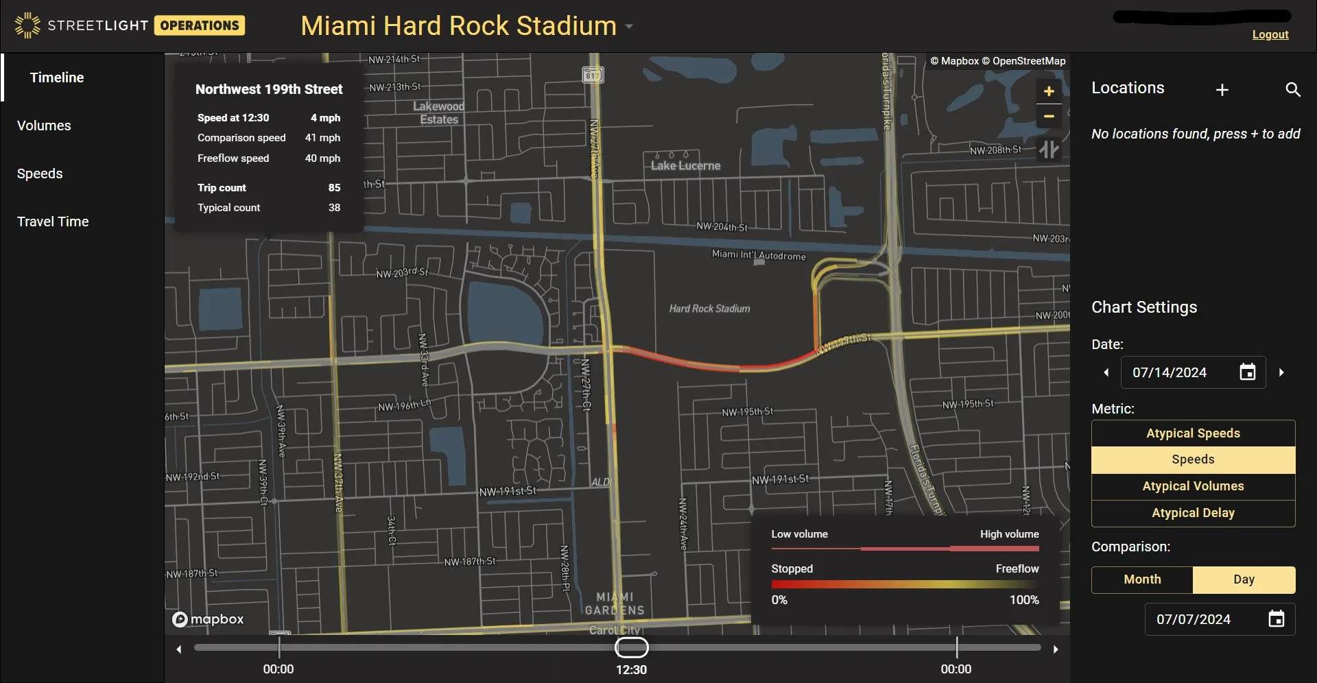
StreetLight introduces Traffic Monitor

New tool can instantly pinpoint and visualise disruptions on traffic networks
By Adam Hill August 1, 2024 Read time: 2 mins
The delayed start to the Copa America Final in Miami created traffic issues

StreetLight Data, has introduced a real-time traffic disruption assessment product called Traffic Monitor.

The Jacobs subsidiary says it can instantly pinpoint and visualise disruptions - for example, with major sports events or climate-related problems on the network - as well as "their ripple effects throughout the network".

Laura Schewel, StreetLight CEO and VP of transportation software at Jacobs, says: "Customers can not only utilise comprehensive mobility information to manage and build infrastructure, they can also better operate that infrastructure in real-time, even in tough situations, all without ever installing physical sensors."

She adds: "Traffic is becoming more irregular – and traffic professionals have to cope with bigger disruptions ranging from storms to major events like the Copa America Final and World Cup.” 

Customers can view recent and ongoing traffic disruptions to understand the severity and duration, allowing rapid response, StreetLight says. This can include adjusting messaging to road users.

As it also shows the performance of traffic over time, Traffic Monitor also means it can help determine whether a certain event’s traffic was managed successfully, and can point to areas for improvement in the future.

Features include:

•    Daily route-based travel times
o    Improve detour planning by measuring travel times and observing routes that drivers take during unusual situations


•    Daily network-wide timeline view
o    Respond to residents with data-driven insights about actual conditions in disrupted locations


•    Daily average speeds
o    Show when speeds fall well below typical, enabling proactive identification and addressing of speeding hotspots in the disruption location to ensure safety


•    Real-time speeds and incidents
o    Dynamically adjust traffic assessment controls with Active Traffic Management


•    Historical volume & speed
o    Highlight times when volumes exceed threshold for lane closure, speeding up project completion with seasonally adjusted, optimised road and lane closure window

For more information on companies in this article

Related Content

  • Travel times halve for tolling converts
    August 5, 2013
    The Port Mann Bridge in Vancouver is a prime example of how the latest ITS systems enable new infrastructures to be built and paid for while still providing additional user benefits. Vancouver has 2.2 million inhabitants and, like so many major cities, is divided into two by a river, the Frazer river. This combination makes Vancouver the second most congested city in North America and the most congested in Canada. Through the middle of the city runs the Trans-Canadian Highway 1 which crosses the Frazer Riv
  • Remote remedies help US authorities identify bridge deficiencies
    September 6, 2017
    Every day 185 million vehicles – cars, trucks, school buses, emergency response units - cross one or more of America’s 55,710 'structurally compromised' steel and concrete road bridges, the highest concentration of which are in Iowa (nearly 5,000), Pennsylvania and Oklahoma. Nearly 2,000 of these crossings are located on interstate highways, according to the American Road and Transportation Builders Association's recent analysis of the US Department of Transportation's 2016 National Bridge Inventory.
  • VanJee’s innovative lidar system on show
    April 18, 2024
    VanJee, a leading global ITS and lidar company headquartered in Beijing, has brought its innovative WLR-733 real-time scanning radar to Intertraffic. This impressive piece of kit is a mechanical lidar with 64 layers, boasting a powerful combination of features.
  • New opportunities in a data-rich future
    March 19, 2014
    Jason Barnes looks at where the detection and monitoring sector is heading. In the future, there will be no such thing as an un-instrumented road. Just a short time ago, that could have been a quote from a high-level policy document but with the first arrivals of vehicles with 802.11p connectivity – the door-opener to Vehicle-to-X (V2X) applications – it’s a statement which has increasing validity. The technology which uses our roads will also provide information on road conditions but V2X isn’t the only