Inrix has launched a software as a service (SaaS) application which it says makes managing traffic and corridor performance easier and cheaper.
Inrix IQ Signal Analytics joint platform delivers intersection and corridor analytics in a cloud-based platform for traffic professionals working in management, engineering, operations and maintenance.
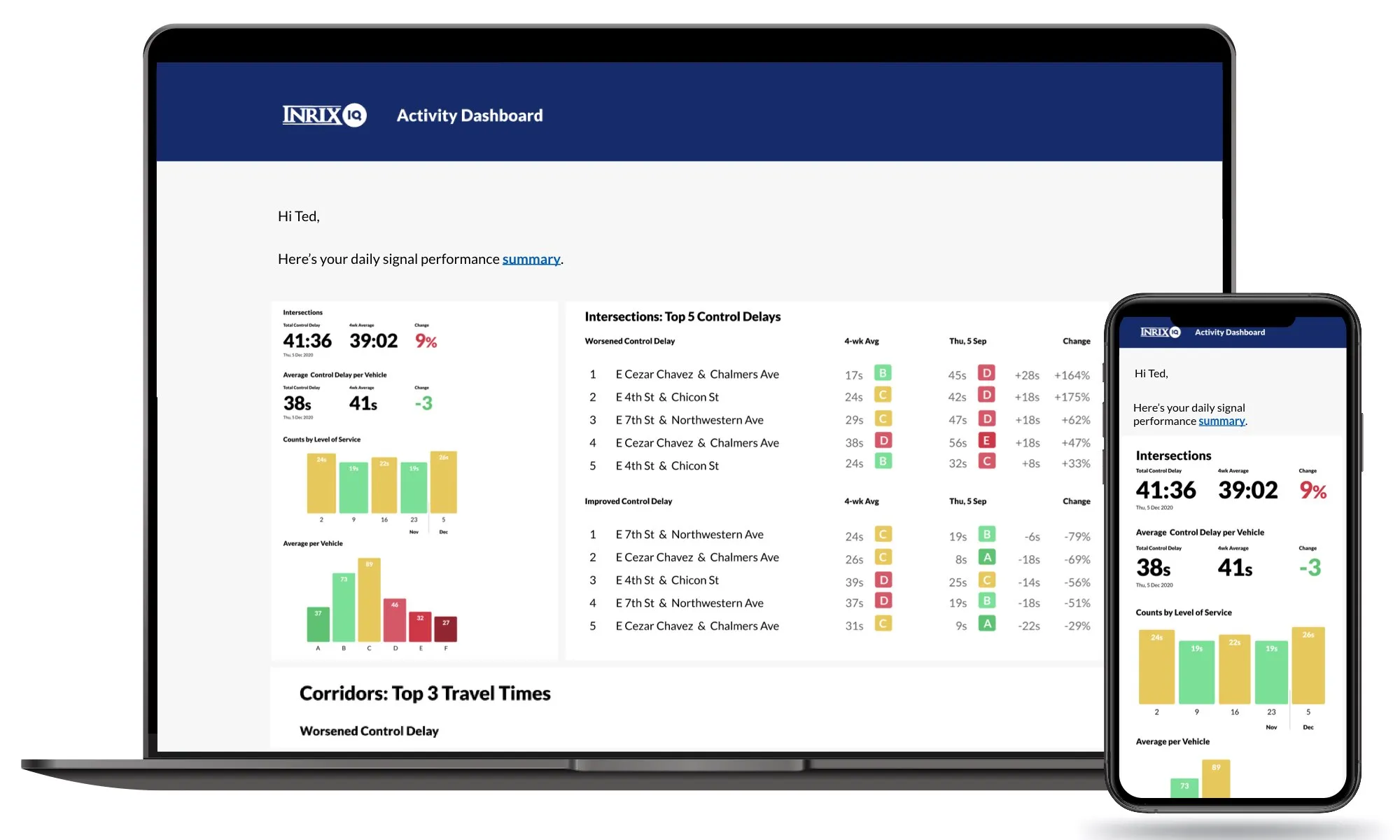
Signal Analytics is an intersection analytics platform based exclusively on anonymous connected vehicle data. It calculates metrics including control delay, split failures, turn ratio and volume at a lower cost than instrumenting an intersection.
Systemwide summary metrics are reported daily and presented in a web-based application available through Inrix IQ, a SaaS application suite for uncovering mobility insights.
Avery Ash, head of product management and strategy for Inrix IQ, says: “Signal Analytics is a robust set of visualisations and analytics that transforms complex data into easily understood, managed and optimised dashboards and reports that people can act on.”
Signal Analytics leverages more than 25 million trips and 300 million miles daily to deliver every metric necessary for operators to fully understand performance on more than 210,000 signalised intersections across the US, the company adds.
Customisable daily reports and dashboards highlight key metrics, problems and trends for intersections and corridors across a road network.
Advanced functionality such as user-defined date(s) for individual vehicle movement, utilise the Center for Advanced Transportation Technology Laboratory at the University of Maryland’s Regional Integrated Transportation Information System platform.
Scott Sedlik, senior vice president and general manager of public sector at Inrix, says: “Every transportation agency in America now has the ability to monitor and manage the performance of their entire traffic signals system without hardware. Agencies can prioritise system enhancements, saving time and dollars while providing near-ground-truth accuracy for all performance measures.”
The City of Austin’s Mobility Management Center, operated by signals consultant Kimley Horn, uses Inrix to track flow on 33 mobility corridors.
Kimley Horn traffic engineer Lance Ballard says: “In Austin, Signal Analytics has allowed us to quantitatively verify the extent of existing issues and the degree of improvement once adjustments are made. Corridor-based aggregation and regular reporting of trends will be huge for us. Now, we can be more proactive in identifying operational issues before residents complain.”