
Bluetooth sensors aid drivers during tunnel closures

Essential road resurfacing works in Melbourne, Australia, led to the closing of two major tunnels for five days over the Christmas period. Despite predictions of major congestion, extensive planning and the use of BlipTrack Bluetooth and wi-fi sensors at key locations, delays were minimised. 
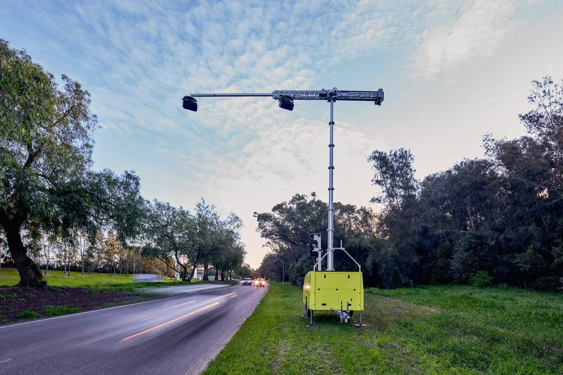
Installed by BlipTrack’s Australian partner, Austraffic, the sensors provided VicRoads highway department with data to assess how a diversion route was operating and to compare journey times with previous days or
February 5, 2014 Read time: 1 min
Essential road resurfacing works in Melbourne, Australia, led to the closing of two major tunnels for five days over the Christmas period.

Despite predictions of major congestion, extensive planning and the use of BlipTrack Bluetooth and wi-fi sensors at key locations, delays were minimised.

Installed by BlipTrack’s Australian partner, Austraffic, the sensors provided 4728 VicRoads highway department with data to assess how a diversion route was operating and to compare journey times with previous days or weeks, enabling VicRoads to warn drivers of expected delays.

For more information on companies in this article

Related Content

  • Wireless traffic monitoring from Intellidesign
    November 20, 2013
    provides integrated functionality that would normally require external modems or chargers, enabling the system to be quickly adapted to a very specific ITS applications or other remote telemetry requirement. The company’s wireless intelligent transportation systems platforms provide a range of flexible, easy to install solutions for a many ITS applications. These include Bluetooth and Wi-Fi MAC address capture, real time and historic vehicle and pedestrian travel time, origin and destination studies and a
  • Edinburgh launches live transport updates in Google Maps
    January 11, 2016
    Passengers of Lothian Buses and Edinburgh Trams will be the first in Scotland to access real-time service information on Google Maps thanks to a partnership between Transport for Edinburgh and Google. Google Maps on desktop and mobile now uses real-time predictions to deliver more accurate directions between any two places in Edinburgh, taking into account delays and diversions, with live updates from every bus and tram in the fleet. Google Maps has an overview of where all buses and trams are on the
  • Ohio DoT to use Inrix data to clear roads after major storms
    July 24, 2012
    Inrix will collaborate with the Ohio Department of Transportation (ODoT) to use the company’s traffic information and cloud-based analytics to further the state’s goal of clearing roads statewide within three hours after major storms. “Restoring travel to normal conditions as quickly as possible not only improves public safety but keeps people and commerce moving across the state,” said Ted Trepanier, senior director of public sector, Inrix. “We’re providing Ohio with an objective, data-driven approach for
  • As many as '50,000' daily cases of illegal phone use on English roads
    June 17, 2024
    Results from UK DfT and Aecom using Acusensus tech suggest worrying scale of problem