David Crawford reports on how the authorities in New Zealand are using Bluetooth technology to monitor the effects of a new expressway as it is being constructed. New Zealand Highway Agency (NZHA) is using Bluetooth-based vehicle detection to assess the impact of its biggest road building project as the various sections are completed. The large-scale deployment of a Bluetooth-based vehicle detection system is making substantial contributions to traffic data needs in progressing the new Waikato Expressway, a

David Crawford reports on how the authorities in New Zealand are using Bluetooth technology to monitor the effects of a new expressway as it is being constructed.
New Zealand Highway Agency (NZHA) is using Bluetooth-based vehicle detection to assess the impact of its biggest road building project as the various sections are completed. The large-scale deployment of a Bluetooth-based vehicle detection system is making substantial contributions to traffic data needs in progressing the new Waikato Expressway, and in the operation of state highways overall, in the country’s North Island. In the process, the scheme is also acting as a long-term test of the accuracy and reliability of the technology, leading to its adoption to provide cost-effective live monitoring and strategic data gathering for NZHA’s national network.
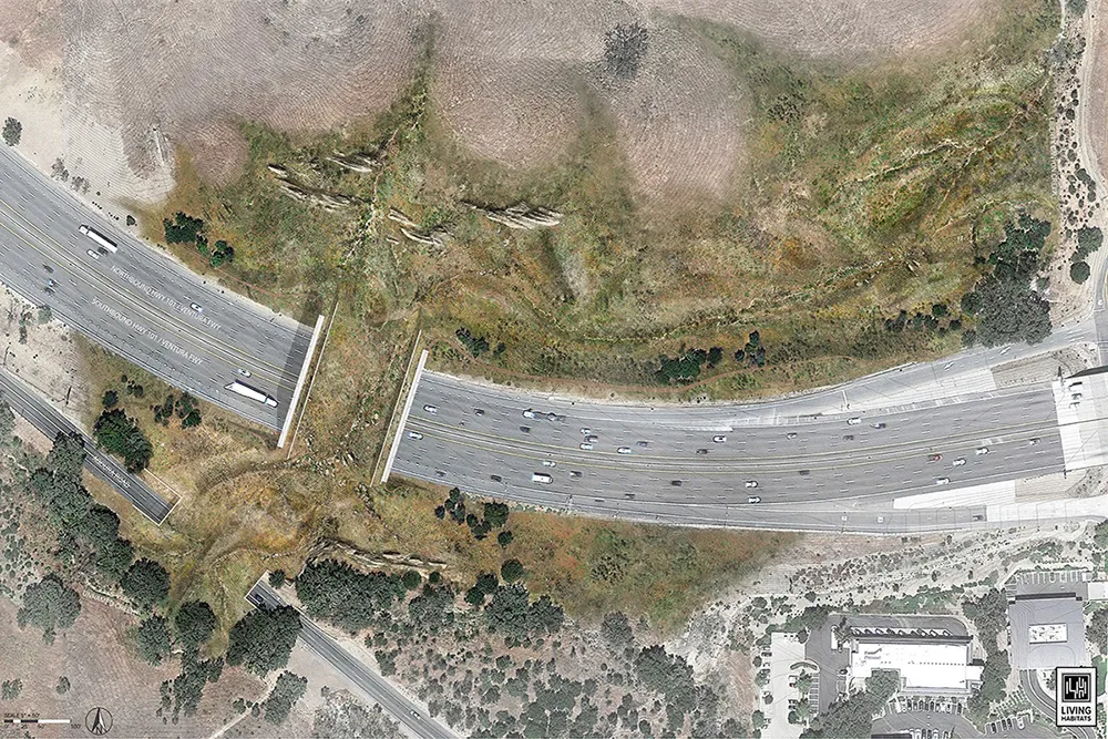
Waikato Expressway is one of seven major state highway improvements identified in 2009 to the NZ government as being essential to its economic prosperity. It forms a new section of the 2,047km state highway 1 (SH1), the country’s longest and most important road link which runs the length of both the main islands.
The decision to use Bluetooth detection for rapid assessment of journey time changes and route selection arose from the lengthy period needed for completion of the route and the NZTA’s desire not to delay assessments of the impact on traffic until after the 2020 completion date.
The challenge was to cost-effectively collect data that could be used in assessing the incremental benefits as each section opened.
This was to be aggregated until 2019 for comparison with the travel time data collected prior to each section opening.
In preparation for the project the agency reviewed conventional methods of measuring traffic – including floating vehicle data and automatic number plate recognition – but rejected these as not meeting its need to cost-effectively collect early, regular, location-specific data. It therefore decided to bring in Asia/Pacific regional engineering consultancy Beca, the local partner of Danish bluetooth sensor technology developer Blip Systems which manufacturers the BlipTrack traffic sensor.
The proposal was to expand an existing Bluetooth monitoring infrastructure already deployed in Auckland. This would generate the near real-time and cumulative vehicle data needed by automatically scanning in-vehicle Bluetooth-enabled devices passing detector locations. The battery-powered sensors have mains or solar power charging and use mobile phone communications, which facilitates short-term deployments.
Prior to the start of the construction project NZTA installed a sequence of detectors along the Expressway route and on other regional roads likely to be affected by the new road. This is enabling it to collect enough data to establish pre-construction base-line travel times and journey reliability, which can then be compared to post-construction data on each phase.
In addition the NZTA wanted to test the reliability of Bluetooth detection over long distances. As the agency already collects traffic flow data along SH1 using conventional methods, it can continuously compare the number of vehicles recorded by using Bluetooth technology with total traffic flows, to indicate how well the new sensors are performing. The results of one such comparison over a two-month period appear in table 1.
With certain sections of the expressway already completed, comparative data is beginning to emerge and already the expressway can be shown to be delivering worthwhile travel time savings such as on the 8km-long Te Rapa phase. Completed in 2012, this section diverts traffic from a busy business area north of Hamilton, the most populous community in the region and the country’s largest inland city. The results are benefiting 95% of the vehicles that use this part of the route.
The savings are based on the ‘before’ and ‘after’ journey times between two locations and was the country’s first such major assessment using Bluetooth sensors. Approximately three months before the new section opened, NZTA installed three sensors to measure traffic flows and after the opening it used the equipment to detect journey time changes and the relative proportions of traffic using the new and old routes. This revealed that the respective times were 25.25 minutes before the work started and 19.75 minutes once the Te Rapa phase was opened.
This was the country’s first major ‘before’ and ‘after’ assessment using Bluetooth and demonstrated mean journey time savings averaging 3.3 minutes by vehicles using the new expressway with those remaining on the old, but less congested, route benefitting from a two minute time saving.
The monitoring also revealed the split in routes taken by the 38,700 vehicles which on average use this section of road each day.
Following the opening of the new section just over half (19,900) of drivers opted to use the expressway each day while the remaining 18,800 remained on the old road. As NZTA calculates the cost of congestion to be NZ$21.7/hr the resulting savings to the NZ economy of those 3.3 and two minute savings combine to make a total of NZ$38,000/day.
In December 2013 the NZTA opened the 12.7km-long Ngaruawahia phase. The old route had the highest collective risk of any road in the country in the New Zealand Road Assessment Programme (KiwiRAP), with several fatal and serious crashes every year. In the first three weeks after opening the new section, the agency detected savings of between 3.25 and 5.0 minutes depending on direction and time of day.
By 2019, when the last of the seven stages is finished, the expressway will stretch for 102km and provide a continuous four-lane divided highway, reducing the length of the main SH1 route by 6km. There will be a further 12km of new or upgraded links and a new bridge over the Waikato River, to the north of Hamilton.
As construction has proceeded the NZTA has worked closely with local authorities along the route, to help it decide whether there is a need for any changes on the ‘bypassed’ sections of the old SH1 route, to provide further inducements to motorists to start using the new expressway. These could include speed limit reductions or traffic calming before or after an expressway interchange.
On the basis of its feasibility work and data gathering to date, however, the agency is confident that the Expressway will achieve its aims without such measures, as a safer and shorter route with a higher design speed. At an estimated cost of between NZ$1.5bn and NZ$2bn, it will improve safety and journey reliability through reducing congestion and travel times by a predicted 35 minutes over its full length.
The NZTA needed to ensure that samples of Bluetooth-equipped vehicles would be statistically significant. For a road flow of 10,000 vehicles a day, a 15% sample rate is needed to achieve 99% confidence that the sample data is within 2% of that of the traffic volume as a whole.
The agency has taken advantage of the fact that, at two locations on the Expressway, Bluetooth sensors straddle dual loop traffic detectors that log total traffic volumes every 15 minutes. Combining these data sets produced histograms of Bluetooth device detection rate (DDR, devices detected/vehicles counted by loops) showing the mean as 17.5%.
NZTA senior transport planner Andrew Temperley told ITS International: “All the monitoring work that we have undertaken to date confirms that the Bluetooth technology is operating effectively, with a good vehicle sampling rate” (See panel and table 2). At the same time, he says, “throughout the course of the project up to 2019, there will be opportunities for us to review the effectiveness of the established Bluetooth regime. We will also be able to consider the relative merits of other emerging technologies.”
New Zealand Highway Agency (NZHA) is using Bluetooth-based vehicle detection to assess the impact of its biggest road building project as the various sections are completed. The large-scale deployment of a Bluetooth-based vehicle detection system is making substantial contributions to traffic data needs in progressing the new Waikato Expressway, and in the operation of state highways overall, in the country’s North Island. In the process, the scheme is also acting as a long-term test of the accuracy and reliability of the technology, leading to its adoption to provide cost-effective live monitoring and strategic data gathering for NZHA’s national network.
Waikato Expressway is one of seven major state highway improvements identified in 2009 to the NZ government as being essential to its economic prosperity. It forms a new section of the 2,047km state highway 1 (SH1), the country’s longest and most important road link which runs the length of both the main islands.
The decision to use Bluetooth detection for rapid assessment of journey time changes and route selection arose from the lengthy period needed for completion of the route and the NZTA’s desire not to delay assessments of the impact on traffic until after the 2020 completion date.
The challenge was to cost-effectively collect data that could be used in assessing the incremental benefits as each section opened.
| Floating car (obeying ALL Speed Limits) | Google Maps | Bluetooth traffic sensor (media |
|---|---|---|
| 1 hour 29 minutes (off peak); 1 hour 34 minutes (Peak) | 1 hour 30 minutes | 1 hour 31 minutes |
| Direction | Loop Detector | Bluetooth average daily count per day | Approximate size of Bluetooth sample% |
|---|---|---|---|
| Northbound | 10304 | 1984.82 | 19.25% |
| Southbound | 10370 | 1864.50 | 17.98% |
This was to be aggregated until 2019 for comparison with the travel time data collected prior to each section opening.
In preparation for the project the agency reviewed conventional methods of measuring traffic – including floating vehicle data and automatic number plate recognition – but rejected these as not meeting its need to cost-effectively collect early, regular, location-specific data. It therefore decided to bring in Asia/Pacific regional engineering consultancy Beca, the local partner of Danish bluetooth sensor technology developer Blip Systems which manufacturers the BlipTrack traffic sensor.
The proposal was to expand an existing Bluetooth monitoring infrastructure already deployed in Auckland. This would generate the near real-time and cumulative vehicle data needed by automatically scanning in-vehicle Bluetooth-enabled devices passing detector locations. The battery-powered sensors have mains or solar power charging and use mobile phone communications, which facilitates short-term deployments.
Prior to the start of the construction project NZTA installed a sequence of detectors along the Expressway route and on other regional roads likely to be affected by the new road. This is enabling it to collect enough data to establish pre-construction base-line travel times and journey reliability, which can then be compared to post-construction data on each phase.
In addition the NZTA wanted to test the reliability of Bluetooth detection over long distances. As the agency already collects traffic flow data along SH1 using conventional methods, it can continuously compare the number of vehicles recorded by using Bluetooth technology with total traffic flows, to indicate how well the new sensors are performing. The results of one such comparison over a two-month period appear in table 1.
With certain sections of the expressway already completed, comparative data is beginning to emerge and already the expressway can be shown to be delivering worthwhile travel time savings such as on the 8km-long Te Rapa phase. Completed in 2012, this section diverts traffic from a busy business area north of Hamilton, the most populous community in the region and the country’s largest inland city. The results are benefiting 95% of the vehicles that use this part of the route.
The savings are based on the ‘before’ and ‘after’ journey times between two locations and was the country’s first such major assessment using Bluetooth sensors. Approximately three months before the new section opened, NZTA installed three sensors to measure traffic flows and after the opening it used the equipment to detect journey time changes and the relative proportions of traffic using the new and old routes. This revealed that the respective times were 25.25 minutes before the work started and 19.75 minutes once the Te Rapa phase was opened.
This was the country’s first major ‘before’ and ‘after’ assessment using Bluetooth and demonstrated mean journey time savings averaging 3.3 minutes by vehicles using the new expressway with those remaining on the old, but less congested, route benefitting from a two minute time saving.
The monitoring also revealed the split in routes taken by the 38,700 vehicles which on average use this section of road each day.
Following the opening of the new section just over half (19,900) of drivers opted to use the expressway each day while the remaining 18,800 remained on the old road. As NZTA calculates the cost of congestion to be NZ$21.7/hr the resulting savings to the NZ economy of those 3.3 and two minute savings combine to make a total of NZ$38,000/day.
In December 2013 the NZTA opened the 12.7km-long Ngaruawahia phase. The old route had the highest collective risk of any road in the country in the New Zealand Road Assessment Programme (KiwiRAP), with several fatal and serious crashes every year. In the first three weeks after opening the new section, the agency detected savings of between 3.25 and 5.0 minutes depending on direction and time of day.
By 2019, when the last of the seven stages is finished, the expressway will stretch for 102km and provide a continuous four-lane divided highway, reducing the length of the main SH1 route by 6km. There will be a further 12km of new or upgraded links and a new bridge over the Waikato River, to the north of Hamilton.
As construction has proceeded the NZTA has worked closely with local authorities along the route, to help it decide whether there is a need for any changes on the ‘bypassed’ sections of the old SH1 route, to provide further inducements to motorists to start using the new expressway. These could include speed limit reductions or traffic calming before or after an expressway interchange.
On the basis of its feasibility work and data gathering to date, however, the agency is confident that the Expressway will achieve its aims without such measures, as a safer and shorter route with a higher design speed. At an estimated cost of between NZ$1.5bn and NZ$2bn, it will improve safety and journey reliability through reducing congestion and travel times by a predicted 35 minutes over its full length.
The NZTA needed to ensure that samples of Bluetooth-equipped vehicles would be statistically significant. For a road flow of 10,000 vehicles a day, a 15% sample rate is needed to achieve 99% confidence that the sample data is within 2% of that of the traffic volume as a whole.
The agency has taken advantage of the fact that, at two locations on the Expressway, Bluetooth sensors straddle dual loop traffic detectors that log total traffic volumes every 15 minutes. Combining these data sets produced histograms of Bluetooth device detection rate (DDR, devices detected/vehicles counted by loops) showing the mean as 17.5%.
NZTA senior transport planner Andrew Temperley told ITS International: “All the monitoring work that we have undertaken to date confirms that the Bluetooth technology is operating effectively, with a good vehicle sampling rate” (See panel and table 2). At the same time, he says, “throughout the course of the project up to 2019, there will be opportunities for us to review the effectiveness of the established Bluetooth regime. We will also be able to consider the relative merits of other emerging technologies.”