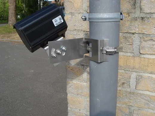
Iteris enhances travel time system

Iteris has upgraded its Vantage detection solutions with Vantage Velocity 2.0, which includes several enhancements to its Bluetooth-based travel time system. Vantage Velocity, Iteris’ Bluetooth-based travel time system, employs sensors installed at defined segments along the road to capture the identity of passing Bluetooth-enabled devices. Utilising advanced algorithms, the host software analyses the matches between sensors to create accurate real-time speed and travel time data on freeways and arterial ro
August 9, 2013 Read time: 2 mins
73 Iteris has upgraded its Vantage detection solutions with Vantage Velocity 2.0, which includes several enhancements to its Bluetooth-based travel time system.
 
Vantage Velocity, Iteris’ Bluetooth-based travel time system, employs sensors installed at defined segments along the road to capture the identity of passing Bluetooth-enabled devices. Utilising advanced algorithms, the host software analyses the matches between sensors to create accurate real-time speed and travel time data on freeways and arterial roadways.

The enhancements in Vantage Velocity 2.0 provide public agencies with the flexibility to meet their traffic management needs by enabling them to create their own user-definable congestion maps. Improved reporting allows operators to obtain a complete view of real-time traffic and origin-destination data while understanding demand trends over periods of several days. The new field unit data viewer allows users to begin monitoring incoming Bluetooth matches directly from the installation site, which provides instant validation of the installation performance.

“These enhancements to our Vantage Velocity product are a result of the market’s growing demand for real-time traffic information,” said Todd Kreter, senior vice president of development and operations for Iteris’ Roadway Sensors segment. “The upgrade will provide our customers with the ability to monitor road conditions and respond faster to various traffic situations.”

For more information on companies in this article

Related Content

  • Inrix teams up with AccuWeather
    April 12, 2013
    US traffic information provider AccuWeather is to integrate Inrix real-time traffic and incident information, travel times and traffic camera images into its StoryTeller traffic app. AccuWeather customers receive the same traffic information used by leading vehicle manufacturers, commercial fleets, departments of transportation and news organisations worldwide. The Inrix traffic intelligence platform analyses real-time data from over a hundred sources including traditional road sensors, official accident an
  • Developing an integrated WIM/ANPR enforcement system
    July 31, 2012
    The weigh in motion market remains especially buoyant and technological development continues to reflect this. Although there are major differences in operating philosophies, particularly between developed and developing countries, both the numbers of countries using Weigh In Motion (WIM) technology and the numbers of systems that they deploy are on the increase.
  • Report analyses multiple ITS projects to highlight cost and benefits
    March 16, 2015
    Every year in America cost benefit analysis is carried out on dozens of ITS installations and pilot studies and the findings, along with the lessons learned, are entered into the Department of Transportation’s (USDOT’s) web-based ITS Knowledge Resources database. This database holds more than 1,600 reports and periodically the USDOT reviews the material on file to draw conclusions from this wider body of evidence. It has just published one such review ITS Benefits, Costs, and Lessons Learned: 2014 Update Re
  • IRD launches smart city analytics platform
    February 12, 2021
    Data from vehicles, bikes and pedestrians can be used to cut congestion and emissions