
AIT powers up traffic AI Box set

Mobility Observation Box allows comparable, meaningful risk-based assessment of data
By Adam Hill April 7, 2022 Read time: 2 mins
The battery-operated system is quick and easy to install and de-install, the organisation says (© AIT)

Researchers from the Austrian Institute of Technology (AIT), in cooperation with Transoft Solutions, have developed a solution for measuring traffic conditions and ‘conflicts’ between vehicles on the road. 

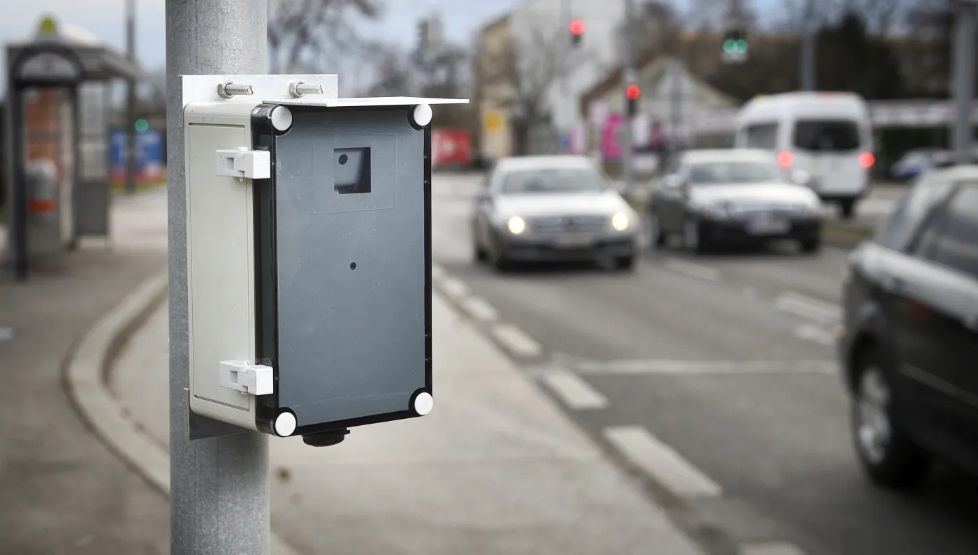
The Mobility Observation Box (MOB), which sits at the roadside, collects video data on the effects of various infrastructural and traffic engineering measures on the risk of collisions and injuries.

It makes it possible to measure the safety of transport infrastructure according to objective criteria. This means, AIT says, that it allows comparable, meaningful risk-based assessment of data.

Machine learning algorithms and artificial intelligence automatically recognise different groups of road users – such as pedestrians, cyclists, cars, trucks or e-scooters – and evaluate how they move, which provides a basis for targeted mitigation measures. 

All road users within a traffic scene can be monitored to a high degree of precision, in a repeatable and unobtrusive way. Each road user is detected, classified, and tracked.

This data is then used to assess and provide metrics on road safety (such as near-collision and speeding incidents), as well as traffic flow conditions (volumes and speeds, for example). A better understanding of the conditions which lead up to a collision helps road authorities to improve infrastructure without relying solely on historical collision data.

MOB can also be used to plan or retrofit road systems to determine cost-effective recommendations for specific traffic safety measures.

The battery-operated system is quick and easy to install and de-install and does not require a supplemental power source. As it is small, traffic is not distracted or influenced by the MOB’s presence, the researchers say.
 

For more information on companies in this article

Related Content

  • LiDAR sets its sights on future problems
    February 23, 2017
    AAdvances in LiDAR are helping transport authorities improve services and identify potential problem areas, as geospatial technology expert Dr Neil Slatcher explains. The effects of climate change on the transport infrastructure have long been a cause of concern within the transportation sector - and not only on the structures themselves but also on the surrounding areas. This year, those concerns have become reality with landslides, structural collapses and surfacing issues impacting services across the wo
  • Cloud keeps UK traffic on the move
    November 23, 2021
    Sopra Steria is introducing the new digital infrastructure for National Highways' NTIS
  • Avoiding the call of the wild
    June 29, 2018
    Hitting an animal on a rural road can be fatal for all parties involved – but detecting and avoiding them requires clever technology. Andrew Williams carefully scans the horizon for details. Wildlife-vehicle collisions are an ever-present threat in rural areas around the world, and there is certainly nothing funny about suddenly finding an angry moose in your headlights on a sharp bend. A variety of detection and avoidance systems are currently in use or under development to help prevent your vehicle being
  • When traffic data can get it totally wrong
    November 30, 2021
    How can a highway devoid of traffic provide data suggesting it is filled with vehicles crawling along? Michael Vardi of Valerann provides an insight into how data can easily be skewed - and what can be done to prevent it