Bluecity Lidar helps plan Pune intersection

Indian city wants to understand road user behaviour prior to infrastructure changes
By Adam Hill September 9, 2022 Read time: 1 min
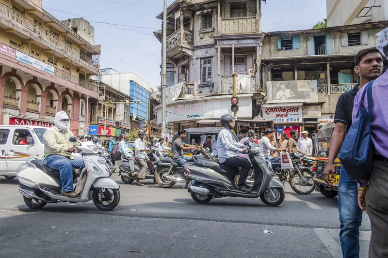
Pune's authorities want to be sure their planning reflects real-life road use (© Sergey Frolov | Dreamstime.com)

The city of Pune, in the western Indian state of Maharashtra, has chosen Lidar specialist Bluecity for a pilot project around intersection safety.

The company's Lidar and AI-powered technology is being employed to help city authorities understand road user behaviour at a busy intersection "with many smaller arteries connecting to it" and where major infrastructure changes are planned.

The road is to be widened, and city authorities want to be sure their planning reflects real-life road use.

Bluecity says its solution provides real-time multimodal data - anonymised to prevent privacy concerns - and can detect and identify all road users, including vehicles, cyclists and pedestrians. 

Following a demonstration of the technology by Bluecity and a local integrator, the city decided to install one Lidar sensor at the intersection.

The 3D high-resolution sensor can detect and classify traffic data in any weather or lighting condition, the company says; this is then analysed by the Bluecity iQ platform, allowing Pune's authorities to visualise traffic patterns. 

Bluecity says one sensor is all that is required in most cases for full coverage of an intersection and installation is quick and easy. 

Following this pilot project, Bluecity says Pune will be looking at installing the technology at other intersections. 

For more information on companies in this article

Related Content

  • Inrix aids authorities in dealing with data
    August 18, 2015
    New traffic data products and services have been launched to aid transport and urban planners and business with detailed intelligence on journey patterns, reports Jon Masters. Manual travel surveys ought soon to become a thing of the past for transport planners and the business community. The technology now exists for getting sophisticated levels of traffic and trip data from connected vehicles. Cars and commercial fleets carrying a GPS device, or a mobile phone or smartphone are the sources of the informat
  • Acusensus phone-detection units arrive on English roads
    August 1, 2023
    Australian road safety company says trailer units will be positioned on selected highways
  • ITS Australia Awards 2024: the winners!
    February 16, 2024
    15th annual ITS Australia Awards in Brisbane reflected end-user safety and industry collaboration
  • Cellint measures speed and travel time without roadside infrastructure
    April 10, 2014
    Collecting speed and travel time data without using roadside infrastructure could offer new possibilities to cash-strapped road authorities. Streaming video may be useful for traffic controllers to monitor incidents and automatic number plate recognition may be required for enforcement, but neither are necessary for many ITS functions. For instance travel times, tailbacks, percentage of vehicles turning, origin and destination analysis can all be done using Bluetooth and/or WI-Fi sensors and without video o