Bluecity Lidar helps plan Pune intersection

Indian city wants to understand road user behaviour prior to infrastructure changes
By Adam Hill September 9, 2022 Read time: 1 min
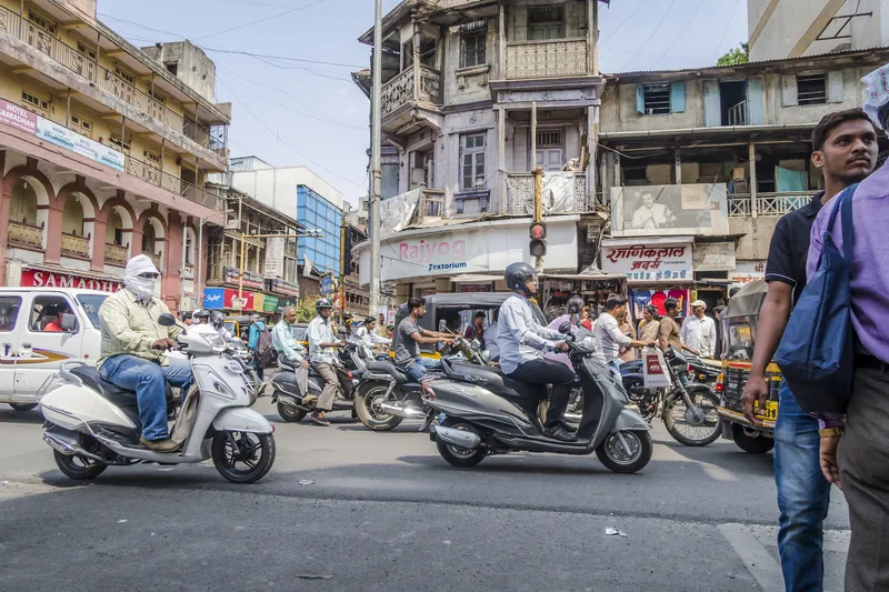
Pune's authorities want to be sure their planning reflects real-life road use (© Sergey Frolov | Dreamstime.com)

The city of Pune, in the western Indian state of Maharashtra, has chosen Lidar specialist Bluecity for a pilot project around intersection safety.

The company's Lidar and AI-powered technology is being employed to help city authorities understand road user behaviour at a busy intersection "with many smaller arteries connecting to it" and where major infrastructure changes are planned.

The road is to be widened, and city authorities want to be sure their planning reflects real-life road use.

Bluecity says its solution provides real-time multimodal data - anonymised to prevent privacy concerns - and can detect and identify all road users, including vehicles, cyclists and pedestrians. 

Following a demonstration of the technology by Bluecity and a local integrator, the city decided to install one Lidar sensor at the intersection.

The 3D high-resolution sensor can detect and classify traffic data in any weather or lighting condition, the company says; this is then analysed by the Bluecity iQ platform, allowing Pune's authorities to visualise traffic patterns. 

Bluecity says one sensor is all that is required in most cases for full coverage of an intersection and installation is quick and easy. 

Following this pilot project, Bluecity says Pune will be looking at installing the technology at other intersections. 

For more information on companies in this article

Related Content

  • CCAM innovation at ITS World Congress 2021
    September 27, 2021
    We live in an era of increasingly cooperative, connected and automated mobility (CCAM) but there’s still a huge way to go - visitors to ITS World Congress in Hamburg will be able to see projects, innovations and real-life solutions showcased in the city
  • Wireless traffic data in real time
    January 31, 2012
    The effect of moving objects on the electromagnetic landscape set up by cellular telephony networks can be detected and interpreted to give real-time traffic data across large geographical areas at low cost. Here, we revisit the Celldar concept. Global economic downturn has pushed public-sector agencies, transport administrations among them, to push even harder for cost efficiencies. Unfortunately, when it comes to transport safety and efficiency the public sector often has to work up to a cost rather than
  • ITSWC 2021: New solutions for the new normal
    September 20, 2021
    October’s ITS World Congress in Hamburg will profile the changing face of mobility, with real-world examples of electric vehicle implementation, shared transport and autonomy taking centre stage
  • Intertraffic 2022: less than two weeks to go!
    March 15, 2022
    Make sure you're part of the biggest reunion in the ITS industry for years - why miss out?