
Vancouver moves quickly on 'slow streets'

Plans include wider pavements and vehicle lanes set aside for walking and cycling
By David Arminas June 2, 2020 Read time: 1 min
Vancouver to 'repurpose' some streets to help with Covid recovery (© David Arminas)

Vancouver plans to install 50 km of “slow streets” for walking, cycling and for business and restaurant patios as part of a Covid-19 recovery plan.

The western Canadian city said that the plans are to help residents and businesses adapt to the new reality of living and operating through a pandemic.

Already 12km has been set aside, according to media reports.

“We will work closely with businesses and community partners to address needs for space while also ensuring our streets and public spaces remain safe and accessible,” said Lon LaClaire, general manager of the city’s engineering services.

Guidelines for what it calls the “repurposing” of parts of streets will be drawn up this month.

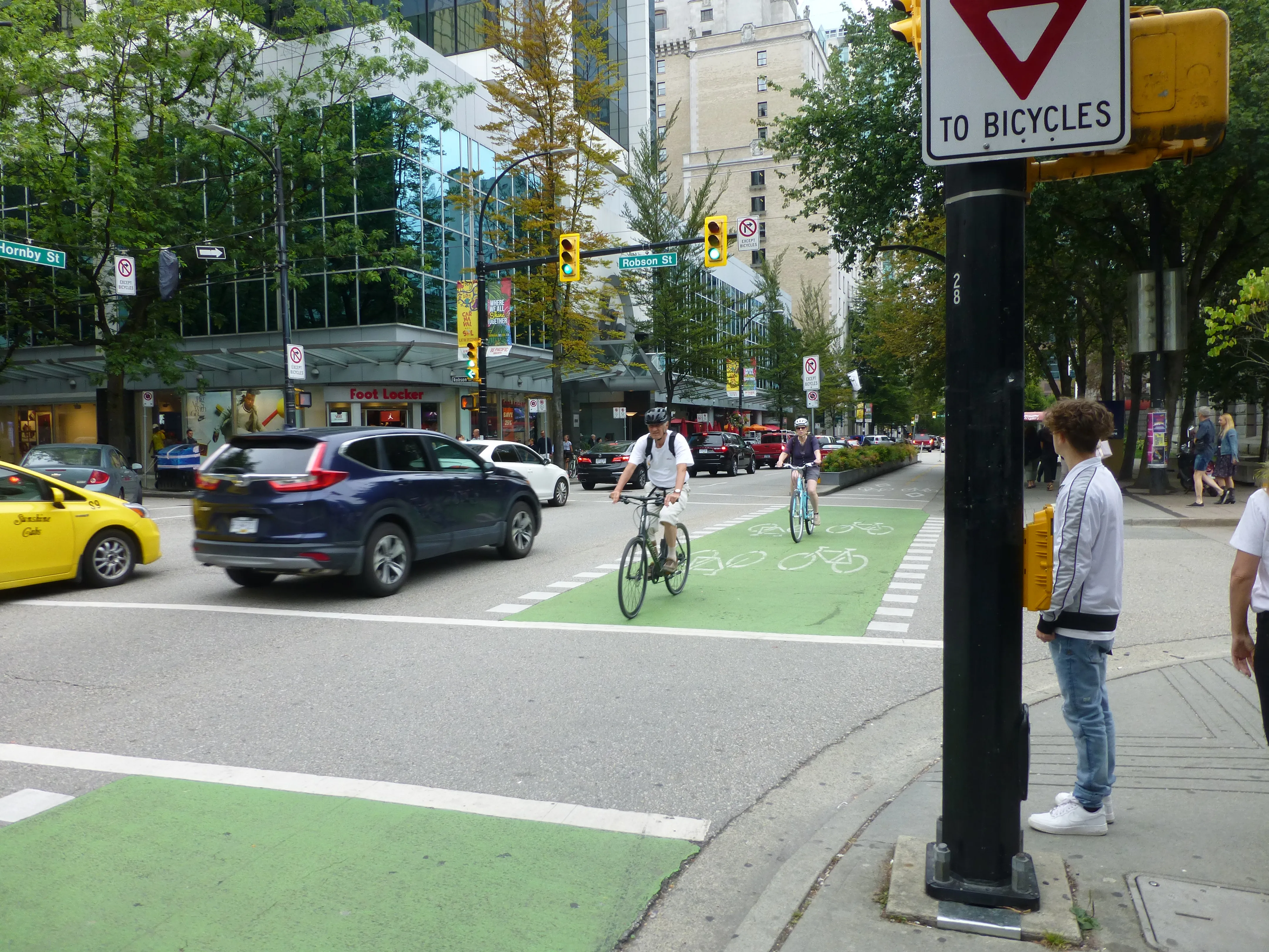
Roads and areas for repurposing include parking spaces and vehicle travel lanes on arterial streets.

Some residential streets will become “slow streets” by allowing local traffic only in order to create space for foot and bicycle traffic, according to the city.

Pavements for queuing at businesses will be extended into kerb lanes to provide space for people to line up and also give pedestrians room to safely pass by.

Short-term loading and pick-up zones will be created near businesses with high turnover of products.

Related Content

  • September 18, 2020
    CurbFlow unveils ‘Waze for parking’
    Solution to find clear spaces for loading and unloading is being trialled in two US cities
  • October 22, 2014
    New Haven shows small can be beautiful
    Connecticut’s new administration is using smart policy and ITS solutions to bridge social divides. Andrew Bardin Williams investigates. With only 130,000 residents, New Haven can hardly be called a metropolis. Measuring less than 502km (18 square miles), the city is huddled against the coast, squeezed between two mountains (appropriately called East Rock and West Rock) that, at 111m and 213m (366ft and 700ft) respectively, can hardly be called mountains. The airport is small and has limited service, and th
  • August 13, 2015
    Syracuse models post-industrial revival for US cities
    A connective corridor in Syracuse, New York State, could be a model for other post-industrial cities, as David Crawford discovers. The aim of the city of Syracuse’ 5.6km-long Connective Corridor in Onandaga County in upstate New York is to create a model ‘complete street’ for use in wider regeneration schemes. Key transport-sector components are traffic calming, high-quality transit with accessible passenger information, plus walkability and bike-friendliness.
  • August 19, 2022
    Safety first in the Big Apple
    For a variety of reasons, seniors are particularly vulnerable to traffic violence – but better road design can help. Adam Hill examines New York City’s new plan to keep older people from becoming collision statistics