Vancouver moves quickly on 'slow streets'

Plans include wider pavements and vehicle lanes set aside for walking and cycling
By David Arminas June 2, 2020 Read time: 1 min
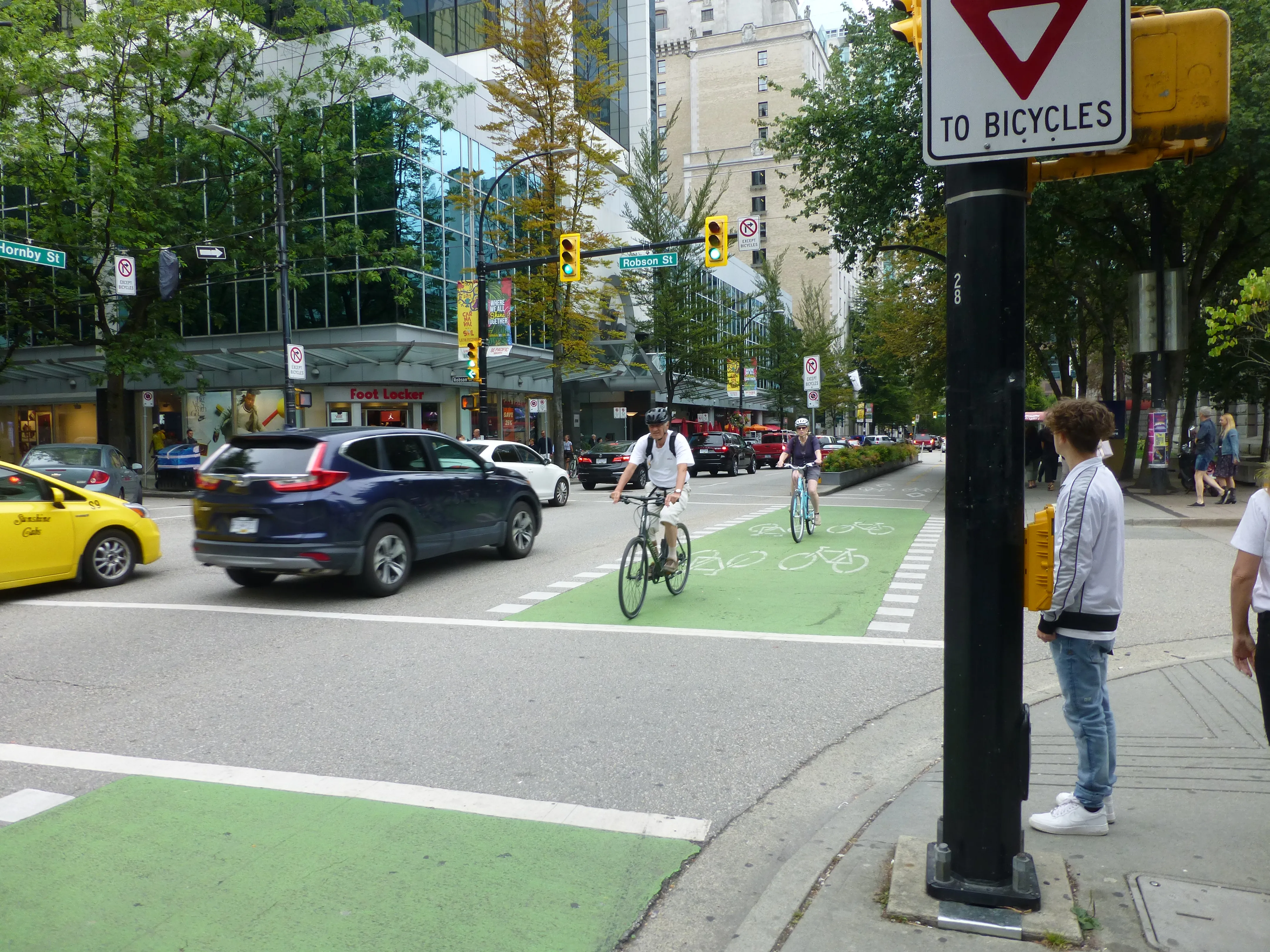
Vancouver to 'repurpose' some streets to help with Covid recovery (© David Arminas)

Vancouver plans to install 50 km of “slow streets” for walking, cycling and for business and restaurant patios as part of a Covid-19 recovery plan.

The western Canadian city said that the plans are to help residents and businesses adapt to the new reality of living and operating through a pandemic.

Already 12km has been set aside, according to media reports.

“We will work closely with businesses and community partners to address needs for space while also ensuring our streets and public spaces remain safe and accessible,” said Lon LaClaire, general manager of the city’s engineering services.

Guidelines for what it calls the “repurposing” of parts of streets will be drawn up this month.

Roads and areas for repurposing include parking spaces and vehicle travel lanes on arterial streets.

Some residential streets will become “slow streets” by allowing local traffic only in order to create space for foot and bicycle traffic, according to the city.

Pavements for queuing at businesses will be extended into kerb lanes to provide space for people to line up and also give pedestrians room to safely pass by.

Short-term loading and pick-up zones will be created near businesses with high turnover of products.

Related Content

  • Knowing when to slow down
    August 8, 2018
    Level 2 driver assistance vehicles have little problem reading fixed metal signs at the roadside - but it’s a different story with VMS in tunnels, finds Alan Dron. Following a series of hands-free driving tests in tunnels, an Australian road authority believes that car manufacturers have to up their game before vehicles have the required levels of competence to consistently perform ‘assisted driving’ tasks. The trials, in the state of Victoria late last year, tested the ability of several vehicles to stay
  • Bridging the highway travel information gap
    March 14, 2012
    A new traffic management solution is attempting to bridge the gap in information available on freeways and arterial roadways. Andrew Bardin Williams reports. Agencies responsible for national networks of roads around the world have the ability to measure, analyse and disseminate accurate travel information to drivers. Millions of dollars go into data collection infrastructure to collect traffic congestion and travel time information on major freeways or highways. For example, a driver on the I-210 in the Lo
  • Dubai metro - the world's longest automated rail system
    July 31, 2012
    David Crawford reviews the recent opening of Dubai's Red Line. The US$7.6bn Dubai Metro, the Phase I Red Line of which started partial operation in September 2009, will be the world's longest driverless rail system on its planned completion in 2011. With a total length of some 75km, it will then overtake the 68.7km Vancouver SkyTrain and be able to carry over 1.2 million passengers on a typical day.
  • StreetLight Data maps future
    February 20, 2019
    Laura Schewel of StreetLight Data talks to Adam Hill about the importance of measuring what you do – and about how paint will remain perhaps the most important piece of technology in the city planners’ armoury for a decade to come Transportation is dangerous, responsible for 30% of global cargo emissions today. Some experts believe that it will be responsible for 80% by 2050. And that’s before you even get on to the safety question - just ask tech entrepreneur Laura Schewel. “Transportation is getting wo