Swedish public transport map asks people to walk instead

Västtrafik creates new route map detailing how many footsteps are between stops
By Adam Hill July 1, 2020 Read time: 1 min
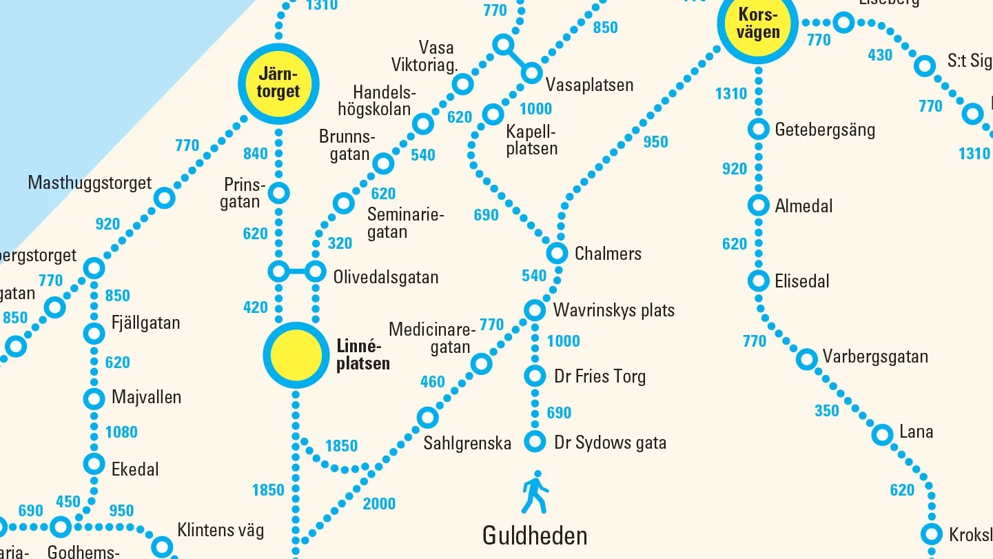
Västtrafik's new 'walking' map of Gothenburg (credit: Forsman & Bodenfors)

A public transport company in the city of Gothenburg, Sweden, is asking travellers to walk rather than take its buses and trams.

To promote social distancing and to ease overcrowding, Västtrafik has produced a new version of its map showing the number of steps between bus and tram stops in the city - calling it "a simple reminder that distances are actually quite short in the city centre".

“If more people have the possibility to walk instead of taking the bus or tram in Gothenburg, we encourage that," said Lars Backström, CEO of Västtrafik. 

"That way we make it safer for those who really need to use public transport."

The company says that people are already choosing alternatives to public transport post-Covid, taking the bus or cycling to work. 

More than 30% claim they walk more now compared to before the pandemic, it adds.

The new map is featured in print adverts and on billboards as part of an initiative created by Forsman & Bodenfors.

For more information on companies in this article

Related Content

  • London needs just one road user charge, says report
    July 8, 2019
    London’s patchwork of road charging schemes should be replaced by a single, distance-based user charge, according to new research. Apart from anything else, it would be much fairer… The UK capital’s multiple road charging schemes require a radical overhaul, according to a new report by the Centre for London thinktank. The suggested solution is to replace existing levies on drivers with a single, distance-based user charge which would more fairly reflect how much, and at what time, people are using London
  • Edinburgh launches live transport updates in Google Maps
    January 11, 2016
    Passengers of Lothian Buses and Edinburgh Trams will be the first in Scotland to access real-time service information on Google Maps thanks to a partnership between Transport for Edinburgh and Google. Google Maps on desktop and mobile now uses real-time predictions to deliver more accurate directions between any two places in Edinburgh, taking into account delays and diversions, with live updates from every bus and tram in the fleet. Google Maps has an overview of where all buses and trams are on the
  • Conduent counts on Italian buses
    April 21, 2021
    Passenger-monitoring system will allow transit companies to comply with Covid regs
  • PTV sets its sights on Smart City solutions
    February 9, 2017
    Making a city smarter not only relies on understand technological opportunities but also human decision-making, as Miller Crockart explains. Cities are about people – a fact that can easily be forgotten when experts talk about roads, healthcare and education as though they are abstract and unconnected monoliths rather than things people use. Understanding how and why people use services is vital for making decisions on how they can be optimised for maximum efficiency across inter-connected networks that for