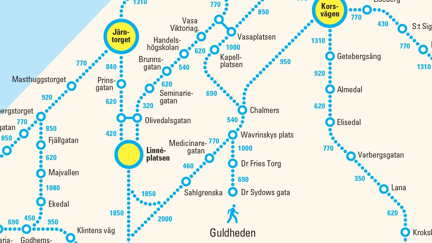
Swedish public transport map asks people to walk instead

Västtrafik creates new route map detailing how many footsteps are between stops
By Adam Hill July 1, 2020 Read time: 1 min
Västtrafik's new 'walking' map of Gothenburg (credit: Forsman & Bodenfors)

A public transport company in the city of Gothenburg, Sweden, is asking travellers to walk rather than take its buses and trams.

To promote social distancing and to ease overcrowding, Västtrafik has produced a new version of its map showing the number of steps between bus and tram stops in the city - calling it "a simple reminder that distances are actually quite short in the city centre".

“If more people have the possibility to walk instead of taking the bus or tram in Gothenburg, we encourage that," said Lars Backström, CEO of Västtrafik. 

"That way we make it safer for those who really need to use public transport."

The company says that people are already choosing alternatives to public transport post-Covid, taking the bus or cycling to work. 

More than 30% claim they walk more now compared to before the pandemic, it adds.

The new map is featured in print adverts and on billboards as part of an initiative created by Forsman & Bodenfors.

For more information on companies in this article

Related Content

  • Modelling MaaS and making it happen
    June 15, 2017
    Colin Sowman looks at some of the emerging technology being introduced to evaluate and operate Mobility as a Service. The fast-growing interest in Mobility-as-a-Service (MaaS) has prompted the creation of a host of software systems for those wanting to become a MaaS provider or participate in MaaS offerings. Most recently, at ITS International’s MaaS Market conference, Portuguese company Brisa Innovation announced a name change to A-to-Be to reflect its increasing involvement in the MaaS sector with the lau
  • Asking drivers what information they need: radical but effective
    March 19, 2014
    When Texas A&M Transportation Institute was asked to devise a temporary traveller information system for work zones, it started by asking drivers what they need. Robert Brydia explains the thinking, implementation and results. US Interstate 35 (I-35) runs roughly north–south originating in Laredo, Texas and ends 1,500 miles away in Duluth, Minnesota having passed through Oklahoma, Kansas, Missouri and Iowa. Within Texas the I-35 splits into I-35E and I-35W passing through Dallas and Fort Worth respectiv
  • Jenoptik sees value in international outlook
    June 13, 2024
    Technology is always changing in the traffic management sector. Tobias Deubel of Jenoptik talks to Adam Hill about the past, the future – and the importance of global partnerships
  • VMS can counter small screens’ big problems
    June 9, 2015
    Lacroix Trafic’s Steve Collins believes the improving trends in road safety could go into reverse unless authorities make full use of the latest LED technology to meet drivers’ information needs. Road authorities and vehicles manufacturers could and should be far more active in countering some of the transportation industry’s major problems, according to Steve Collins export sales director at Lacroix Trafic.