Moovit uses riders to help get far from crowds

User-generated reports will make people feel more comfortable using public transit, firm says
By Adam Hill June 11, 2021 Read time: 2 mins
Moovit: minding the gap

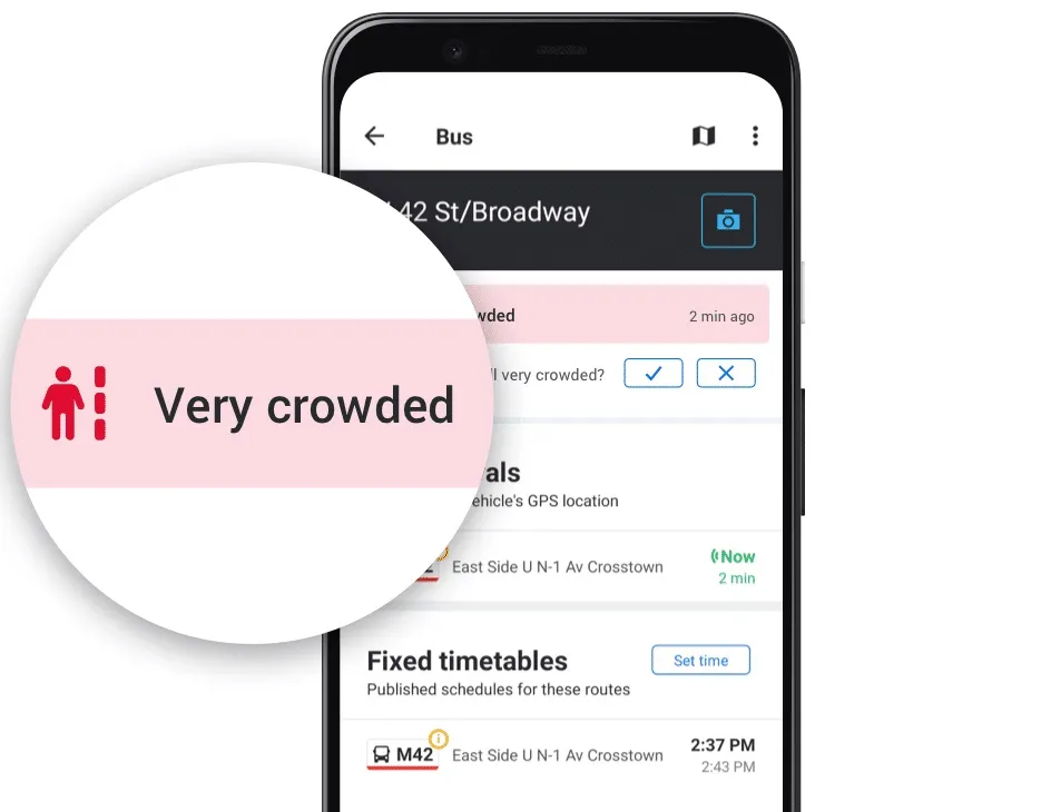
Mobility as a Service specialist Moovit has added a user-generated 'crowd avoidance' feature to its app.

Designed to enable public transit riders to avoid crowds on platforms and carriages, users can "now report crowding levels at stations and on lines, allowing others to see how crowded the station is before entering, or how packed a bus or train line is before boarding", the company says. 

Moovit says most transit agencies do not provide real-time crowding information "due to no, or lack of, crowd counters installed on their fleets or at stations".

Moovit users can tap Report from the Quick Actions bar in the Station Details screen and follow the prompts and one-tap survey to report how busy the station currently is - choices are Not Crowded, A Little Crowded, Crowded or Very Crowded.

This information can be seen for 10 minutes by other users in the Station Details and Stations Nearby screens on the app.

Reporting crowding levels on buses or trains themselves is similar, with users able to select Available Seats, Standing Only, or Crowded - this data will be displayed, again in a 10-minute window - across the Suggested Routes, Itinerary, Route Preview, Stations Nearby and Station Details screens.

Other users of the Android app can also now confirm and update these user-created reports about station crowdedness.

Yovav Meydad, Moovit’s chief growth and marketing officer, says the existing Mooviter Community of more than 700,000 local 'editors', who map transit information in their cities, "has been very positive and impactful".

“We’re drawing on this belief again, empowering millions of Moovit users to help one another feel comfortable returning to public transit," Meydad says.

In cities where real-time crowding information for lines is available, Moovit will display the real-time feeds supplied by transit agencies instead of the user-reported information. 

Moovit says the app, which can be downloaded on Google Play and the App Store, is available in 3,400 cities across 112 countries.

For more information on companies in this article

Related Content

  • Cloud-based app paves way for near field ticketing
    December 17, 2013
    Cubic latest introduction provides a short cut for transit authorities looking to offer travellers mobile, smart phone payment options. Transit operators wanting to provide travellers with a mobile fare payment option now have an ‘off-the-shelf’ solution in Cubic’s NextWave. Through the use of near field communications (NFC) technology, NextWave turns travellers’ mobile phones and tablets into the equivalent of a ticket vending machine able to instantly re-load contactless transit cards. It also enables the
  • GIS mapping of road-related assets can pay dividends
    June 6, 2014
    Map-based computerised road asset management can pay dividends as Colin Sowman discovers.
  • e-Call emergency service doesn't go far enough
    January 30, 2012
    eCall misses the point and is only a tacit acknowledgement that the road safety issue has not yet been adequately addressed, according to FEMA's Aline Delhaye. According to the Federation of European Motorcyclists' Associations (FEMA), the European Commission's (EC's) ambitions for eCall implementation are premature and fail to take account of all road users' needs or of technological progress elsewhere.
  • Integrated corridor management 'to enhance travel efficiency'
    August 29, 2012
    New systems of software are coming together to form the technological backbone of a project that will apply practically to one corridor in Dallas, but influence travel across a wider area. Dallas Area Rapid Transit (DART) is the lead agency for an extensive Integrated Corridor Management (ICM) project in Dallas, covering an area stretching north east of downtown Dallas, 20 miles long by two miles wide. The corridor is defined loosely by the US-75 freeway and DART’s light rail ‘red line’. These are the theor