Moovit uses riders to help get far from crowds

User-generated reports will make people feel more comfortable using public transit, firm says
By Adam Hill June 11, 2021 Read time: 2 mins
Moovit: minding the gap

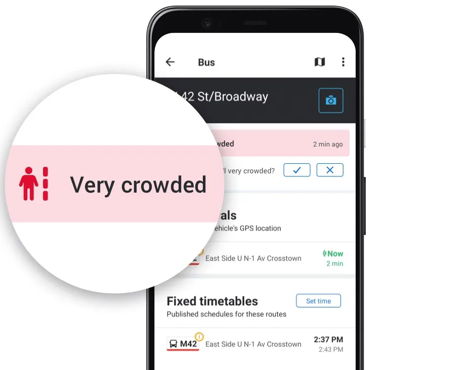
Mobility as a Service specialist Moovit has added a user-generated 'crowd avoidance' feature to its app.

Designed to enable public transit riders to avoid crowds on platforms and carriages, users can "now report crowding levels at stations and on lines, allowing others to see how crowded the station is before entering, or how packed a bus or train line is before boarding", the company says. 

Moovit says most transit agencies do not provide real-time crowding information "due to no, or lack of, crowd counters installed on their fleets or at stations".

Moovit users can tap Report from the Quick Actions bar in the Station Details screen and follow the prompts and one-tap survey to report how busy the station currently is - choices are Not Crowded, A Little Crowded, Crowded or Very Crowded.

This information can be seen for 10 minutes by other users in the Station Details and Stations Nearby screens on the app.

Reporting crowding levels on buses or trains themselves is similar, with users able to select Available Seats, Standing Only, or Crowded - this data will be displayed, again in a 10-minute window - across the Suggested Routes, Itinerary, Route Preview, Stations Nearby and Station Details screens.

Other users of the Android app can also now confirm and update these user-created reports about station crowdedness.

Yovav Meydad, Moovit’s chief growth and marketing officer, says the existing Mooviter Community of more than 700,000 local 'editors', who map transit information in their cities, "has been very positive and impactful".

“We’re drawing on this belief again, empowering millions of Moovit users to help one another feel comfortable returning to public transit," Meydad says.

In cities where real-time crowding information for lines is available, Moovit will display the real-time feeds supplied by transit agencies instead of the user-reported information. 

Moovit says the app, which can be downloaded on Google Play and the App Store, is available in 3,400 cities across 112 countries.

For more information on companies in this article

Related Content

  • Fara keeps data delivery simple
    January 25, 2018
    Simplifying the delivery of data and information gathered by traffic management, ticketing and other systems can improve travel efficiency and the traveller’s experience. Having quantified and analysed the previously unmonitored movement of road vehicles, trains, metros, cyclists and pedestrians, the ITS sector is a prime example of the digital world. Patterns discerned from those previously random happenings enable authorities to design more efficient transport systems, allow transport operators to run
  • Israel aspires to ITS-led future
    May 29, 2013
    Shay Soffer, Chief Scientist with the Israel National Road Safety Authority, talks to Jason Barnes about his country’s current ITS outlook and how he sees this developing in the future. Israel ranks alongside countries such as the US and France in the road safety stakes, with an average 7.1 deaths per billion kilometres driven. But at that point the similarities end, as the country’s overriding issue is pedestrian safety. This is driven by several factors, including being a relatively small country where pe
  • Receiving real time passenger information in Finland
    February 3, 2012
    David Crawford sees lively prospects for Finnish innovation
  • New Hampshire drivers get real time traffic information online
    January 3, 2013
    As part of its ongoing efforts to bring real-time traveller information to New Hampshire motorists, the New Hampshire Department of Transportation (NHDOT) has partnered with TrafficLand, a Virginia-based company, to provide real-time viewing access to the NHDOT's highway cameras. The public can now view traffic and road conditions from NHDOT cameras in ten regions of the state via the TrafficLand website, www.Trafficland.com. The camera locations are tied to interactive Google maps, which display travel sp