Moovit uses riders to help get far from crowds

User-generated reports will make people feel more comfortable using public transit, firm says
By Adam Hill June 11, 2021 Read time: 2 mins
Moovit: minding the gap

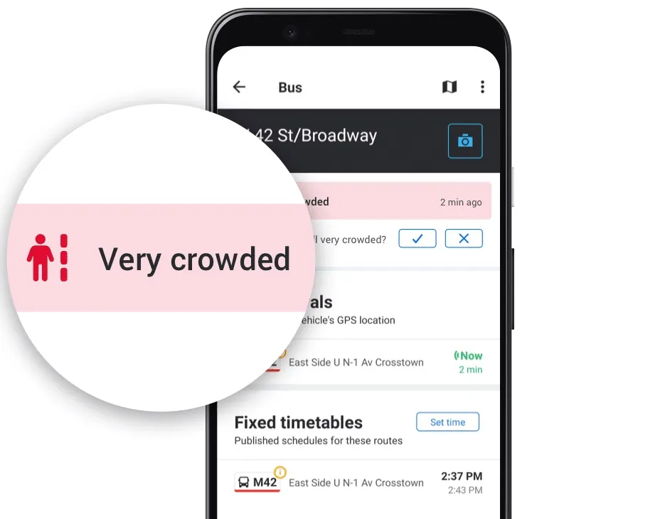
Mobility as a Service specialist Moovit has added a user-generated 'crowd avoidance' feature to its app.

Designed to enable public transit riders to avoid crowds on platforms and carriages, users can "now report crowding levels at stations and on lines, allowing others to see how crowded the station is before entering, or how packed a bus or train line is before boarding", the company says. 

Moovit says most transit agencies do not provide real-time crowding information "due to no, or lack of, crowd counters installed on their fleets or at stations".

Moovit users can tap Report from the Quick Actions bar in the Station Details screen and follow the prompts and one-tap survey to report how busy the station currently is - choices are Not Crowded, A Little Crowded, Crowded or Very Crowded.

This information can be seen for 10 minutes by other users in the Station Details and Stations Nearby screens on the app.

Reporting crowding levels on buses or trains themselves is similar, with users able to select Available Seats, Standing Only, or Crowded - this data will be displayed, again in a 10-minute window - across the Suggested Routes, Itinerary, Route Preview, Stations Nearby and Station Details screens.

Other users of the Android app can also now confirm and update these user-created reports about station crowdedness.

Yovav Meydad, Moovit’s chief growth and marketing officer, says the existing Mooviter Community of more than 700,000 local 'editors', who map transit information in their cities, "has been very positive and impactful".

“We’re drawing on this belief again, empowering millions of Moovit users to help one another feel comfortable returning to public transit," Meydad says.

In cities where real-time crowding information for lines is available, Moovit will display the real-time feeds supplied by transit agencies instead of the user-reported information. 

Moovit says the app, which can be downloaded on Google Play and the App Store, is available in 3,400 cities across 112 countries.

For more information on companies in this article

Related Content

  • Multi-operator, multi-mode integrated travel information
    February 1, 2012
    David Crawford looks forward to the completion of Stockholm's JustNu project. End-2010 is the target date for delivery of the final stages of Stockholm public transport authority (PTA) Stockholms Lokaltrafik (SL)'s ambitious JustNu (Right Now) integrated travel information system. Installation began in 2004, and the result will represent a large-scale and highly exportable solution to the need for harmonisation of traveller information in urban regions with multiple transport operators.
  • Vancouver's metro transport promotes alternatives to driving
    January 26, 2012
    David Crawford looks at Vancouver and the legacy of a Olympic transport success
  • Less travel aggravation to blunt Aggieland fans’ motivation
    June 17, 2016
    Returning travel times to normal within two hours of the end of a major football game was the challenge facing College Station, Adam Lyons explains how this was achieved. College Station, TX, also known as ‘Aggieland’, is located right in the middle of the Dallas/Fort Worth, San Antonio and Houston triangle making the city accessible to over 14 million Texans within less than a four-hour drive. One of the biggest draws to this area is Texas A&M University (TAMU) and the Aggie football games in the fall, mea
  • London leads on open transport data
    May 16, 2016
    London has come out on top of an analysis of the performance of several major cities in providing open data on transport and mapping. The Future Spaces Foundation, a charity that studies living spaces, has said in its Vital Cities: Transport Systems Scorecard that London’s record of providing open access to real time transport data is the best example of data sharing. The Scorecard analyses the transport networks of 12 cities around the world on indicators ranging from breathability to the density of