New version of Esri CityEngine

Esri CityEngine 2011, the latest version of Esri's software for creating high-quality 3D content, is now available.
January 31, 2012 Read time: 1 min

50 ESRI CityEngine 2011, the latest version of Esri's software for creating high-quality 3D content, is now available. This latest release of CityEngine makes it easier to use geographic information system (GIS) data to create geographically accurate models for urban design, historical reenactment models, or realistic models of actual cities. It now includes support for georeferenced data such as Esri's File Geodatabase (GDB) and KML, while the user interface has been greatly improved for ease of use with 'drag and drop' data import features.

For more information on companies in this article

Related Content

  • PTV releases upgrades for traffic and pedestrian modelling software
    December 13, 2016
    The new releases of PTV’s Visum 16, Vissim 9 and Viswalk 9 software solution for macroscopic traffic modelling and microscopic traffic and pedestrian simulation come with several new features and functions.
  • TomTom and Esri fusion transform urban mobility
    April 28, 2025

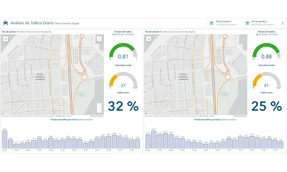
    A collaboration between TomTom and Esri will take centre stage at the upcoming Congress with a session titled "Driving Insights: Unlocking the Power of TomTom Historic Traffic Data in ArcGIS.” Led by industry experts Frans Keijzer from TomTom and Jaime Nieves from Esri Spain, this presentation will showcase how integrating TomTom's historical traffic data with the ArcGIS platform has transformed urban mobility in Gran Canaria, Spain.

  • New technology revolution in urban traffic control?
    January 26, 2012
    Urban traffic control is a well-defined and practised art. Nevertheless, there are technologies here and on the horizon with the potential to revolutionise how we do things. By Gavin Jackman and Andrew Kirkham, TRL, and Jason Barnes. Distributed monitoring and control of urban traffic networks and flows is nothing new. PC-based Urban Traffic Control (UTC) is now well established and operating in many locations around the world. However, it is worth considering the effects of the huge growth in the use of sm
  • 3D lane geometry for TomTom Orbis Maps
    January 7, 2025
    New development uses AI, including fundamental vision models