Fleetstar mapping tools

Cybit has just launched a new 'suite of mapping tools for its Fleetstar-Online solution'.
February 6, 2012 Read time: 1 min
1060 Cybit has just launched a new 'suite of mapping tools for its Fleetstar-Online solution'. The new suite includes three configurable options: traditional digital mapping; 1691 Google Maps incorporating Street View technology; and ScreenWatcher, an application that now provides companies with vehicle updates every 20 seconds.

According to the company, the mapping options provide customers with the flexibility to tailor the mapping to suit their individual needs. For example: companies that operate large distribution sites can benefit from upgrading to the live ScreenWatcher option; home delivery companies can have unequivocal vision over the locations visited from Google Street View; whilst for monitoring routes and measuring against plan, traditional digital mapping remains the clearest option.

Related Content

  • HDR predicts an adaptable and flexible future for roadways
    December 19, 2016
    HDR consultants, Brian Swindell and Bernie Arseanea, consider managed lanes’ untapped potential. It is no surprise that corridor planning continues to challenge agencies and owners as demand continues to surpass roadway capacity.
  • Debating contactless toll charging by smartphone
    April 25, 2012
    Developments in the mass transit sector could provide indicators of potential for greater use of mobile consumer electronic devices for charging and tolling, according to Consult Hyperion’s Mike Burden. However, opinion among toll system suppliers is divided. Jason Barnes reports The combination of mass-market devices and their protocols, typified by smartphones featuring near field communication (NFC), points to some exciting cross-fertilisation possibilities in the charging and tolling sector, says Consul
  • New approach to data handling aids development of smarter cities
    January 14, 2013
    David Crawford has been to the Irish capital to see a potent memorandum of understanding at work. An imaginative collaboration between the world’s largest IT company and one of Europe’s smaller capital cities is demonstrating a new approach to data handling that could have far reaching implications for urban public transport worldwide. A close working relationship between IBM and Dublin City Council (DCC) dates from 2010.
  • Via: streets can be for people, not cars 
    December 20, 2021
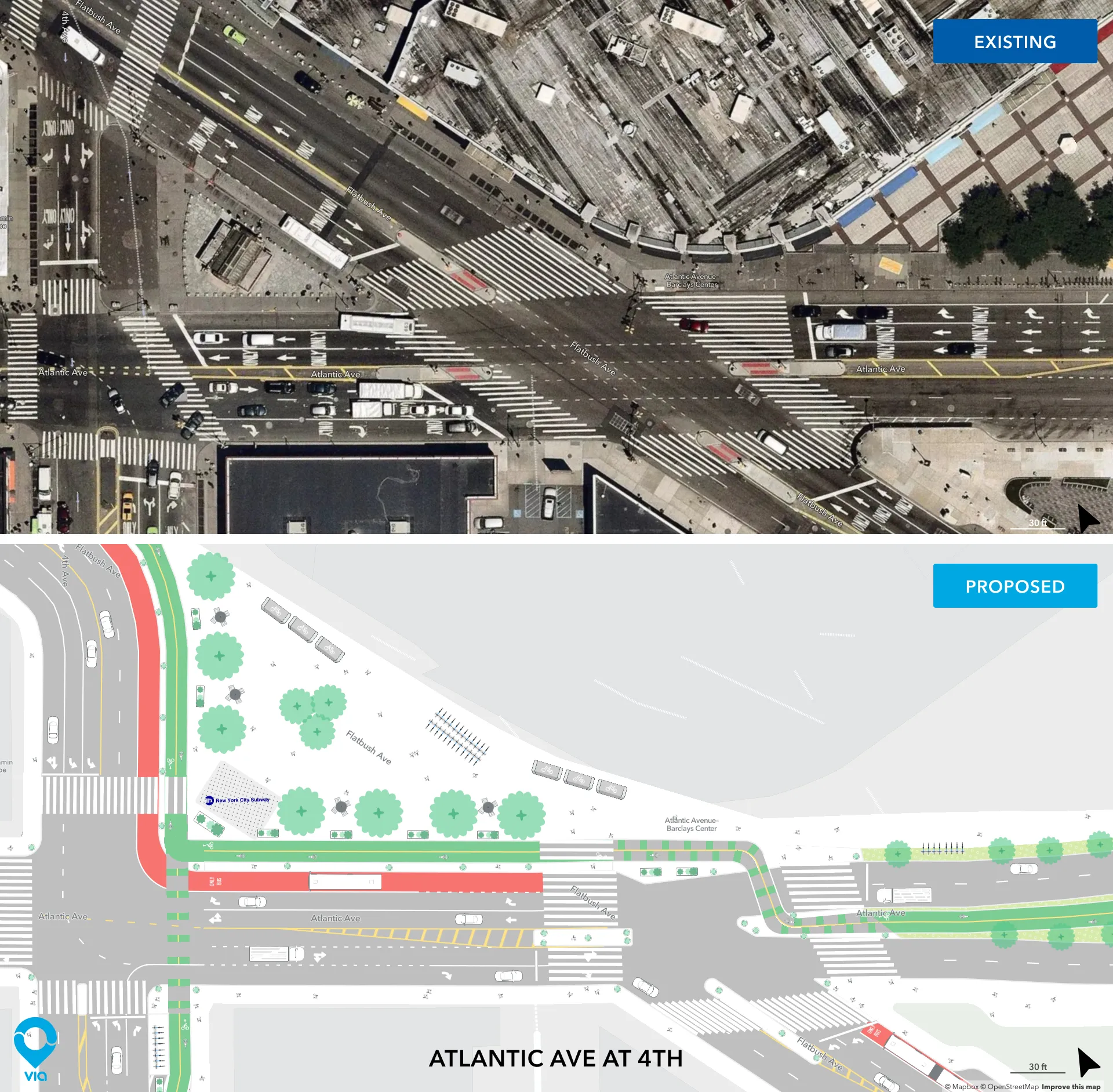
    Advocacy group Transportation Alternatives redesigned NYC streets using Via's Remix platform