GreenRoad, the specialist in fleet driver performance and safety management, has added new functionality to GreenRoad 360 which includes posted speed performance, idling heat maps, and extended data integration with new APIs.
RSS4495 GreenRoad, the specialist in fleet driver performance and safety management, has added new functionality to GreenRoad 360 which includes posted speed performance, idling heat maps, and extended data integration with new APIs.
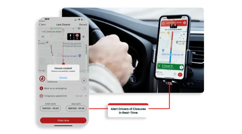
The company claims that the posted speed performance delivers the ability to nearly eliminate speed violations by automatically capturing incidents where a vehicle is travelling above the posted speed limit; reflecting the impact of these incidents on the safety score; and mapping the details. Seamlessly integrated with the GreenRoad Central web-based management dashboard, posted speed performance can be customised to suit specific fleet policies and features colour-coded graphical reporting for easy review and efficient management.
“Speeding is a major contributor to fleet crash incidents and excessive speed can dramatically increase fuel consumption. Additionally, because speeding on city and residential streets is often riskier than speeding on motorways, managing posted speed performance is a key requirement for most fleets. Now, fleet drivers and management have a new level of safety protection and insight,” said Glenn Pereira, director of product marketing for GreenRoad.
“There is no ‘silver bullet’ when it comes to minimising driver risk, but used in conjunction with a number of other measures, the GreenRoad system is helping us to develop a comprehensive picture of where we have risks within our fleet,” said Brent Mitchell, director of operational support,3902 Balfour Beatty Utility Solutions, which uses GreenRoad 360 across its fleet of 1,400 vehicles. “GreenRoad not only allows us to identify risks, but also protects our drivers when they are out on the road, providing a range of data to help us analyse incidents.”
The new idling heat map feature provides fleet managers with an at-a-glance view of idling hot spots across specific geographies and routes, while the expanded data integration feature delivers a new set of application program interfaces (APIs) for integration with partner and customer systems including live data delivery such as GPS data, fleet administration automation interfaces, and behavioural insight interfaces.
The company claims that the posted speed performance delivers the ability to nearly eliminate speed violations by automatically capturing incidents where a vehicle is travelling above the posted speed limit; reflecting the impact of these incidents on the safety score; and mapping the details. Seamlessly integrated with the GreenRoad Central web-based management dashboard, posted speed performance can be customised to suit specific fleet policies and features colour-coded graphical reporting for easy review and efficient management.
“Speeding is a major contributor to fleet crash incidents and excessive speed can dramatically increase fuel consumption. Additionally, because speeding on city and residential streets is often riskier than speeding on motorways, managing posted speed performance is a key requirement for most fleets. Now, fleet drivers and management have a new level of safety protection and insight,” said Glenn Pereira, director of product marketing for GreenRoad.
“There is no ‘silver bullet’ when it comes to minimising driver risk, but used in conjunction with a number of other measures, the GreenRoad system is helping us to develop a comprehensive picture of where we have risks within our fleet,” said Brent Mitchell, director of operational support,
The new idling heat map feature provides fleet managers with an at-a-glance view of idling hot spots across specific geographies and routes, while the expanded data integration feature delivers a new set of application program interfaces (APIs) for integration with partner and customer systems including live data delivery such as GPS data, fleet administration automation interfaces, and behavioural insight interfaces.