TomTom launches RoadDNA

TomTom has launched TomTom RoadDNA, a new product for vehicle localisation that will help make automated driving a reality, faster. Designed with vehicle data storage and processing limitations in mind, RoadDNA delivers highly accurate location information that can easily be integrated into the on-board system of a vehicle. RoadDNA’s propriety technology delivers a highly optimised lateral and longitudinal view of the roadway. By matching RoadDNA data with vehicle sensor data in real-time a vehicle knows
September 14, 2015 Read time: 2 mins
1692 TomTom has launched TomTom RoadDNA, a new product for vehicle localisation that will help make automated driving a reality, faster. Designed with vehicle data storage and processing limitations in mind, RoadDNA delivers highly accurate location information that can easily be integrated into the on-board system of a vehicle.

RoadDNA’s propriety technology delivers a highly optimised lateral and longitudinal view of the roadway. By matching RoadDNA data with vehicle sensor data in real-time a vehicle knows its location on the road, even while travelling at high speeds or when changes occur to the roadside.

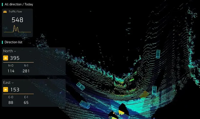
By converting a 3D point cloud of road side patterns into a compressed, 2D view of the roadway, RoadDNA delivers a solution that needs little storage space and limits processing requirements, without losing detail. It eliminates the complexity of identifying each single roadway object, but instead creates a unique pattern of the roadway environment. This makes the technology robust and scalable.  

TomTom RoadDNA, combined with the TomTom HAD Map, delivers accurate and robust technology by providing real-time information about a vehicle’s precise location on a map whilst coping with changes in the environment.

“We know that the future of automated driving hinges on the ability of a vehicle to continuously know exactly where it is located on the road,” said Harold Goddijn, TomTom CEO. “TomTom RoadDNA is the only technology of its kind that delivers highly accurate vehicle localisation content in an efficient and cost effective way.”

Related Content

  • November 10, 2017
    Sony’s vision systems help limit risk in road tunnels
    Sony’s Stephane Clauss looks at the imaging requirements in tunnels. In the event of a fire inside a tunnel, the dispersion of gases and heat is prevented, creating extreme temperatures that have led to many deaths. Following tragic incidents including Mont Blanc, European legislation requires longer tunnels to be fitted with incident and smoke detection systems.
  • August 10, 2020
    Lufft sensors help German smart city
    Using data can increase efficiency. Jerg Theurer of Mhascaro explains how one German town is becoming a smart city – with some help from Lufft sensors in a winter roads project
  • July 22, 2021
    Control room tech ends data overload
    There have never been so many data sources available to traffic control centre operators – but too much data can be as bad as too little when making decisions. Adam Hill asks how control room technology companies can help operators screen out the white noise
  • March 16, 2012
    Google maps the future of traffic and travel information?
    Will the relentless growth of Google lead to it becoming the ultimate provider of travel information services? Huw Williams investigates Google’s strategy and David Crawford discovers what two principal rivals are doing to keep pace. In the first weeks of 2012 one company staked two divergent claims on the future of transport. One is the science fiction of only a decade ago, turned into reality: the driverless car. The other seems more prosaic, yet in its own way is just as significant a marker of the futur