Canadian automotive company Magna International is teaming up with Israeli remote sensing specialist Innoviz Technologies to deliver LiDAR remote sensing solutions for the implementation of autonomous driving features and full autonomy in future vehicles.
Recognizing that LiDAR is necessary to achieve the desired levels of performance and safety, Magna selected Innoviz's technology to be integrated into its autonomous driving systems to provide a complete sensor-fusion solution to automakers.
Innoviz
Canadian automotive company 5026 Magna International is teaming up with Israeli remote sensing specialist Innoviz Technologies to deliver LiDAR remote sensing solutions for the implementation of autonomous driving features and full autonomy in future vehicles.
Recognizing that LiDAR is necessary to achieve the desired levels of performance and safety, Magna selected Innoviz's technology to be integrated into its autonomous driving systems to provide a complete sensor-fusion solution to automakers.
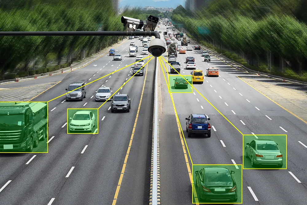
Innoviz offers high-definition, solid-state LiDAR which enables 3D remote sensing to produce accurate real-time images of the vehicle's surroundings while meeting automotive standards and reducing cost and size. The Innoviz LiDAR can be seamlessly integrated into any vehicle and is designed to effectively manage changing light and weather conditions.
Recognizing that LiDAR is necessary to achieve the desired levels of performance and safety, Magna selected Innoviz's technology to be integrated into its autonomous driving systems to provide a complete sensor-fusion solution to automakers.
Innoviz offers high-definition, solid-state LiDAR which enables 3D remote sensing to produce accurate real-time images of the vehicle's surroundings while meeting automotive standards and reducing cost and size. The Innoviz LiDAR can be seamlessly integrated into any vehicle and is designed to effectively manage changing light and weather conditions.