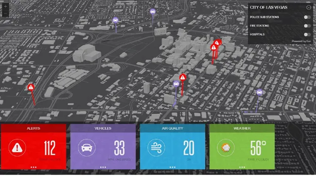
Live Earth integrates Inrix traffic data with live transportation for enhanced situational awareness

Situational awareness platform Live Earth has announced an agreement with connected car services provider Inrix, with the aim of bringing real-time visualisation to the transportation industry.
June 30, 2017 Read time: 2 mins

Situational awareness platform Live Earth has announced an agreement with connected car services provider 163 Inrix, with the aim of bringing real-time visualisation to the transportation industry.

Managing complex transportation systems for a city, state or region requires monitoring a variety of live data feeds for public transit, weather, vehicle traffic, parking availability, live traffic information and more. Live Earth synchronises data from multiple systems on an interactive map and leverages Inrix traffic intelligence, parking services and traffic cameras to provide a single fused picture allowing organisations to understand quickly and act fast.

Live Earth synchronises multiple data streams, and provides instant replay to allow play, pause and rewind of various data layers on a map.

With Inrix, Live Earth now has access to the most robust driver network, including more than 300 million connected vehicles and devices, covering over five million miles of roads, ramps and interchanges. Combined with Live Earth’s geospatial display, the transportation industry now has a powerful tool to visualise all moving assets, changing road and traffic conditions and live video feeds across an entire city, state or region, say the two companies.
“With the swipe of your finger, you can now animate traffic congestion over multiple hours at multiple different playback speeds,” says Jeff Carpenter, CEO of Live Earth. “Synchronising multiple data feeds provides deep context and the ability to quickly and visually correlate events and congestion.”

“Live Earth’s platform enables Inrix data to be leveraged in ways never seen before,” said Kevin Foreman, general manager of GeoAnalytics at Inrix. “DOTs, cities, shipping and security companies can now effortlessly visualise hours of traffic congestion, instantly view live traffic cameras, quickly pinpoint trouble areas and act before situations become critical.”

Related Content

  • Ohio DOT Selects Inrix and StreetLight Data for on-demand mobility intelligence
    September 26, 2017
    The Ohio Department of Transportation (ODOT) has added analytics and origin-destination to its existing Inrix traffic services to help monitor, measure and manage the state’s road network. As part of the agreement, StreetLight Data will enable ODOT to transform Inrix data into actionable intelligence. Ohio DOT will utilise analytic tools and traffic services from Inrix and StreetLight Data to improve system planning, traffic management and operations in Ohio.
  • Improved traffic information from Inrix
    November 22, 2013
    Inrix XD Incidents is a breakthrough in traffic intelligence, according to the company, which says it reports more accidents, road closures and other incidents across significantly more roads in more countries and at much greater speed than ever before. Inrix XD Incidents detects accidents and road closures faster by automatically correlating real-time traffic flow data with information from nearly 400 public and private sources including media partners, departments of transportation, emergency responder
  • Iteris adds MAP21 to performance measurement software
    June 2, 2015
    Iteris has announced it has added MAP-21 (Moving Ahead for Progress in the 21st Century) features to the robust iPeMS performance measurement software platform, designed to help agencies meet forthcoming performance reporting requirements of the transportation legislation. The module supports the National Performance Management Research Data Set (NPMRDS) that is provided free to states and Metropolitan Planning Organisations (MPOs). Iteris’ iPeMS platform provides cloud-based hosting of processed NPMRDS
  • Esri shows benefits of aggregating multiple data live streams
    November 18, 2020
    The age of connected vehicles is fast becoming a reality. While it brings great promise, it also brings new challenges for those seeking to derive insights from the voluminous data each connected vehicle will transmit. Any number of transportation agencies are beginning to grapple with the challenge of monitoring the live streams of data for traffic management, and ultimately for greater safety of their roadways.