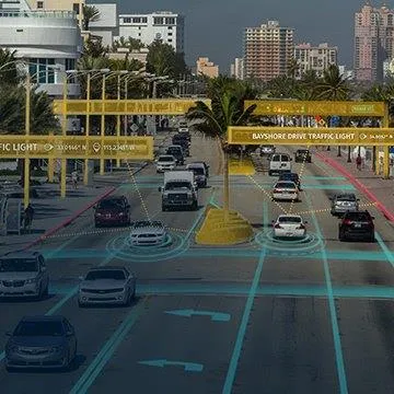
First 3D dataset of all Roads in Western Europe completed

Intermap Technologies has announced the completion of its 3D Roads - the only dataset to provide accurate 3D models for every road, from the largest highway to the smallest urban and rural roads, throughout Western Europe.
March 2, 2012 Read time: 2 mins
221 Intermap Technologies has announced the completion of its 3D Roads – the only dataset to provide accurate 3D models for every road, from the largest highway to the smallest urban and rural roads, throughout Western Europe. Derived from a radar-generated 2D road network combined with height information from the company’s NextMap digital terrain model, 3D Roads is said to be the first accurate, seamless, and comprehensive collection of road data available to the region.

“Previously, only a limited number of roads have been mapped to this precision,” said John Craig, director of product management, automotive, at Intermap Technologies. “Since our 3D Roads accurately cover all roads in Western Europe, the automotive industry can now test and deliver innovative technologies with no geographic restrictions.”

New applications derived from Intermap’s 3D Roads can help enhance a vehicle’s efficiency, utility, and safety. For example, energy management applications can help save fuel and reduce harmful emissions by finding the most fuel-efficient route, accurately predicting an electric vehicle’s range, or predicatively shifting gears in trucks. Also, road slope and curvature can be sensed in advance with vehicle safety systems such as predictive front lighting which optimally directs front headlights in anticipation of upcoming bends and hills in the road ahead.

Intermap’s 3D Roads feature more than six million kilometres of all classes of roads in Germany, France, Italy, Spain, Austria, United Kingdom, Holland, Belgium, Luxembourg, Denmark, Czech Republic, Switzerland, Ireland, and Portugal.

For more information on companies in this article

Related Content

  • Do satellites provide a heavenly view of tolling’s future?
    December 16, 2014
    Satellite-based tolling opens up new options for authorities and can be integrated with DSRC systems as David Crawford discovers. As the proud custodian of the European Union (EU)’s longest road network covered by a single (truck) charging scheme – and the only one to include all major roads - Slovakia has become the continent’s poster-nation for the virtues of GNSS/CN (Global Navigation Satellite System/Cellular Network)-based tolling. It is also proved to be a very fast implementer. Speaking at the 2014 I
  • Making enforcement multi-functional
    June 23, 2016
    New enforcement equipment is coming onto the market apace, as Colin Sowman discovers. If there is one word that epitomises the current trend in enforcement technology then that word is consolidation: multi-function cameras, miniaturisation and combining radar and visual detection methods. One example is Turkish company Ekin Technology’s recently introduced Micro Plate is claimed to be the smallest licence plate recognition device. In addition to logging licence plate data, the system records speed, date, ti
  • Ertico coordinates big data debate
    November 2, 2016
    David Crawford finds that agreeing a common data standard for auto manufacturers’ onboard sensors, navigation system companies and map makers is proving a complex task.
  • Here unveils 3D road models for ADAS and driver safety
    January 21, 2020
    Here Technologies has launched Here Lanes with the aim of increasing driver awareness and road safety through advanced driver assistance systems (ADAS).