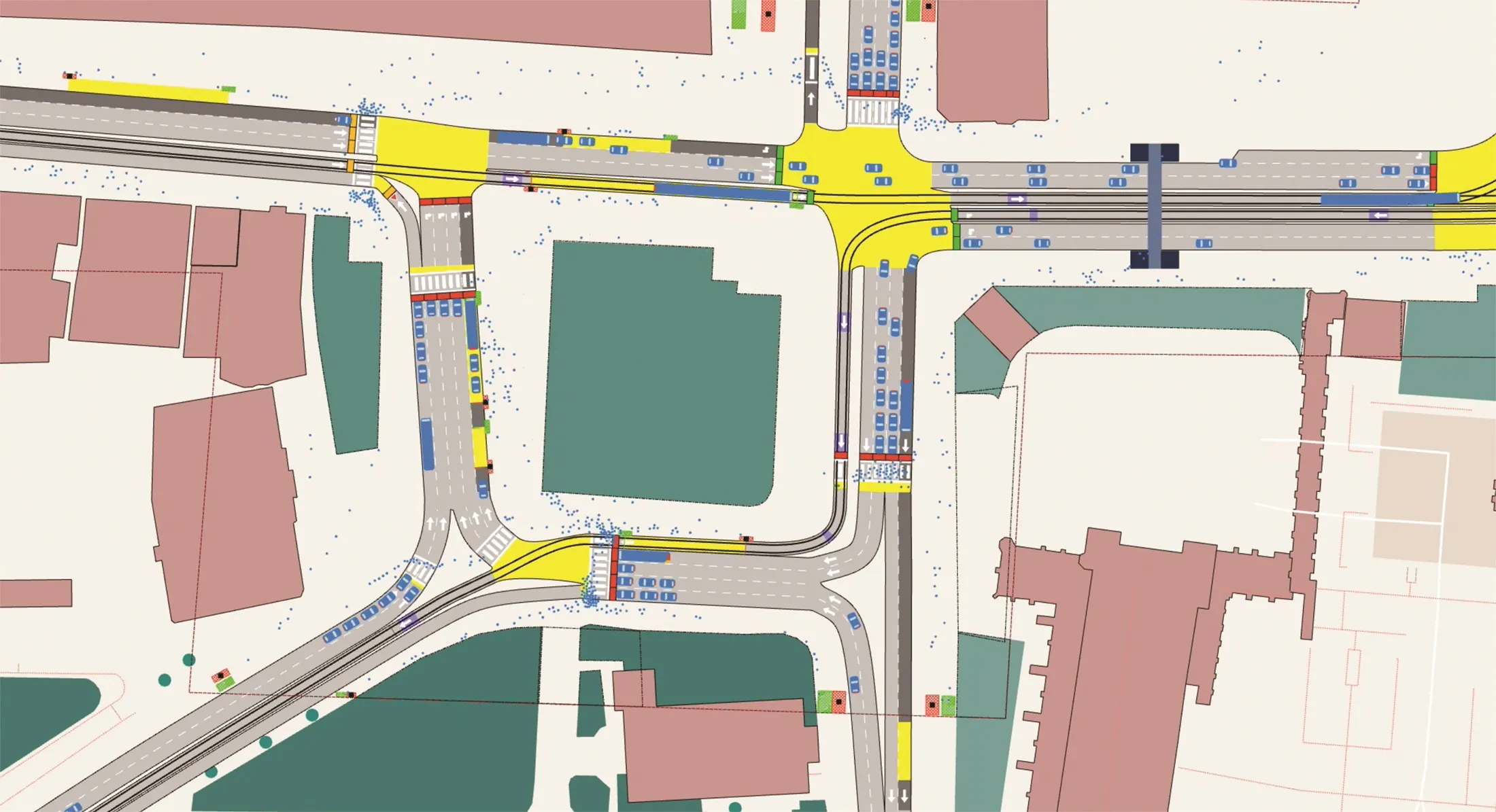
The Department for Transport is to contribute US$4.6 million to help create a digital road map that will give the most detailed information yet to councils and emergency services. The new map, developed by Ordnance Survey, has the potential to transform how all levels of government maintain and improve roads by detailing information such as road widths, traffic calming measures and height and weight restrictions. This dataset could also be linked to other information held by government, including planned ro
February 26, 2015
Read time: 2 mins
The 1837 Department for Transport is to contribute US$4.6 million to help create a digital road map that will give the most detailed information yet to councils and emergency services.
The new map, developed by Ordnance Survey, has the potential to transform how all levels of government maintain and improve roads by detailing information such as road widths, traffic calming measures and height and weight restrictions. This dataset could also be linked to other information held by government, including planned road works and cycle paths.
The information may also be used in satellite navigation systems. It will also help emergency services find the quickest routes when responding to emergency calls.
Local and national government currently use a variety of maps when planning road projects and maintenance. The new mapping system will bring all existing information together, cutting bureaucracy and saving money spent by councils and government on exchanging and comparing different maps.
Announcing the funding, Transport Minister Robert Goodwill said: “This government is backing schemes that will make Britain’s transport system world-class. This mapping project has the potential to substantially improve how we look after our roads. It will help make journeys more efficient and ensure traffic keeps moving.”
Neil Ackroyd, Ordnance Survey acting chief executive, said: “We’re pleased to be working with the6932 Local Government Association, GeoPlace and the Local Highways Authorities to create a single, unified highways product for use across both the public and private sector.”
The new map, developed by Ordnance Survey, has the potential to transform how all levels of government maintain and improve roads by detailing information such as road widths, traffic calming measures and height and weight restrictions. This dataset could also be linked to other information held by government, including planned road works and cycle paths.
The information may also be used in satellite navigation systems. It will also help emergency services find the quickest routes when responding to emergency calls.
Local and national government currently use a variety of maps when planning road projects and maintenance. The new mapping system will bring all existing information together, cutting bureaucracy and saving money spent by councils and government on exchanging and comparing different maps.
Announcing the funding, Transport Minister Robert Goodwill said: “This government is backing schemes that will make Britain’s transport system world-class. This mapping project has the potential to substantially improve how we look after our roads. It will help make journeys more efficient and ensure traffic keeps moving.”
Neil Ackroyd, Ordnance Survey acting chief executive, said: “We’re pleased to be working with the


