ArcGIS for AutoCAD free download

ESRI has announced the availability of ArcGIS for AutoCAD, a free AutoCAD application that allows CAD users to visualise and query Geographic Information System (GIS) data within the CAD environment without conversion. ArcGIS for AutoCAD accesses dynamic geo-referenced ArcGIS Server map services and displays them in the AutoCAD drafting environment.
March 13, 2012 Read time: 1 min
50 ESRI has announced the availability of ArcGIS for AutoCAD, a free AutoCAD application that allows CAD users to visualise and query Geographic Information System (GIS) data within the CAD environment without conversion. ArcGIS for AutoCAD accesses dynamic geo-referenced ArcGIS Server map services and displays them in the AutoCAD drafting environment.

"For the first time, CAD users will have a simple way to connect to GIS enterprise data," says Don Kuehne, ESRI Product Manager. "These users will benefit from the results of GIS analysis through geo-referenced cartographic products inside AutoCAD's editing environment for context and reference without the complexities of conversion and translation."

The map service metadata is accessible in the standard AutoCAD Properties window and the map feature attributes can be viewed via the IDENTIFY tool. All vector, raster, and imagery formats that ArcGIS Server supports can be viewed in the CAD environment.

Related Content

  • April 28, 2025
    TomTom and Esri fusion transform urban mobility

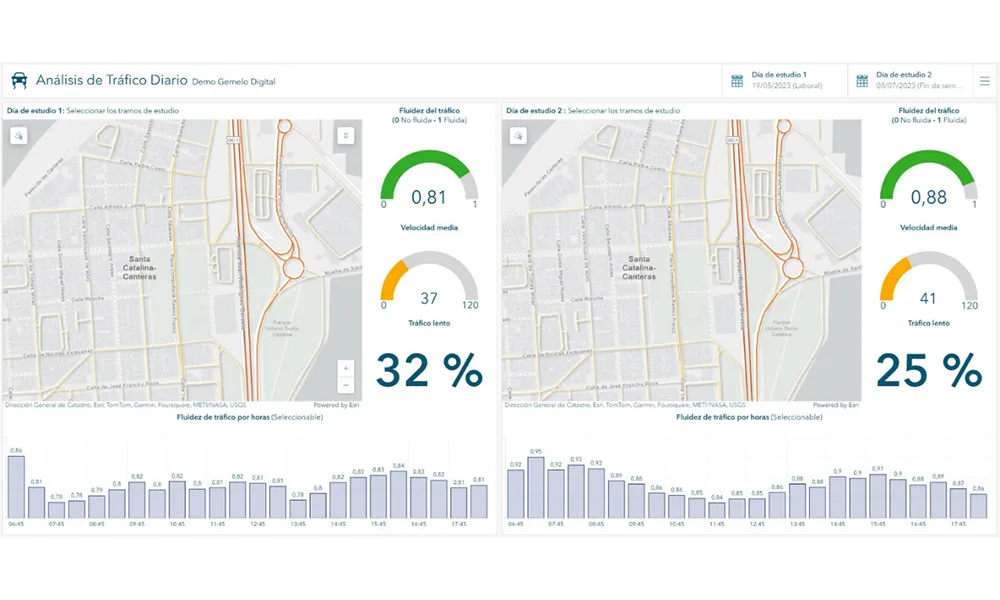
    A collaboration between TomTom and Esri will take centre stage at the upcoming Congress with a session titled "Driving Insights: Unlocking the Power of TomTom Historic Traffic Data in ArcGIS.” Led by industry experts Frans Keijzer from TomTom and Jaime Nieves from Esri Spain, this presentation will showcase how integrating TomTom's historical traffic data with the ArcGIS platform has transformed urban mobility in Gran Canaria, Spain.

  • June 7, 2012
    Camera technology a flexible and cost-effective option
    Perceptions of machine vision being an expensive solution are being challenged by developments in both core technologies and ancillaries. Here, Jason Barnes and David Crawford look at the latest developments in the sector. A notable aspect of machine vision is the flexibility it offers in terms of how and how much data is passed around a network. With smart cameras, processing capabilities at the front end mean that only that which is valid need be communicated back to a central processor of any descripti
  • April 5, 2013
    Transportation analytics to aid growing carrier company
    Pitt Ohio, a transportation solutions provider headquartered in Pittsburgh, Pennsylvania, can now more proactively plan its business by creating routes, managing complex schedules, and monitoring progress throughout the day. The company has licensed Esri's ArcGIS for Transportation Analytics solution, powered by the ArcGIS platform. Pitt Ohio is a member of the Reliance Network, a group of regional carriers that work together to provide seamless service for customers. The company provides less-than-trucklo
  • May 31, 2013
    Data goldmines offer rich pickings
    Astronomical is not too grand a term to describe the current rate of growth in transportation-related data. Massive amounts of traffic related information, such as speed, volume, incidents and weather are being generated every second by road operators and users alike. Big data’ derives its name from the sheer amount and complexity of available raw data. Its potential value is starting to emerge among the intelligent transportation systems community. A gold rush is taking place to capture this value, with da