Inherent weaknesses in satellite communications are leading several countries to re-evaluate terrestrial-based backup systems. There is a tale frequently told in satellite navigation circles, of how landing systems at Newark Airport were disrupted by a truck driver using GPS jamming equipment as he drove along the New Jersey Turnpike. While there was no threat to flight safety as the interference to GPS reference stations being tested, the story highlights how apparently benign threats have the potential t

Inherent weaknesses in satellite communications are leading several countries to re-evaluate terrestrial-based backup systems.
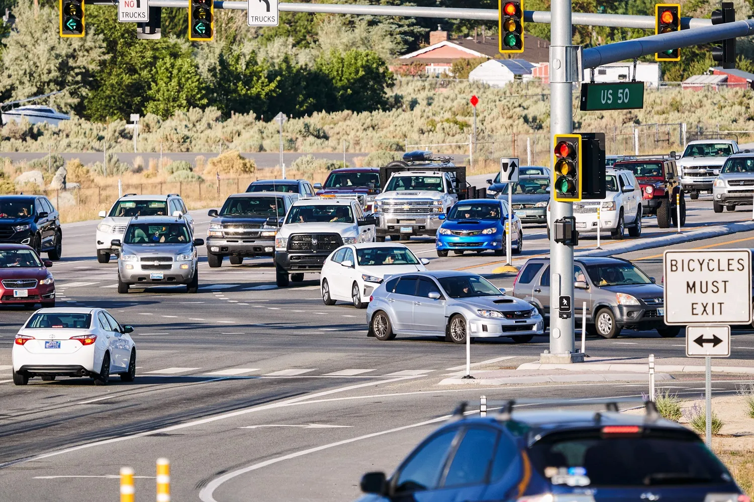
There is a tale frequently told in satellite navigation circles, of how landing systems at Newark Airport were disrupted by a truck driver using GPS jamming equipment as he drove along the New Jersey Turnpike. While there was no threat to flight safety as the interference to GPS reference stations being tested, the story highlights how apparently benign threats have the potential to cause a great deal of problems for GPS and other GNSS satellite based systems. It is also a tangible example of a frequently occurring phenomenon according to the results of a study by Chronos Technology, which has developed equipment to detect and locate GPS jamming signals.
The company’s monitoring equipment remains in place collecting data from locations beside a motorway in England and on a roof top close to London’s Stock Exchange and the results show jamming closely correlates with traffic flows, exhibiting morning and evening peaks. In central London there is a third night time peak.
“We think the majority of GPS jamming events are caused by commercial vehicle drivers,” says Chronos Technology managing director Charles Curry. A large number of commercial vehicle drivers deliver in London at night and use the GPS jammers to avoid their employers’ vehicle tracking systems.
It is illegal to use GPS jamming devices in the UK - but not to sell them and they can be purchased online for as little as £40 ($64). Chronos detected 140 jamming devices pass its motorway monitoring site in a month, which concerns Curry: “There is no area of industry, agriculture and commerce that doesn’t rely on dependable GPS and this dependency is GPS’ vulnerability. Aviation always has back up systems, most others do not. The telecoms industry uses GPS for timing and shipping is switching to an almost complete dependency on GPS navigation.
“There is the possibility of a terrorist attack scenario, so there is a need for good back ups, resilience and threat detection. There should be greater concern, but without panic. Authorities, businesses and users should be aware of the risks.”
In the US the Department for Homeland Security is studying interference to civilian use of GPS while the1690 European Commission’s 5578 DG Move and DG Connect directorates are leading investigations of the size of the threat across Europe.
For enhancing the accuracy of GPS, Europe has the EGNOS (European Geostationary Navigation Overlay Service) augmentation system. EGNOS has a terrestrial network for sending data when satellite signals are blocked and eventually it will have the Galileo satellite constellation, complete with security in the form of a Public Regulated Services system of encryption.
“Some think Galileo is the answer but it will present the same issues for all but those with access to the secure version,” says Martyn Thomas, vice president of Britain’s275 Royal Academy Of Engineering (RAE). “Security only solves the issue of signal spoofing, not jamming. GPS, Russia’s Glonass constellation and China’s Compass system, all face the same issues of incidental or malicious interference.”
The 2011 report also predicts a rise in criminal jamming of GPS and Galileo signals due to the increasing use of GNSS for vehicle tracking and revenue raising purposes such as road user charging. Subsequently the EU and the US have initiated investigations into the scale of the GPS jamming and the profile of jamming cases has led to renewed interest in the issue.
In its report, the RAE suggests more support for the eLORAN (enhanced long range navigation) method of land-based radio navigation as a GPS back-up. This uses very long range and powerful low-frequency signals that cannot practically be jammed and are not blocked by intervening high ground.
Russia, the US and the all UK all developed versions of this type of system from the long range radio navigation originally devised in the second world war. The US considered the technology obsolete and switched off its eLORAN network in 2010.
“The US was in the process of decommissioning its LORAN masts but it looks like that decision has been reversed as the need for land-based navigation has become more apparent,” says Thomas.
South Korea has stated that it will deploy a national eLORAN system after North Korea repeatedly blocked the GPS signals for up to 16 days using a variety of frequencies and signal strengths. In response South Korea expects its eLORAN network will be operational by 2016.
The UK Government has taken the threat to GPS signals seriously and has been trialing a version of eLORAN since 2007 through the General Lighthouse Authorities. The first fully functioning system has now reached ‘initial operational capability’ and in the event of GPS failure it will provide position accuracy within 10 metres for ships navigating part of the Dover Straits. To counter the threat of GPS failure, another seven eLORAN stations are to be built along the south and east coasts of England and Scotland.
Tim Just is head of space for the2231 Technology Strategy Board (TSB), an agency of the UK Government’s Department for Business, Innovation & Skills which is tasked with investing in high growth sectors and innovation. It funded the Gaardian project to develop technology that assess the accuracy and reliability of positional, navigation and timing (PNT) data as well as Sentinel, a follow-on project to develop systems for detecting interference or jamming of GNSS signals.
“We have knowledge transfer networks of 60,000 members across various groups and sectors. One group called location and timing identified the potential threat to GPS about 10 years ago, without scaremongering, but turned it into a question of ‘what do we do about this’?”
The Sentinel research has now effectively ended, although data gathering exercises are continuing, and Chronos and others have start marketing the technology developed.
“It is actually quite straightforward to detect and locate jammers. Discrimination of multi-path signals and other background interference is often needed but once that is done what emerges in the data is patterns of human-like behaviour,” says Curry. “There is not a great deal of attention being paid to these risks at present, but critical infrastructure disruption or damage to companies’ commercial profitability may bring the issue to the fore. Saying it probably won’t happen is a head in the sand attitude.”
Report highlights GNSS vulnerability
The Royal Academy of Engineering’s report on the reliance and vulnerabilities of satellite navigation systems identified three deliberate threats to GNSS signals – jamming, spoofing and meaconing.
Jamming is the most common and the focus of the RAE report. Spoofing, as it sounds, creates a controllable false signal to misreport position, while meaconing delays or rebroadcasts a GNSS signal maliciously or with the intention of improving reception, but with the same effect of misreporting position
The report also highlights GNSS’ vulnerability to system failures and the effects of solar flares and ‘space weather’. If a large coronal mass ejection aligns with the Earth, says the report, a super-storm could arise with a major and long enduring impact on space and ground electronic infrastructure. The last such event was in 1859. The probability of such an event reoccurring is reckoned in the order of once in 200 years.
It concluded that the use of GPS had become ‘so convenient and ubiquitous to form a strong tendency among users to treat it as a given’. Road transport uses are the most prevalent, including in-vehicle navigation and management of commercial fleets, taxi services and public transportation as well as a number of road charging schemes using GPS to report vehicle position.
Key recommendations include raising awareness and increasing resilience and that stolen vehicle tracking and road charging systems should be designed to negate criminals jamming the GPS. It also calls for coordinated national security to recognise the importance of positional, navigation and timing (PNT) data and treat it as an integral part of the national infrastructure
The report says the availability of high quality PNT sources is now so important that a widely available alternative to GNSS is recommended as an essential asset. Ideally, this should be free to use and provide additional benefits, such as availability inside buildings and in GNSS blind-spots.
If government support is maintained, eLORAN could be a viable alternative.
There is a tale frequently told in satellite navigation circles, of how landing systems at Newark Airport were disrupted by a truck driver using GPS jamming equipment as he drove along the New Jersey Turnpike. While there was no threat to flight safety as the interference to GPS reference stations being tested, the story highlights how apparently benign threats have the potential to cause a great deal of problems for GPS and other GNSS satellite based systems. It is also a tangible example of a frequently occurring phenomenon according to the results of a study by Chronos Technology, which has developed equipment to detect and locate GPS jamming signals.
The company’s monitoring equipment remains in place collecting data from locations beside a motorway in England and on a roof top close to London’s Stock Exchange and the results show jamming closely correlates with traffic flows, exhibiting morning and evening peaks. In central London there is a third night time peak.
“We think the majority of GPS jamming events are caused by commercial vehicle drivers,” says Chronos Technology managing director Charles Curry. A large number of commercial vehicle drivers deliver in London at night and use the GPS jammers to avoid their employers’ vehicle tracking systems.
Quantifying the threat
However, there are further significant findings and implications. “It doesn't take a lot of power to cause a lot of damage. GPS signals are generally very weak and jamming equipment has a far greater range than their advertisers claim. Even the smallest, lowest power jammers can take out all GPS receivers within a 250 metre radius,” Curry says.It is illegal to use GPS jamming devices in the UK - but not to sell them and they can be purchased online for as little as £40 ($64). Chronos detected 140 jamming devices pass its motorway monitoring site in a month, which concerns Curry: “There is no area of industry, agriculture and commerce that doesn’t rely on dependable GPS and this dependency is GPS’ vulnerability. Aviation always has back up systems, most others do not. The telecoms industry uses GPS for timing and shipping is switching to an almost complete dependency on GPS navigation.
“There is the possibility of a terrorist attack scenario, so there is a need for good back ups, resilience and threat detection. There should be greater concern, but without panic. Authorities, businesses and users should be aware of the risks.”
In the US the Department for Homeland Security is studying interference to civilian use of GPS while the
For enhancing the accuracy of GPS, Europe has the EGNOS (European Geostationary Navigation Overlay Service) augmentation system. EGNOS has a terrestrial network for sending data when satellite signals are blocked and eventually it will have the Galileo satellite constellation, complete with security in the form of a Public Regulated Services system of encryption.
“Some think Galileo is the answer but it will present the same issues for all but those with access to the secure version,” says Martyn Thomas, vice president of Britain’s
eLORAN as back-up
Spoofing is a less common form of deliberate interference described in an RAE report (see sidebar). With society’s growing dependence on positional, navigational and timing (PMT) data, the report says many safety critical GNSS-based applications are being operated without non-GNSS back-ups.The 2011 report also predicts a rise in criminal jamming of GPS and Galileo signals due to the increasing use of GNSS for vehicle tracking and revenue raising purposes such as road user charging. Subsequently the EU and the US have initiated investigations into the scale of the GPS jamming and the profile of jamming cases has led to renewed interest in the issue.
In its report, the RAE suggests more support for the eLORAN (enhanced long range navigation) method of land-based radio navigation as a GPS back-up. This uses very long range and powerful low-frequency signals that cannot practically be jammed and are not blocked by intervening high ground.
Russia, the US and the all UK all developed versions of this type of system from the long range radio navigation originally devised in the second world war. The US considered the technology obsolete and switched off its eLORAN network in 2010.
“The US was in the process of decommissioning its LORAN masts but it looks like that decision has been reversed as the need for land-based navigation has become more apparent,” says Thomas.
South Korea has stated that it will deploy a national eLORAN system after North Korea repeatedly blocked the GPS signals for up to 16 days using a variety of frequencies and signal strengths. In response South Korea expects its eLORAN network will be operational by 2016.
The UK Government has taken the threat to GPS signals seriously and has been trialing a version of eLORAN since 2007 through the General Lighthouse Authorities. The first fully functioning system has now reached ‘initial operational capability’ and in the event of GPS failure it will provide position accuracy within 10 metres for ships navigating part of the Dover Straits. To counter the threat of GPS failure, another seven eLORAN stations are to be built along the south and east coasts of England and Scotland.
Multiple interest
According to Curry, Britain and Ireland have taken a lead position on alternatives to GPS, partly because of the Dover Straits and partly due to the way its industry and technology specialists are encouraged to exchange ideas, with funding support for research and development projects.Tim Just is head of space for the
“We have knowledge transfer networks of 60,000 members across various groups and sectors. One group called location and timing identified the potential threat to GPS about 10 years ago, without scaremongering, but turned it into a question of ‘what do we do about this’?”
The Sentinel research has now effectively ended, although data gathering exercises are continuing, and Chronos and others have start marketing the technology developed.
“It is actually quite straightforward to detect and locate jammers. Discrimination of multi-path signals and other background interference is often needed but once that is done what emerges in the data is patterns of human-like behaviour,” says Curry. “There is not a great deal of attention being paid to these risks at present, but critical infrastructure disruption or damage to companies’ commercial profitability may bring the issue to the fore. Saying it probably won’t happen is a head in the sand attitude.”
Report highlights GNSS vulnerability
The Royal Academy of Engineering’s report on the reliance and vulnerabilities of satellite navigation systems identified three deliberate threats to GNSS signals – jamming, spoofing and meaconing.
Jamming is the most common and the focus of the RAE report. Spoofing, as it sounds, creates a controllable false signal to misreport position, while meaconing delays or rebroadcasts a GNSS signal maliciously or with the intention of improving reception, but with the same effect of misreporting position
The report also highlights GNSS’ vulnerability to system failures and the effects of solar flares and ‘space weather’. If a large coronal mass ejection aligns with the Earth, says the report, a super-storm could arise with a major and long enduring impact on space and ground electronic infrastructure. The last such event was in 1859. The probability of such an event reoccurring is reckoned in the order of once in 200 years.
It concluded that the use of GPS had become ‘so convenient and ubiquitous to form a strong tendency among users to treat it as a given’. Road transport uses are the most prevalent, including in-vehicle navigation and management of commercial fleets, taxi services and public transportation as well as a number of road charging schemes using GPS to report vehicle position.
Key recommendations include raising awareness and increasing resilience and that stolen vehicle tracking and road charging systems should be designed to negate criminals jamming the GPS. It also calls for coordinated national security to recognise the importance of positional, navigation and timing (PNT) data and treat it as an integral part of the national infrastructure
The report says the availability of high quality PNT sources is now so important that a widely available alternative to GNSS is recommended as an essential asset. Ideally, this should be free to use and provide additional benefits, such as availability inside buildings and in GNSS blind-spots.
If government support is maintained, eLORAN could be a viable alternative.