Number plate analysis tool from Tattile

Tattile has unveiled a software tool which it says enables users to aggregate and analyse data of all connected cameras in a given area. 
By Ben Spencer January 24, 2020 Read time: 1 min
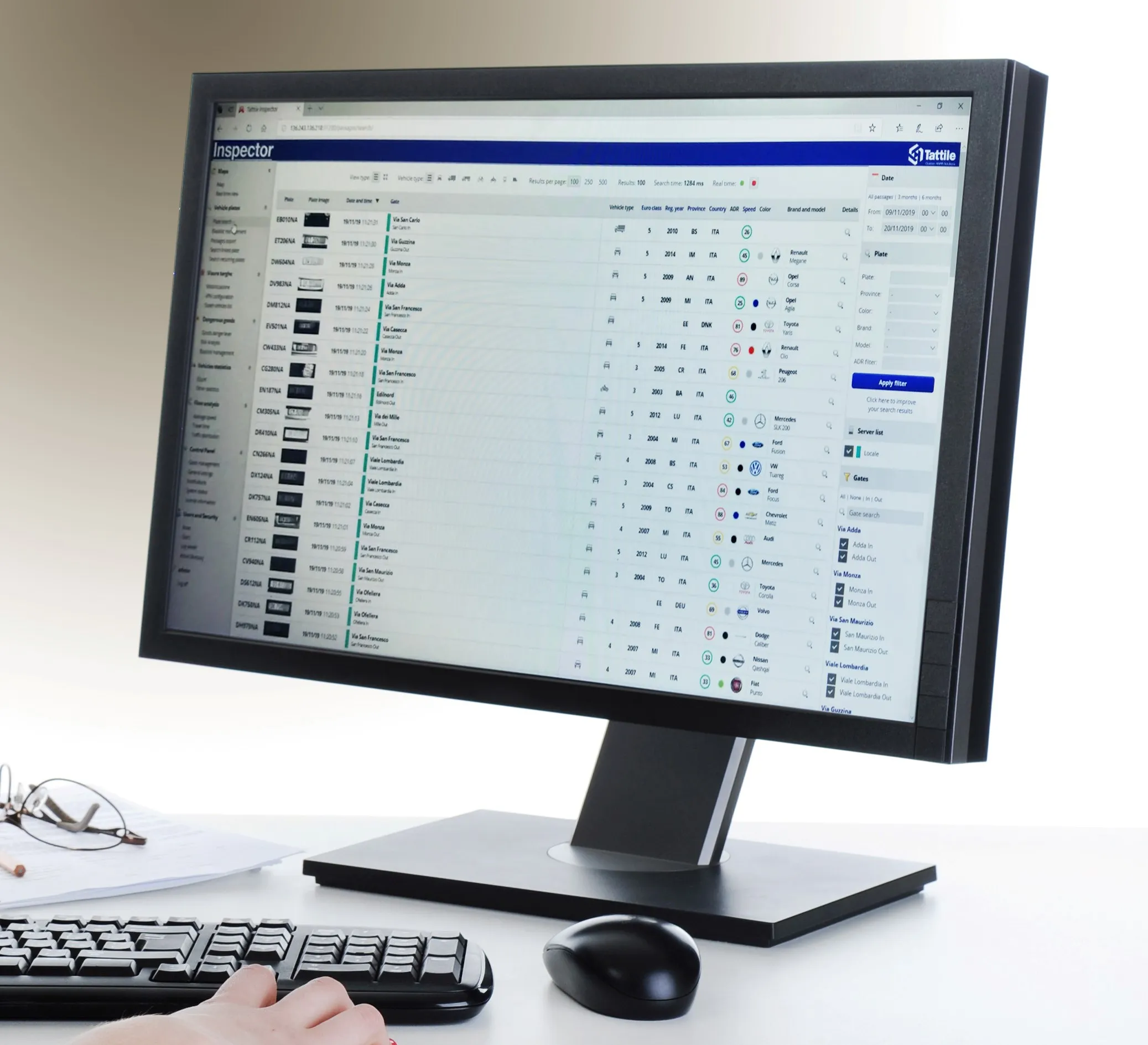
Tattile Inspector screen display (Credit: Tattile)

The Tattile Inspector is expected to store photos and number plate details by a given number of connected cameras in a database. The software collects and analyses the pictures and is also expected to generate a full transit analysis down to specific vehicles which can be identified by number plate, vehicle brand, colour and class. It can then send reports via SMS or email to enable authorities to take quick action for when a vehicle is stolen or involved in a crime, the company adds. 

Through several plug-in options, the Inspector database search can be adjusted to include automatic incident detection alarms from Tattile Rigel, such as wrong-way driving or pedestrians in the road area. 

According to Tattile, users can perform a car profile through filtering based on physical parameters as well as matching a pre-load list of known faces with faces detected on the pictures taken from drivers. 

Additionally, the software can be connected to the Italian national plate and transit database called SCNTT (Sistema Centralizzato Nazionale per Transiti e Targhe). Users can check number plates for valid insurance, revision data and province registration. 
 

Related Content

  • Car2X data analysis from Nordsys
    October 8, 2015
    Nordsys has unveiled its mobile test and diagnosic tool for car2x communication environments. The waveBEE touch system is a ruggedised tablet computer that receives wireless communication based on Europe’s ETSI/ITS and the US’s IEEE WAVE specifications and enables the operator to analyse car2X messages in detail.
  • Bus lane enforcement reduces costs, journey times
    May 4, 2012
    The Southcote Lane site in the UK town of Reading is a notorious shortcut for motorists travelling into the town centre. The resultant congestion at the end of the bus lane, when motorists tried to re-enter the main traffic flow, caused congestion and disruption to bus timetables. Reading Borough Council wanted a cost-efficient, effective solution to accurately capture bus lane violations and improve bus travel times. Reading became the first local authority in the UK to deploy Siemens's LaneHawk fully auto
  • The inside story of how traffic chaos was avoided after I-95 collapse
    August 23, 2023
    June’s collapse of major US roadway I-95 in Pennsylvania could have caused lengthy traffic chaos. But - relatively speaking at least - it didn’t and gridlock was avoided. Alan Dron finds out why
  • In vehicle systems allow drivers to provide travel information
    July 27, 2012
    The use of a Vehicle Data Translator will allow every vehicle on a given segment of road to contribute to a highly accurate, readily accessible source of localised weather information, thus improving safety in all conditions. Sheldon Drobot and William P. Mahoney III, US National Center for Atmospheric Research, Paul A. Pisano, USDOT/Federal Highway Administration, and Benjamin B. McKeever, USDOT/Research and Innovative Technology Administration, write. On the morning of June 10 2009, under the cover of den