Number plate analysis tool from Tattile

Tattile has unveiled a software tool which it says enables users to aggregate and analyse data of all connected cameras in a given area. 
By Ben Spencer January 24, 2020 Read time: 1 min
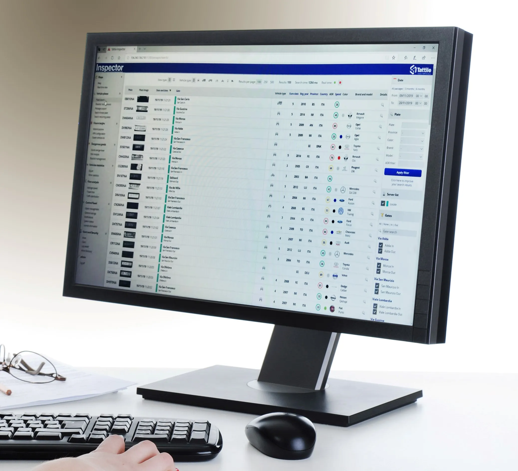
Tattile Inspector screen display (Credit: Tattile)

The Tattile Inspector is expected to store photos and number plate details by a given number of connected cameras in a database. The software collects and analyses the pictures and is also expected to generate a full transit analysis down to specific vehicles which can be identified by number plate, vehicle brand, colour and class. It can then send reports via SMS or email to enable authorities to take quick action for when a vehicle is stolen or involved in a crime, the company adds. 

Through several plug-in options, the Inspector database search can be adjusted to include automatic incident detection alarms from Tattile Rigel, such as wrong-way driving or pedestrians in the road area. 

According to Tattile, users can perform a car profile through filtering based on physical parameters as well as matching a pre-load list of known faces with faces detected on the pictures taken from drivers. 

Additionally, the software can be connected to the Italian national plate and transit database called SCNTT (Sistema Centralizzato Nazionale per Transiti e Targhe). Users can check number plates for valid insurance, revision data and province registration. 
 

Related Content

  • Big data helps San Diego optimise public transit
    July 14, 2014
    San Diego Metropolitan Transit System (MTS) has turned to Cubic’s big data subsidiary Urban Insights to make better use of its data, according to a report in Information Week. The agency has disparate data sources, including a smart-card payment system, GPS-based automatic vehicle location devices on buses, automatic passenger counters on trolleys, and extensive route and schedule information formatted in the general transit feed specification (GTFS) format developed by Google in 2006. "We look at all
  • Nokia delivers China landslide warning system 
    April 3, 2020
    Nokia has delivered a landslide monitoring and early warning system for highway operations management company BGIGC in China.
  • Idris paves the way for loop based speed enforcement
    February 1, 2012
    With the Idris system now validated as a speed verification tool, the way is open for loops to be used in more complex enforcement applications. Diamond Consulting Services (DCS), developer of the Idris inductive loop-based vehicle detection and classification system, has recently successfully conducted validation trials which, the company says, open the way for Idris to be used for speed verification and loop-based sensors to be used for more complex applications such as speed-on-green and differential spe
  • Integrated corridor management aids multi-modal transport planning
    January 24, 2012
    Telvent’s Jorgen Pedersen and Tip Franklin discuss how integrated corridor management can create synergies within a multimodal transportation infrastructure, while promoting modal shift. The mantra ‘We cannot build ourselves out of congestion’ has long been stated and too often ignored. But with the economy in dire straits, funding deficits and pressure to reduce governmental spending, this is now being taken seriously by almost everyone who has an interest in the flow of traffic. By ‘everyone’ we include