Number plate analysis tool from Tattile

Tattile has unveiled a software tool which it says enables users to aggregate and analyse data of all connected cameras in a given area. 
By Ben Spencer January 24, 2020 Read time: 1 min
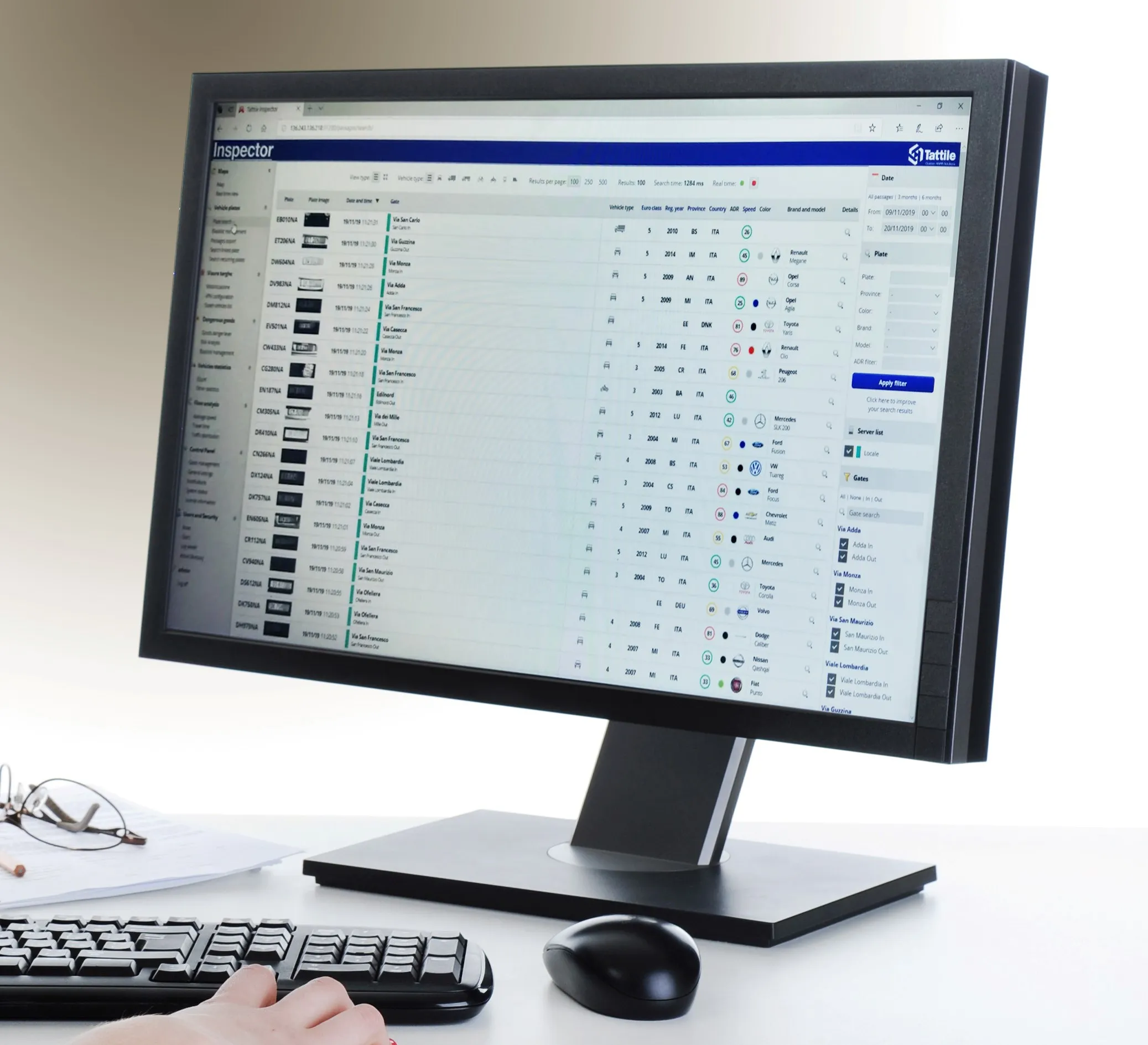
Tattile Inspector screen display (Credit: Tattile)

The Tattile Inspector is expected to store photos and number plate details by a given number of connected cameras in a database. The software collects and analyses the pictures and is also expected to generate a full transit analysis down to specific vehicles which can be identified by number plate, vehicle brand, colour and class. It can then send reports via SMS or email to enable authorities to take quick action for when a vehicle is stolen or involved in a crime, the company adds. 

Through several plug-in options, the Inspector database search can be adjusted to include automatic incident detection alarms from Tattile Rigel, such as wrong-way driving or pedestrians in the road area. 

According to Tattile, users can perform a car profile through filtering based on physical parameters as well as matching a pre-load list of known faces with faces detected on the pictures taken from drivers. 

Additionally, the software can be connected to the Italian national plate and transit database called SCNTT (Sistema Centralizzato Nazionale per Transiti e Targhe). Users can check number plates for valid insurance, revision data and province registration. 
 

Related Content

  • New analysis finds speed cameras may create bad driving behaviour
    October 28, 2015
    Using more than one billion miles of driving behaviour data, collected over three years (2011-2014) and including 8,809 separate journeys in 5,353 vehicles, Wunelli, a LexisNexis company, has revealed the most frequent braking black spots across the UK created by speed cameras, based on motorists braking excessively just before speed cameras to avoid being caught. Eighty per cent of all the UK speed cameras investigated had hard braking activity, with braking increasing six fold on average at these loca
  • The UK’s busiest crossing adopts free flow charging
    April 30, 2015
    Colin Sowman looks at the transition to free-flow charging on the Dartford Crossing, a notorious congestion blackspot on the UK motorway network. The Dartford Crossing, where London’s orbital M25 motorway crosses the lower reaches of the River Thames 32km (20 miles) to the east of Central London, has long been a major source of congestion. Now, to alleviate the congestion caused by some 50 million crossings per year, the Highways Agency has adopted a free-flow charging system - but the Crossing’s location a
  • Huawei addresses congested, separated rail networks with cloud solution
    December 20, 2024
    A shift to a cloud-based operating regime solves the problems of trying to make cluttered, geographically-discrete terrestrial systems work together
  • US Cities push for smarter poles
    June 25, 2018
    US Cities The need to connect existing infrastructure has led various US transit authorities into imaginative alleyways: David Crawford examines some new roles for street furniture. US cities are vying with each other in developing schemes to create a new generation of connected places. Their strategies include taking advantage of their streetlight poles’ height and ubiquity to give them new roles in supporting intelligent nodes. They are now being equipped for collecting real-time data on key transport