Number plate analysis tool from Tattile

Tattile has unveiled a software tool which it says enables users to aggregate and analyse data of all connected cameras in a given area. 
By Ben Spencer January 24, 2020 Read time: 1 min
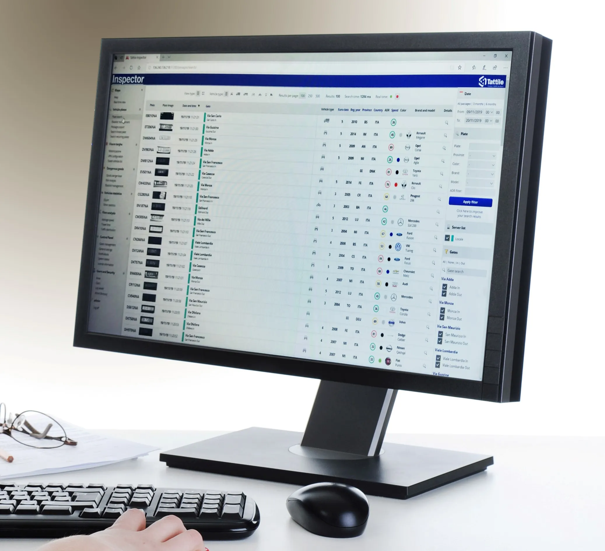
Tattile Inspector screen display (Credit: Tattile)

The Tattile Inspector is expected to store photos and number plate details by a given number of connected cameras in a database. The software collects and analyses the pictures and is also expected to generate a full transit analysis down to specific vehicles which can be identified by number plate, vehicle brand, colour and class. It can then send reports via SMS or email to enable authorities to take quick action for when a vehicle is stolen or involved in a crime, the company adds. 

Through several plug-in options, the Inspector database search can be adjusted to include automatic incident detection alarms from Tattile Rigel, such as wrong-way driving or pedestrians in the road area. 

According to Tattile, users can perform a car profile through filtering based on physical parameters as well as matching a pre-load list of known faces with faces detected on the pictures taken from drivers. 

Additionally, the software can be connected to the Italian national plate and transit database called SCNTT (Sistema Centralizzato Nazionale per Transiti e Targhe). Users can check number plates for valid insurance, revision data and province registration. 
 

Related Content

  • Queensland extends emergency vehcile priority system
    December 18, 2014
    Following encouraging results from an initial small-scale trial of an emergency vehicle priority system in Queensland, Australia, the scheme is now being extended. In an emergency every second counts. Nowhere is this more graphically illustrated than by the survivability statistics for the time to cardiopulmonary resuscitation of pre-hospital cardiac arrest: at four minutes the survival rate is 22% but by 14 minutes the survival has dropped to 5% - as can be seen from the graph below. There is a similar tre
  • Fara keeps data delivery simple
    January 25, 2018
    Simplifying the delivery of data and information gathered by traffic management, ticketing and other systems can improve travel efficiency and the traveller’s experience. Having quantified and analysed the previously unmonitored movement of road vehicles, trains, metros, cyclists and pedestrians, the ITS sector is a prime example of the digital world. Patterns discerned from those previously random happenings enable authorities to design more efficient transport systems, allow transport operators to run
  • Clearview launches Journey Time Monitoring System
    December 14, 2018
    Clearview Intelligence has launched its Journey Time Monitoring System which uses crowdsourced data to generate automatic traffic alerts for temporary and permanent routes. Paul Bates, head of product management for Clearview, says the system – which analyses anonymous GPS-determined locations transmitted by mobile phone and satellite navigation users - removes the need for installing and maintaining roadside technology. Operators can launch the application from a computer and receive data in minutes.
  • Integrated transport and car parking smartcards for Perth
    August 28, 2014
    Developed by Parkeon engineers in the UK in conjunction with the Public Transport Authority of Western Australia, the SmartParker system enables public transport users in Perth to pay for car parking using their SmartRider smartcards. The new SmartParker system, developed by Parkeon in conjunction with the Public Transport Authority of Western Australia, is in operation at Transperth train stations and card users can now link parking payments to their SmartRider travel smartcards. The machines are alread