Number plate analysis tool from Tattile

Tattile has unveiled a software tool which it says enables users to aggregate and analyse data of all connected cameras in a given area. 
By Ben Spencer January 24, 2020 Read time: 1 min
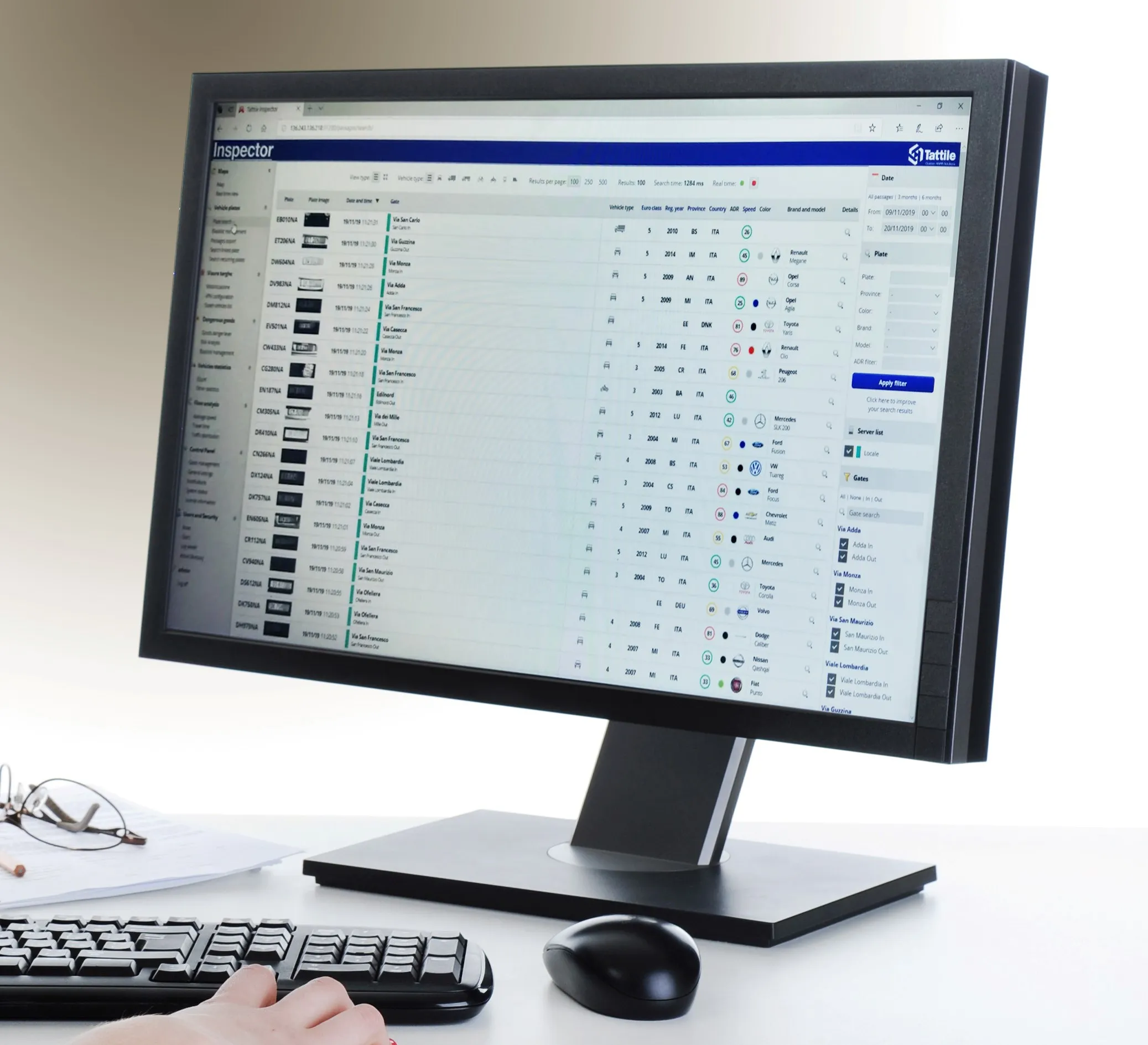
Tattile Inspector screen display (Credit: Tattile)

The Tattile Inspector is expected to store photos and number plate details by a given number of connected cameras in a database. The software collects and analyses the pictures and is also expected to generate a full transit analysis down to specific vehicles which can be identified by number plate, vehicle brand, colour and class. It can then send reports via SMS or email to enable authorities to take quick action for when a vehicle is stolen or involved in a crime, the company adds. 

Through several plug-in options, the Inspector database search can be adjusted to include automatic incident detection alarms from Tattile Rigel, such as wrong-way driving or pedestrians in the road area. 

According to Tattile, users can perform a car profile through filtering based on physical parameters as well as matching a pre-load list of known faces with faces detected on the pictures taken from drivers. 

Additionally, the software can be connected to the Italian national plate and transit database called SCNTT (Sistema Centralizzato Nazionale per Transiti e Targhe). Users can check number plates for valid insurance, revision data and province registration. 
 

Related Content

  • Detection analysis technology successfully predicts traffic flows
    February 3, 2012
    David Crawford investigates new detection analysis technology from IBM. Locations on both the East and West Coasts of the US are scheduled for early deployments of IBM's new Traffic Prediction Tool (TPT) statistical analysis model for the fine-time resolution and near-term prediction of road flow conditions. Developed by IBM's Watson Research Laboratories, TPT is designed to analyse data from the the key detection indicators - average vehicle volumes and speeds passing a location in a given time interval -
  • Development of cooperative driving applications for work zones
    July 17, 2012
    The German AKTIV project is researching several cooperative driving applications for use in work zones. PTV's Michael Ortgiese details progress. The steep increases in traffic volumes predicted back in the early 1990s have unfortunately been proven to be more than accurate. In Germany, the AKTIV project continues to look into cooperative technologies' potential to reduce the impact of those increased traffic volumes and keep traffic moving despite limitations in infrastructure capacity.
  • New markets for travel information apps
    November 26, 2013
    Purpose-designed travel information apps are emerging to support the real estate market in the US – and potentially more widely – in a major diversification away from the conventional automotive and navigation device sectors. In July 2013, Washington State-based Imprev, which develops web-based marketing support aids for realtors, announced its App Generator. Claimed as an industry first, this enables property businesses to create their own branded mobile apps to give away as marketing tools to potential
  • SPONSORED CONTENT: Using AI to achieve real traffic intelligence
    June 3, 2020
    The application of artificial intelligence has the potential to transform the performance of vision-based systems used for a wide and growing set of applications. These include vehicle presence detection and identification, count and classification, and enforcement, explains Roy Czinku of International Road Dynamics