Number plate analysis tool from Tattile

Tattile has unveiled a software tool which it says enables users to aggregate and analyse data of all connected cameras in a given area. 
By Ben Spencer January 24, 2020 Read time: 1 min
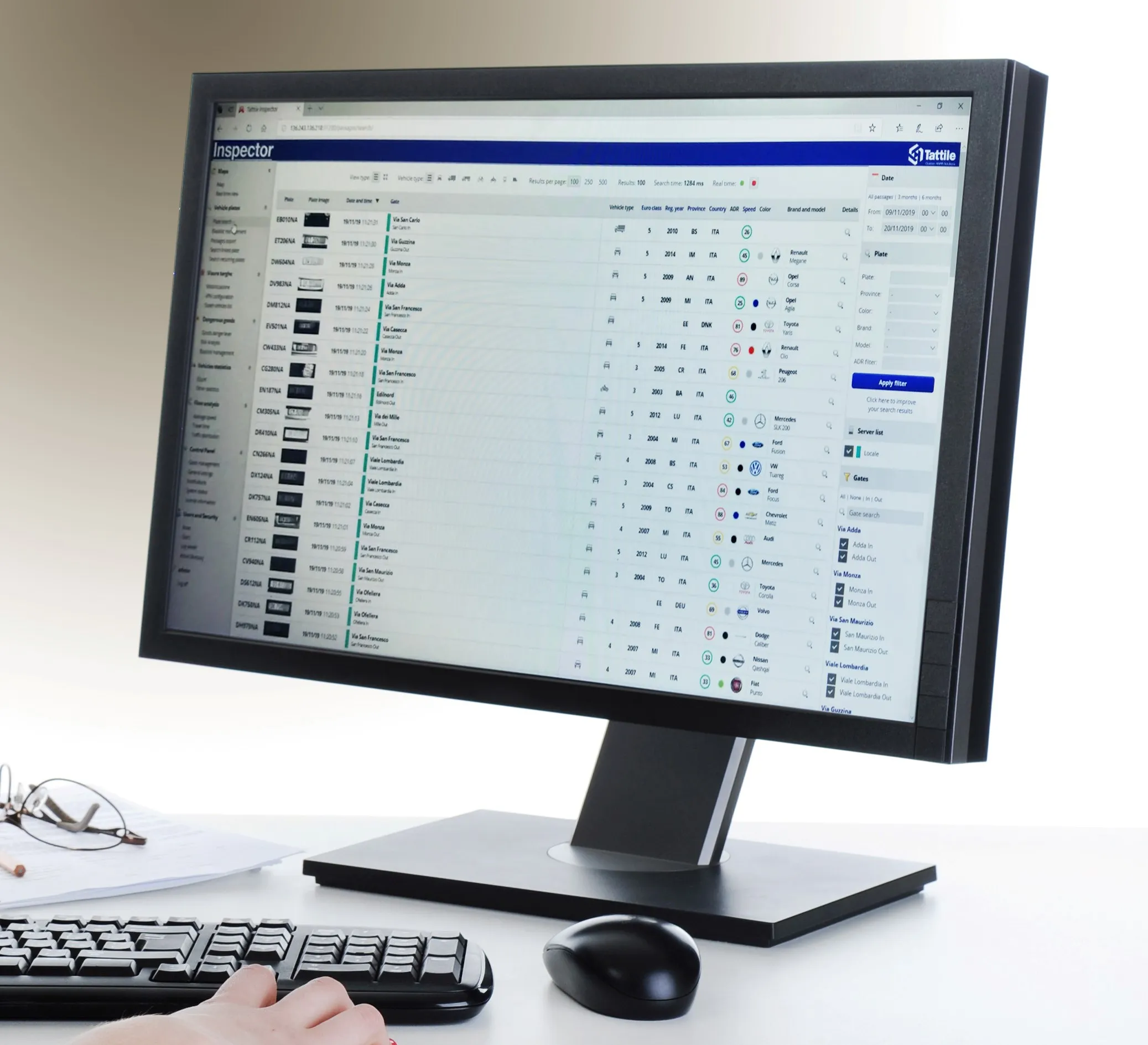
Tattile Inspector screen display (Credit: Tattile)

The Tattile Inspector is expected to store photos and number plate details by a given number of connected cameras in a database. The software collects and analyses the pictures and is also expected to generate a full transit analysis down to specific vehicles which can be identified by number plate, vehicle brand, colour and class. It can then send reports via SMS or email to enable authorities to take quick action for when a vehicle is stolen or involved in a crime, the company adds. 

Through several plug-in options, the Inspector database search can be adjusted to include automatic incident detection alarms from Tattile Rigel, such as wrong-way driving or pedestrians in the road area. 

According to Tattile, users can perform a car profile through filtering based on physical parameters as well as matching a pre-load list of known faces with faces detected on the pictures taken from drivers. 

Additionally, the software can be connected to the Italian national plate and transit database called SCNTT (Sistema Centralizzato Nazionale per Transiti e Targhe). Users can check number plates for valid insurance, revision data and province registration. 
 

Related Content

  • Cross border enforcement a logical step
    January 30, 2012
    The logic supporting a cross-border enforcement Directive for the European Union (EU) is both detailed and compelling. The White Paper on European transport policy published in 2001 included the ambitious objective of reducing by 50 per cent by 2010 the number of people killed on the roads of the EU. But since 2005 the reduction in the number of road deaths has been slowing down: overall, the period from 2001 until 2009 saw the number of fatalities decrease by 36 per cent. According to Community indicators,
  • SVS trials vehicle sensing tech in UK
    March 29, 2021
    Smartmicro solution includes a radar capable of monitoring 12 lanes of traffic
  • Gewi uses Waze data to initiate pothole repair projects
    March 14, 2017
    Gewi has announced a new component for its TIC software which will collect Waze data and automatically take action based on the specific event type and subtype, enabling the software to automatically create road repair projects based on user-generated pothole reports from Waze. The process uses the project feature of the software, which allows the user to decide what action to take when a pothole is reported, such as sending a notification to the maintenance department based on the pothole location. Furt
  • Evidence growing for distance-based charging
    January 18, 2012
    The case is growing for an alternative to fuel taxation for funding highway infrastructure. A more sustainable system of mileage-based charging can be established in a way that is acceptable to the travelling public, writes Jack Opiola. Fuel tax - the lifeblood relied on for 80 years to maintain and improve roads and transit systems - is now in considerable jeopardy in the United States. Increased vehicle fuel efficiency and a poor economy already hamper generation of fuel tax revenue; now a recent federal