
Number plate analysis tool from Tattile

Tattile has unveiled a software tool which it says enables users to aggregate and analyse data of all connected cameras in a given area. 
By Ben Spencer January 24, 2020 Read time: 1 min
Tattile Inspector screen display (Credit: Tattile)

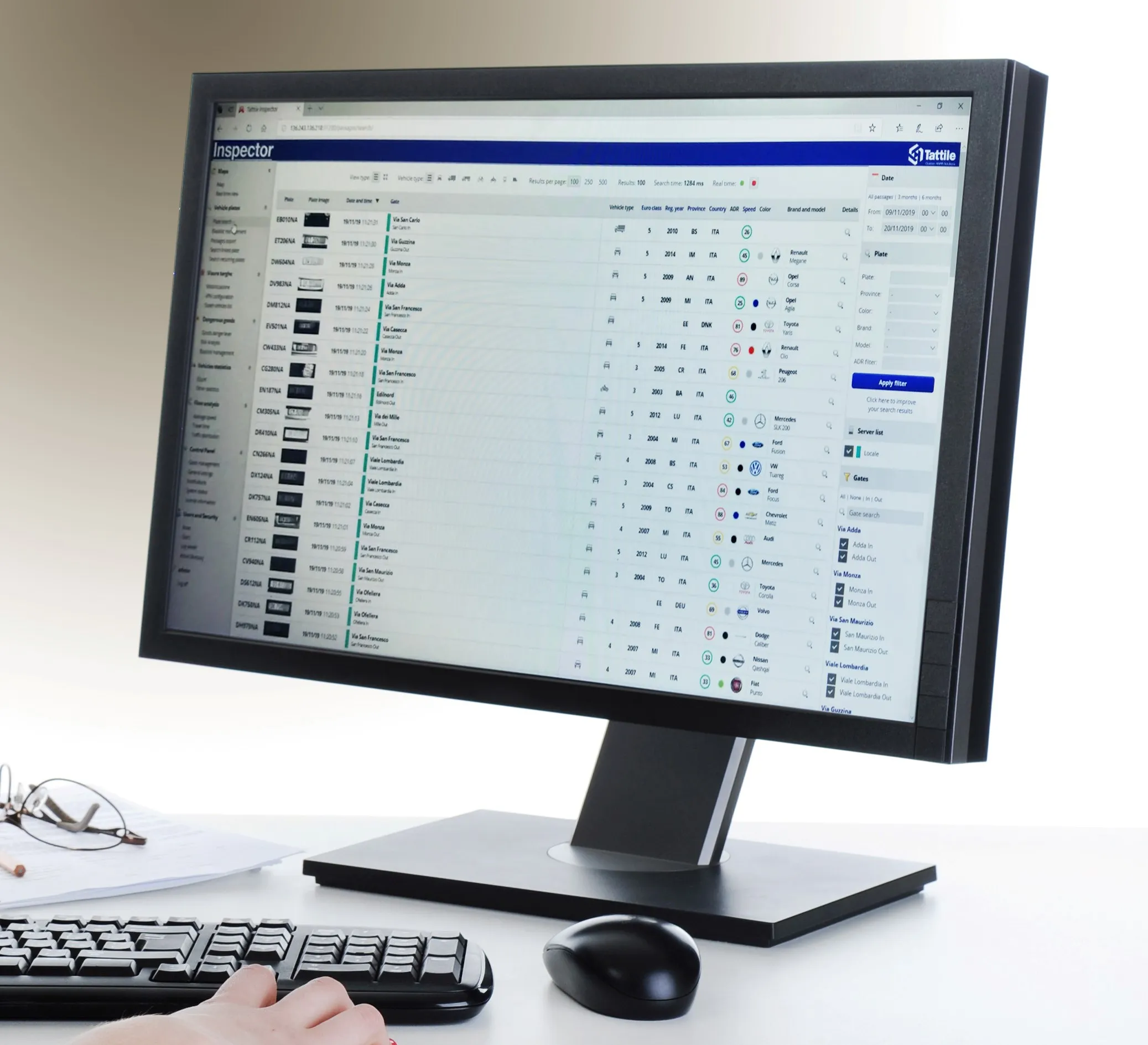
The Tattile Inspector is expected to store photos and number plate details by a given number of connected cameras in a database. The software collects and analyses the pictures and is also expected to generate a full transit analysis down to specific vehicles which can be identified by number plate, vehicle brand, colour and class. It can then send reports via SMS or email to enable authorities to take quick action for when a vehicle is stolen or involved in a crime, the company adds. 

Through several plug-in options, the Inspector database search can be adjusted to include automatic incident detection alarms from Tattile Rigel, such as wrong-way driving or pedestrians in the road area. 

According to Tattile, users can perform a car profile through filtering based on physical parameters as well as matching a pre-load list of known faces with faces detected on the pictures taken from drivers. 

Additionally, the software can be connected to the Italian national plate and transit database called SCNTT (Sistema Centralizzato Nazionale per Transiti e Targhe). Users can check number plates for valid insurance, revision data and province registration. 
 

Related Content

  • AWS finds new solutions
    December 8, 2021
    Forward-thinking public agencies are turning to a new breed of solutions provider to address current traveller needs. They work with system integrators, independent software vendors, and consultants to innovate using Amazon Web Services (AWS) to improve traffic safety, construction project management, analytics and reporting, and secure identification. Phil Silver, a state and local government transportation leader at AWS, provides examples of how builders on AWS are transforming transport using technology
  • Inrix aids authorities in dealing with data
    August 18, 2015
    New traffic data products and services have been launched to aid transport and urban planners and business with detailed intelligence on journey patterns, reports Jon Masters. Manual travel surveys ought soon to become a thing of the past for transport planners and the business community. The technology now exists for getting sophisticated levels of traffic and trip data from connected vehicles. Cars and commercial fleets carrying a GPS device, or a mobile phone or smartphone are the sources of the informat
  • Pedestrians still walking a tightrope in US
    August 23, 2024
    Although the Governors Highway Safety Association says annual US pedestrian traffic deaths fell for first time since Covid, they remain above pre-pandemic levels, finds David Arminas
  • Data collection becoming a crowded market
    October 26, 2017
    New ways of gathering data can revolutionise traffic and travel management, so is the writing on the wall for the traditional methods? Jon Masters reports. There are two big industries that stand to be revolutionised by massive increases in data – healthcare and transportation, says Finlay Clarke, the UK managing director of the smartphone sat nav traffic app, Waze. “At present we’re really only at the start of how cities, in particular, will be transformed,” he says.