The new Richmond Airport connector link road is now open to traffic. The link provides a direct connection from the Pocahontas 895 highway to Richmond International Airport and cuts journey time on this route. This 2.5km road is an extension of the Pocahontas 895 highway and links directly to Airport Drive at Charles City Road. The new road can save drivers around 10 minutes or more on a trip to the airport, especially those coming from Chesterfield County and the Tri-Cities area. Customers using the Airpor
The new Richmond Airport connector link road is now open to traffic. The link provides a direct connection from the Pocahontas 895 highway to Richmond International Airport and cuts journey time on this route.
This 2.5km road is an extension of the Pocahontas 895 highway and links directly to Airport Drive at Charles City Road. The new road can save drivers around 10 minutes or more on a trip to the airport, especially those coming from Chesterfield County and the Tri-Cities area.
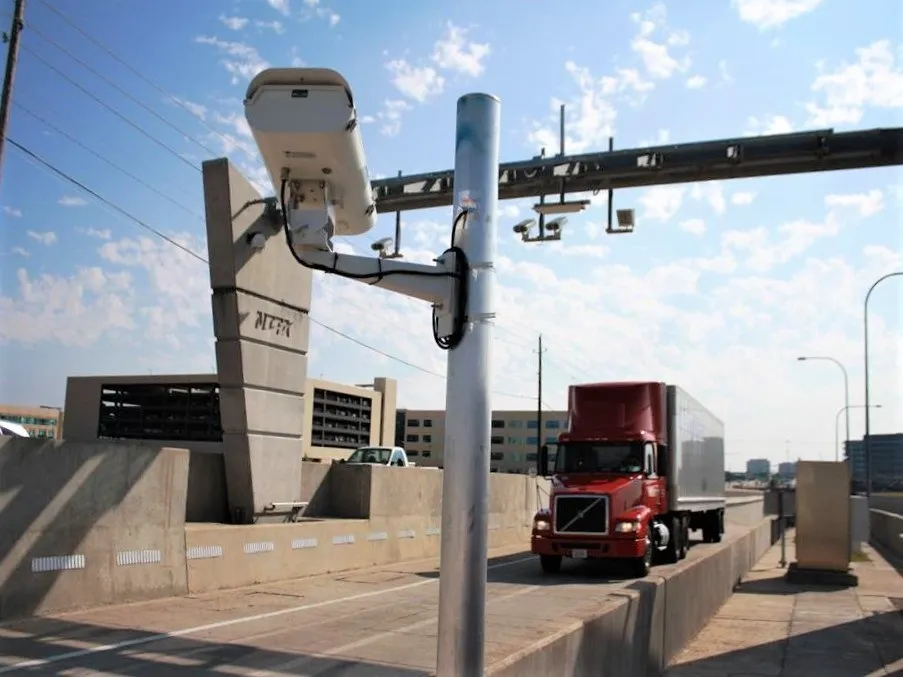
Customers using the Airport Connector pay the toll at the Pocahontas 895 Main Plaza, including those traveling to and from Chesterfield County. The do not pay again at the Airport Connector ramps. Only customers using the Airport Connector and traveling between the airport and Interstate 295 will pay $1.25 at the ramp linking the connector to Pocahontas 895. This toll will be collected electronically, with payment made by E-ZPass or Visa/Mastercard credit or debit cards.
600 Transurban operates and maintains Pocahontas 895 and financed and constructed the Airport Connector Road as part of a public-private partnership with 1747 Virginia Department of Transportation established in 2006. The project cost close to US$50 million but did not require funding from Virginia taxpayers and was supported through a loan provided by the US Federal Government and backed by Transurban.
The link was needed to handle increasing traffic volumes. Over the last decade, Richmond International Airport has been one of the fastest-growing airports in the US. Construction of the new road, designed and built by American Infrastructure, was completed approximately two months early. The project, which began construction in early 2009, boasted more than 665 days without a lost-time accident, the entire two-year length of the project.
Pocahontas 895 is a 14km toll road with an elevated bridge crossing the James River. It is located southeast of Richmond, Virginia, and links Interstate 95 at Chippenham Parkway (Route 150) with Interstate 295 to create a southeastern bypass of the city. It is the only crossing of the James River for 10km in either direction. The new road features sophisticated electronic tolling technology, which helps speed vehicle flow through the tolling area.
This 2.5km road is an extension of the Pocahontas 895 highway and links directly to Airport Drive at Charles City Road. The new road can save drivers around 10 minutes or more on a trip to the airport, especially those coming from Chesterfield County and the Tri-Cities area.
Customers using the Airport Connector pay the toll at the Pocahontas 895 Main Plaza, including those traveling to and from Chesterfield County. The do not pay again at the Airport Connector ramps. Only customers using the Airport Connector and traveling between the airport and Interstate 295 will pay $1.25 at the ramp linking the connector to Pocahontas 895. This toll will be collected electronically, with payment made by E-ZPass or Visa/Mastercard credit or debit cards.
The link was needed to handle increasing traffic volumes. Over the last decade, Richmond International Airport has been one of the fastest-growing airports in the US. Construction of the new road, designed and built by American Infrastructure, was completed approximately two months early. The project, which began construction in early 2009, boasted more than 665 days without a lost-time accident, the entire two-year length of the project.
Pocahontas 895 is a 14km toll road with an elevated bridge crossing the James River. It is located southeast of Richmond, Virginia, and links Interstate 95 at Chippenham Parkway (Route 150) with Interstate 295 to create a southeastern bypass of the city. It is the only crossing of the James River for 10km in either direction. The new road features sophisticated electronic tolling technology, which helps speed vehicle flow through the tolling area.