Peru highway speeds up incident detection time with Valerann

Average on Lima Expresa network was 12 minutes - now it's five with data fusion approach
By Adam Hill February 23, 2024 Read time: 2 mins
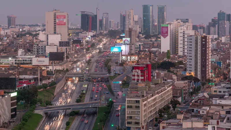
Traffic in Peru's capital, Lima (© Kirill Neiezhmakov | Dreamstime.com)

Peru’s Lima Expresa, a Vinci concession, says it has reduced detection of incidents on its highways following the introduction last year of Lanternn by Valerann.

The 25km road carries 180,000 vehicles per day, connecting the centre of Peru's capital Lima with the port and airport. 

Speaking on a webinar hosted by IBTTA, Francisco Chenguayen, general manager of Lima Expresa, explained that average incident detection time was 12 minutes, prior to the deployment of Lanternn. 

This could be quicker, he said, if the operator was looking at a monitor on the video wall which picked up the event. But in other cases it could be 20-25 minutes – with perhaps the incident only detected because the emergency services, such as the fire brigade, had arrived.

“Now the average is five minutes and there are events which are detected in even less time," confirmed Chenguayen. "This is helping a lot.”

The Lanternn by Valerann solution uses 'data fusion', bringing together information from a variety of sources such as Here and Waze as well as legacy infrastructure such as loops and cameras, to form a single view of traffic flow through the entire network. 

Michael Vardi, co-founder of Valerann, said: “Once you go to a data-centric approach which says 'bring me all the data sources, give me all the alerts from all the data sources', suddenly you have a complete view of what’s happening on the roads.”

Before, the control room was receiving around 400-450 alerts per week, but that has now doubled to 900-950 per week. With this increase comes some false positives, but Vardi explained that the company works to provide context for the customer, and narrow them down to the ones which require attention.

“Before Lanternn we didn’t know the exact time of the vehicle breaking down or when the accident took place because we had to move the camera around and identify it," Chenguayen confirmed. "So a driver could have been waiting for our support for 10-15 minutes before it was detected. Now we have the certainty that, as soon as something happens, we get that information.”

For more information on companies in this article

Related Content

  • Overture is open to the bigger picture
    June 18, 2024
    Four of the biggest players in the world of mapping have joined forces to create easy-to-use, interoperable open data that will power the next generation of maps. Kevin Borras talks collaborative interoperability with Overture Map Foundation’s Marc Prioleau and TomTom’s Willem Strijbosch
  • ITS sector must use less confusing industry terms says Q-Free
    December 23, 2015
    For ITS to gain the recognition it deserves, Q-Free’s Knut Evensen argues that the sector must have a coherent message and avoid confusing the wider community with a bewildering array of terms and acronyms. Any industry or group of people will develop its own lexicon over time. The process is near-inevitable, as individuals’ knowledge bases increase and evolve, and terms for common wisdom are created and become truncated, or even slang. A danger, though, as a relatively small group looks to admit large numb
  • Transport is evolving – and road safety must keep pace, says Parifex
    May 25, 2023
    France-headquartered Parifex works at the cutting edge of Lidar-based speed control systems. CEO Paul-Henri Renard discusses safety advances made in recent decades - and the causes of accidents that remain…
  • Data collection becoming a crowded market
    October 26, 2017
    New ways of gathering data can revolutionise traffic and travel management, so is the writing on the wall for the traditional methods? Jon Masters reports. There are two big industries that stand to be revolutionised by massive increases in data – healthcare and transportation, says Finlay Clarke, the UK managing director of the smartphone sat nav traffic app, Waze. “At present we’re really only at the start of how cities, in particular, will be transformed,” he says.