Rideflag Technologies is working with the San Francisco Bay Area Metropolitan Transportation Commission (MTC) on a multi-phased deployment of its high-occupancy vehicle (HOV) verification tool.
The Canadian company, based in the province of Ontario, recently showcased its occupancy detection smartphone app at the IBTTA Annual Meeting and Exhibition in Seattle in the US.
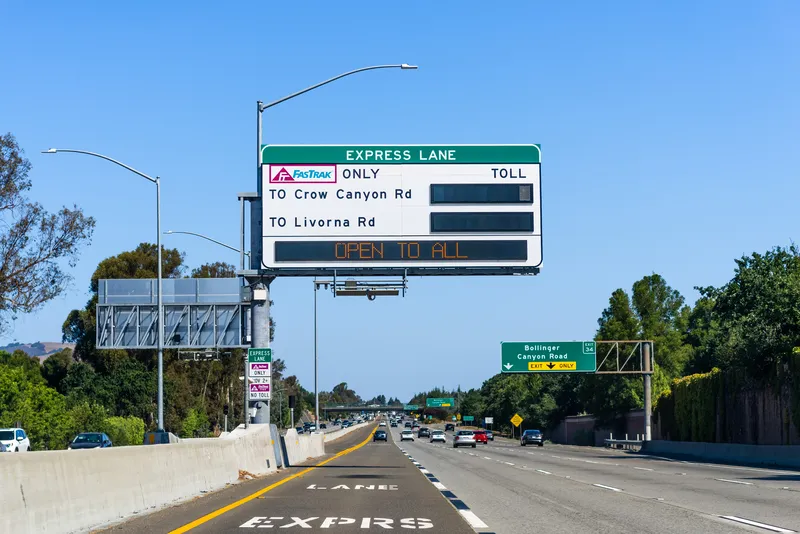
The Bay Area Express Lanes are a local network of managed lanes that are currently being implemented across the interstate highway through close coordination among regional agencies.
Rideflag says that the applicability of its technology is particularly relevant for MTC as the agency is planning to deploy the tool on one of the largest Express lane networks in the world, in addition to San Francisco’s Golden Gate and Oakland Bay bridges. MTC has around 125 lane-miles of operating Express Lanes in an overall planned regional network of 737 lane-miles.
Rideflag’s vehicle occupancy detection (VOD) camera technology accurately counts and verifies vehicle occupants. Using only one smartphone, carpoolers can declare and verify their occupancy in around five seconds or less. Verification can be completed with a face mask, sunglasses, in all lighting conditions and with children.
As well, the technology can be integrated with agency back-office systems through an API call or can directly connect with transponder readers. The app can also fully integrate with advanced agency customer relationship management tools.
Importantly, says Rideflag, while the technology counts the number of occupants within a vehicle and determines whether they are real, it cannot determine occupant identity.
The technology also does not continuously track a user’s location. It looks only at their route on the highway. The location data is gathered only in order to grant the correct HOV benefits to carpoolers.
RideFlag Technologies is partnering with the University of South Florida in the US and which received a research grant from the National Institute for Congestion Reduction.
In collaboration with the Center for Urban Transportation Research at the university, Rideflag’s VOD smartphone app is being tested on multiple express lane facilities to help further improve the technology and optimise its impact on creating new and sustained carpools.