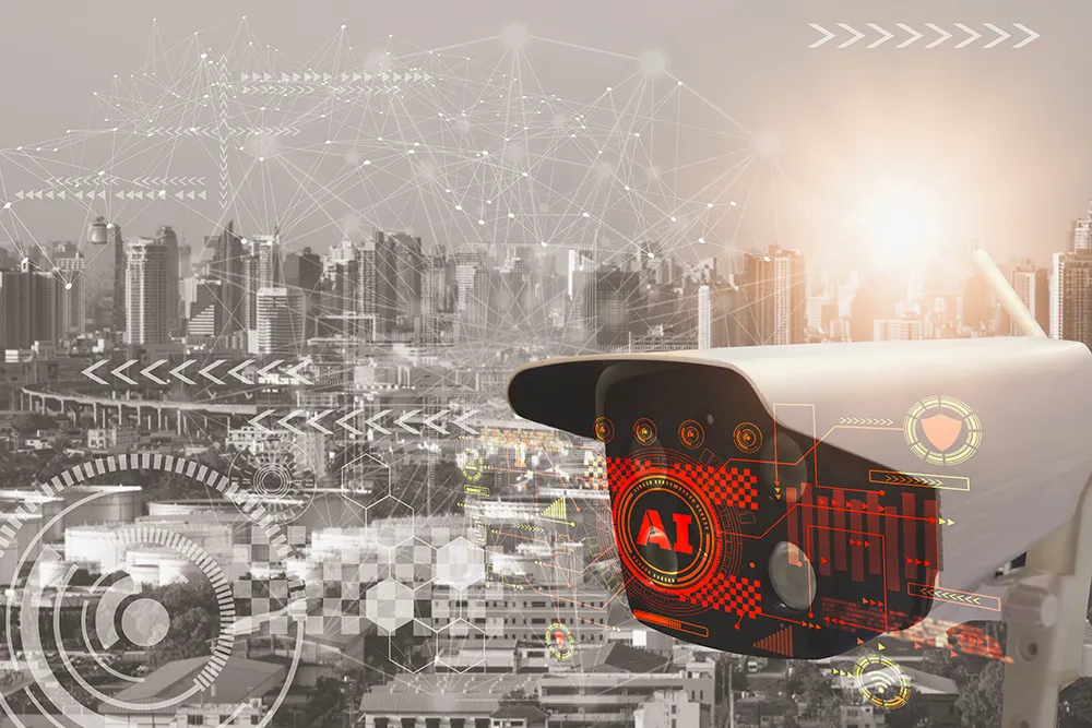
In a rapidly urbanising world, cities are facing a myriad of challenges to address the issues of today and prepare for the future. From new and improved technologies that are unlocking powerful data sets, to the increased popularity of electric vehicles (EVs), and the auto industry’s progress to making on-road automated vehicles (AVs) a reality, there’s a global push for enhancing roadway efficiencies, safety, and overall quality of life for residents.
Cities are seeking dynamic insights that can help inform strategies, each with its unique priorities – from cities in the Middle East, such as Dubai and Riyadh, that have launched ambitious smart city initiatives to diversify their economies, improve infrastructure, and enhance sustainability, to African cities, including Nairobi, Cape Town, and Lagos, that are investing in projects to address urbanisation challenges and improve services. However, there is at least one commonality between all smart cities: it is crucial for city planners and policymakers to access accurate data.
While census data can shed some light on the population and their lives, the most usable insights for city planning will come from understanding how space is used. That’s why cities are leveraging the granular insights afforded by 3D data, not only for their municipalities, but also for their broader regions, and others who could benefit from the technology. Use cases vary but mainly focus on the following applications…
Infrastructure management & planning
Data-enhanced resource management creates more efficient, and resilient systems which ultimately make streets safer and reduce the waste of government funds. Cities like Chattanooga, US, and Helsinki, Finland, are investing heavily in 3D data projects, such as digital twins, which when used for urban planning, could save cities over $280 billion annually by 2030. Incorporating 3D data into roadway planning and management processes enhances precision, efficiency, and safety while reducing costs and environmental impact. Advances in technology and data collection methods, such as Lidar, are making it increasingly accessible and valuable for cities to leverage.

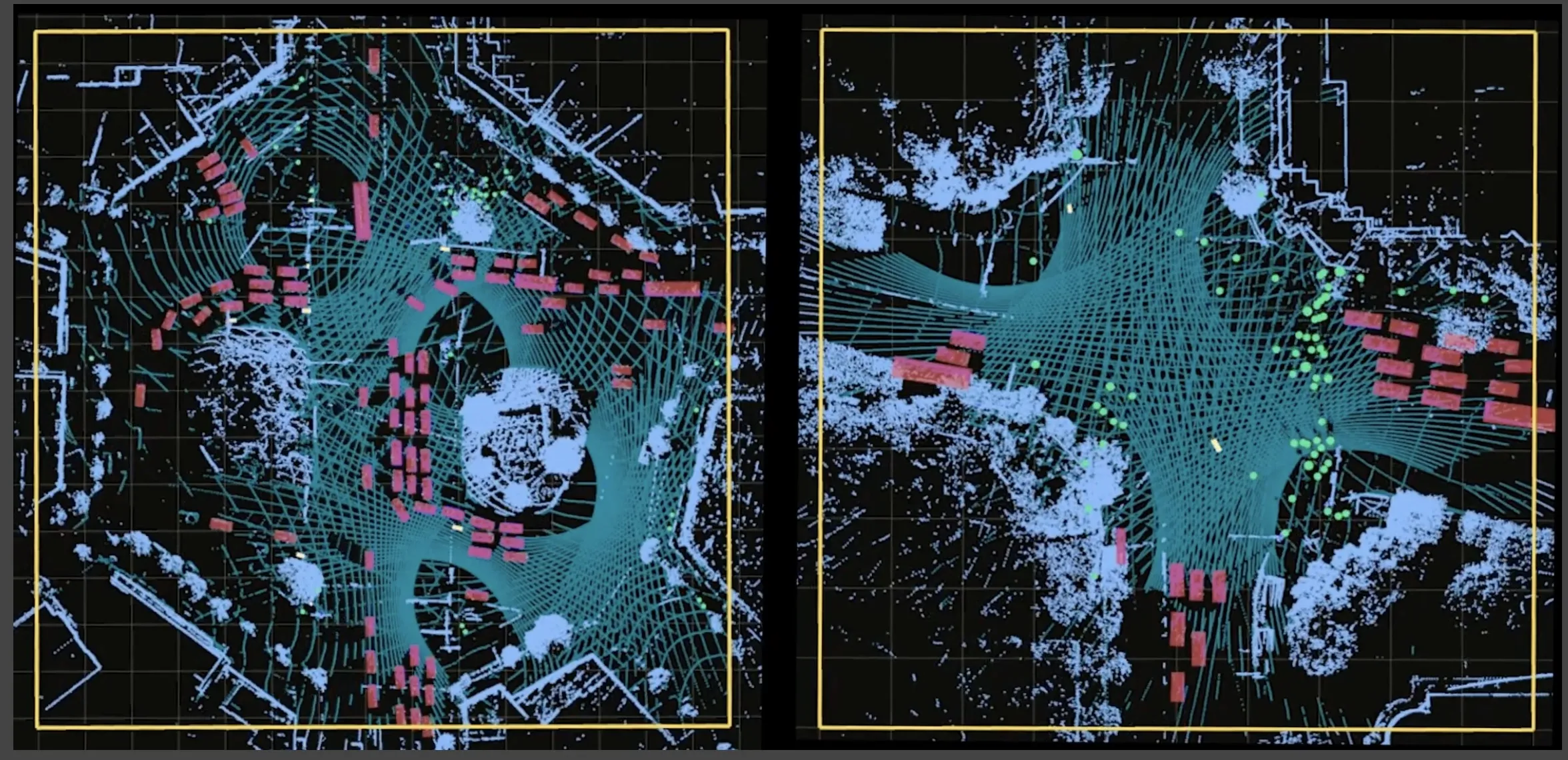
With 3D perception, cities can gain incredibly accurate and detailed analytics on the number, location, and velocity of even dense groups of people, cyclists and different vehicle types within zones equipped with 3D sensors. It’s also used for real-time monitoring of critical infrastructure, providing insights into road usage as well as congestion and contributing factors for a continuous assessment of the state of roadways.
The combination of these insights is invaluable for cities looking to optimise their infrastructure. By understanding traffic and pedestrian routes, city planners can better allocate resources for road maintenance, upgrades, and even safety measures such as adapting signage.
It also powers the identification of high-risk areas and gives a detailed look into accidents and near misses to understand the causes and ways to improve. For example, a city might find that pedestrians are frequently jaywalking at night, causing visibility issues for drivers and increasing the risk of collisions. This information indicates the city should install a pedestrian crossing with event-triggered light signals to enable safe passage.
What’s more, the 3D insights can be used to identify underutilised road space that could be transformed for EV infrastructure. It’s expected that by 2030, up to 86% of car sales will be electric. City planners are under immense pressure to deliver the infrastructure needed to make and support this reality. Charging stations are a key component of this mission and finding locations that are both convenient and don’t disrupt the flow of the city can be a major challenge, made easier with detailed road usage and traffic route data.
How do we optimise urban traffic management?
With 68% of the population expected to live in urban areas by 2050, cities are looking for intelligent ways to optimise traffic. 3D insights into traffic flow and road conditions are being used to unveil patterns for this very reason. Findings can be leveraged to develop more effective traffic signal timing, monitoring, and could even be used to inform dynamic route guidance.
Real-time insights also empower real-time decision-making. One notable application is Seoul Robotics' intersection traffic solution, which uses AI to transform real-time raw 3D data into actionable insights. It’s able to proactively interpret intersection activities based on real-time and statistical data, as opposed to relying on physically triggered signals, and uses standard communication protocols to share highly accurate insights on object location, travel direction, and speed with the various traffic controllers used by cities.
“3D insights can be used to identify underutilised road space that could be transformed for EV infrastructure”
Effective traffic management isn't solely beneficial for drivers—it's also critical for the safety of vulnerable road users such as cyclists and pedestrians. Innovations like the intersection traffic solution ensure pedestrian safety by accurately identifying and mitigating road risks. This includes measures like identifying a slow pedestrian traversing a multi-lane road and extending light signals based on their travel speed so they have time to cross safely.
Collaborate to unlock innovation
The key to success in smart city development is not only the adoption of 3D perception technology but also the sharing of data and insights among cities. Collaboration between cities can accelerate innovation and standardisation in the smart city technology industry. By pooling resources and knowledge, cities can address urban challenges and unlock economic opportunities while enhancing security and promoting data monetisation.
While generating deeper insights into a city is needed to build for the future, enhanced communication between local, county and state governments is equally critical. Recently, the Center of Urban Informatics and Progress (CUIP) at the University of Tennessee at Chattanooga has been working on a data integration platform to make the 3D data it collects accessible between government departments. This platform aims to provide a centralised repository for transportation-related data, allowing local agencies to share information and improve resource allocation.
The benefits of improved communication between government entities are manifold. It allows for more efficient resource allocation, streamlined decision-making processes, and a holistic view of transportation networks, which is essential for the success of connected vehicles. When local, county, and state governments collaborate and share data, the entire transportation ecosystem becomes more efficient, safer and better prepared for the future.
Next-gen vehicles
As the next generation of vehicles approaches, departments of transportation now need to focus on bridging the gaps between vehicles and the city itself. Vehicles will always be limited by their vantage point, meaning blind spots are an inevitability – especially in older cities with narrow, winding roads like in Europe, or those with high density like New York or in Asia. 3D sensors can help overcome these challenges when placed on the infrastructure surrounding roadways, like on traffic lights, buildings, and highway overhangs – these systems can comprehensively capture and communicate detailed analysis of an environment.
Connected vehicles - that is, vehicles which can use telematics to send and receive information about their surroundings - will be the first stage of this new generation of cars. Auto manufacturers are already installing these systems into new cars, and cities have the opportunity to leverage this technology. By providing accurate 3D information about road conditions, traffic patterns, and potential obstacles directly to connected vehicles, cities can enhance both their safety and efficiency.

3D technology will also enable a more seamless transition for AVs. Currently, AVs are being trained on data collected from vehicles equipped with cameras and sensors as they navigate the streets, but there’s a lot of information that is being missed.
Infrastructure-based 3D sensors can collect data 24/7 and provide an all-encompassing vision that is unprecedented for AVs. For example, these sensors will be able to bridge the gap of visibility for cars turning left on a multi-lane road by sharing details of the entire intersection activity from an unobstructed vantage point. Next-gen vehicles rely on high-resolution, real-time data to navigate and make decisions, and cities have the power to provide an additional layer of insight to make them even safer.
“The key to success in smart city development is…the sharing of data and insights among cities”
This next generation of vehicles has already begun to descend on city streets with autonomous ride-share becoming more common in major cities. What’s more, cities are making plans for autonomous public transport too. With connected vehicles and AVs increasingly relying on 3D perception for navigation and obstacle detection, this technology is already proving it will bring us closer to a safe future of autonomous transportation.
Future-proofing smart cities
As cities increasingly tap into the power of 3D perception technology to gain a deeper understanding of how people use their spaces, they're paving the way for improvements that will directly benefit their residents. The rising popularity of 3D perception technology will reimagine urban development, creating cities that are not just smarter, but more efficient and sustainable too.
As cities adapt and embrace smart data-driven initiatives, the integration of 3D technology and better communication between government entities will play a key role in future-proofing urban solutions. This includes managing traffic, integrating AVs, and a whole lot more. By leveraging this technology and fostering collaboration, cities worldwide are on track to create a brighter and more future-ready urban future for everyone.
ABOUT THE AUTHOR
William Muller is vice president of business development at Seoul Robotics