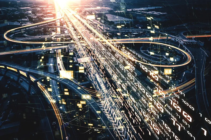
We are in the midst of a mobility revolution. The way people travel is shifting dramatically – from the rise of micromobility and last-mile rides over the last five years to the emergence of autonomous and connected vehicles in the coming five to 10 years.
However, the reality is that our cities and roads today need to adapt to these changes. Global road traffic fatalities continue to be at an all-time high, with almost 3,700 lives lost daily and with over 50% of those belonging to pedestrians and micromobility users. Simultaneously, traffic congestion continues to cost cities billions of dollars every year, in addition to increasing carbon dioxide levels and increasing the risk of car crashes.
As we enter the next decade of rapid innovation in transportation and mobility, it is our collective responsibility to build towards a data-driven smart city that is safe and efficient for all road users.
Building blocks of a smart city
The backbone of a smart transportation infrastructure is real-time, accurate and actionable data that can be communicated and accessed by all users within the space. Achieving this requires:
- Accurate and consistent data on all road users, road conditions, and the surrounding infrastructure through all hours of the day and under varied external conditions.
- Real-time, low-latency communications among the sensors, on-road vehicles, and road users. The ubiquity of 5G connectivity is rapidly enabling data to be passed onto connected vehicles and road users to inform real-time decisions.
- Data transparency to secure citizen buy-in, trust and engagement.
It starts with the data
While it’s true that many transportation agencies have a wealth of data, they are often forced to trade off between the completeness and sophistication of the data versus the total costs of collecting and ingesting the data.
As exemplified by the rise of ‘camera-plus-radar’ combined solutions, the industry is realising that one legacy technology alone is not sufficient to power the mobility of the future. Cameras still suffer in low light or inclement weather; radar often suffers with detection of smaller and slower objects due to its lower resolution. The result is the need for numerous detection systems to cover a single area for redundancy, or simply accepting that there’ll be gaps in the data.
The next generation of traffic detection systems must go beyond the capabilities of cameras, radar and loops combined. So just like autonomous vehicles manufacturers, cities are turning to a more advanced detection system: the Lidar sensor.
Lidar: the eyes of infrastructure
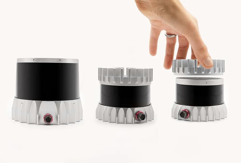
Lidar (light detection and ranging) uses lasers to scan and create a 3D model of the environment. Lidar combines the high-resolution imagery of a camera with the all-day reliability of radar, resulting in accurate data 24/7 and in the most extreme weather conditions. This means being able to detect pedestrians jaywalking at night and vehicles driving through a foggy morning, serving as the reliable pair of ‘eyes’ for any transportation infrastructure.
Lidar is becoming more ubiquitous for several reasons.
Accurate data, privacy-safe
Lidar’s high-resolution output opens up possibilities of advanced classification of objects, including different classes of vehicles, two-wheelers and pedestrians - all with a single sensor.
Additionally, Lidar captures important metrics that were previously challenging or expensive to collect. This includes the exact 3D coordinates, speed, velocity and trajectory of each object to inform transportation planning and advanced applications such as near-miss analysis. This is a necessary step towards data-driven decision-making, of understanding where, why, and how accidents happen, where to prioritise resources and how to quantify improvements.
Lidar also never captures any facially-recognisable information, ensuring data complies with GDPR and other privacy regulations. Gaining citizen trust is critical in any smart city programme, and selecting a privacy-safe technology is a necessary step.
Other factors to consider
While all Lidar sensors provide the benefits of privacy-safe 3D detection, not all Lidar is created equal. There are a few additional factors to consider:
- Resolution of the sensors. Today, Lidar sensors range from 8 to 128 channels of resolution, with higher resolution being a key driver of the accuracy and range at which objects can be detected.
- Reliability of the sensors. This includes the IP-rating (especially important for extended outdoor use!), ability to sustain shock and vibration conditions, and overall performance reliability. Understanding these factors can help reduce headaches and costs in the long term, minimizing the need for regular recalibrations and maintenance.
- Future-proofing the technology. Choosing Lidar is an investment for the future, so selecting a sensor that can adapt and adjust with the needs of tomorrow is critical. A good example is being able to expand detection capabilities without additional investments.
Lidar’s endless possibilities
From Vehicle to Everything (V2X) to pedestrian safety, the potential for Lidar is virtually limitless to help make cities safer and more efficient. As governments start preparing their infrastructure for the mobility revolution, we’re beginning to see the possibilities of Lidar - from immediate projects to longer-term strategic initiatives.
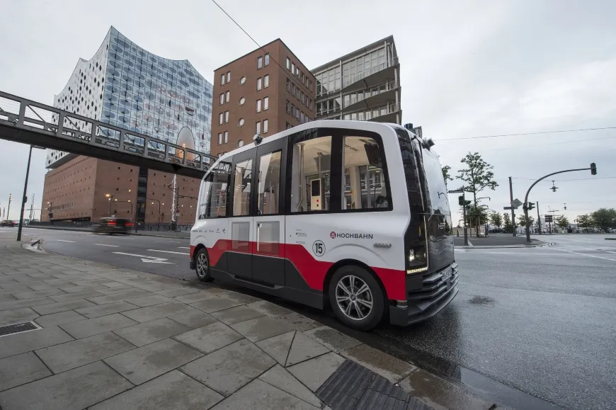
Imagine a pedestrian sprinting across the middle of a street at night, unaware of an incoming vehicle approaching from 50m away. A Lidar sensor, mounted on a lamp post, detects the pedestrian and immediately sends an alert to the driver and activates roadside signage with ‘Pedestrian Detected’ warning. Or imagine a bicyclist turning right at an intersection just as an autonomous shuttle approaches the same corner. A Lidar sensor, mounted on a traffic signal, detects the bicyclist and sends an alert to the autonomous shuttle that slows down immediately to avoid a collision.

These connected transportation ecosystems are exactly what municipalities such as Aachen, Germany, are pursuing.
This is the future of transportation. This is the future with Lidar.
ABOUT THE AUTHOR:
Itai Dadon is VP smart infrastructure at Ouster