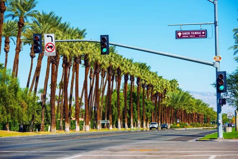
Traffic remains a universal challenge. Cities across the world must constantly manage congestion to allow vehicles and people to move freely, with ease and with minimal impact on air quality.
Those responsible for road infrastructure are local authorities and urban city planners. At the same time, these decision-makers are grappling with the impact and complexities of population growth, climate change and funding cuts.
Yet, innovative approaches to city infrastructure and road planning remain vital. The alternative is traffic congestion negatively impacting local economies and quality of life.
“Traffic shouldn’t just be about managing cars or making the situation better for cars - we need more than that”
Technology is one of the biggest tools we can use to tackle this challenge quickly and effectively. Urban planners can utilise real-time data for a clear view of road conditions – both past and present. This will empower them to minimise bottlenecks and improve flow while providing the insights necessary to transition to multi-model transportation networks with minimal disruption.
So, how can city planners get started on their transition to smarter, more resilient road networks? Particularly at a time when many are being tasked to do more with less.
Global gridlock problem
TomTom’s Traffic Index captures how people, goods and vehicles flow around cities each year. In 2024, before the introduction of the congestion charge, New York was found to have the slowest-moving traffic of any city in the US. On average, it took drivers just over 31 minutes to cover a typical 10 km trip. When traffic is free flowing, it is just 24 minutes.
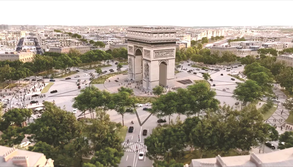
Meanwhile, TomTom’s latest analysis revealed that, across 2024, London was found to be the slowest-moving city centre in Europe, based on actual average travel times. The story gets worse during commuting hours, with the average 10 km journey during the morning peak hours taking 39 and a half minutes. In the evening, it takes 40 minutes.
While traffic in London and New York is consistently bad, we must head to Asia to see the single worst day of traffic. Sapporo, Japan witnessed its worst day of traffic on 17 January 2024, when travel times reached a staggering 47 and a half minutes for a 10 km trip.

This gridlock reflects several factors that city planners simply cannot control. After all, traffic doesn’t always react as you might expect; it’s unpredictable. Firstly, local authorities and urban planners have limited control over factors like residential and workplace locations. Secondly, commuter numbers are creeping back to pre-pandemic levels, compounded by a lack of viable alternatives to car travel in many cities across the globe. Thirdly, congestion will worsen in tandem with more cases of extreme weather conditions.
Looking ahead, city planners must harness mapping data to address the traffic issues they can influence — improving road networks, reducing congestion and ensuring smoother traffic flows.
Harnessing data-driven, multimodal transport networks
To solve congestion, we need to think about traffic beyond cars. Traffic shouldn’t just be about managing cars or making the situation better for cars - we need more than that.
The Traffic Index highlighted that cities which focused on stimulating new modes of transport to develop a more balanced transport network have reduced congestion. The typical examples are Amsterdam and Copenhagen – both cities are world leaders in multimodal transport networks, with locals regularly using a combination of cars, buses, trams, bikes and their feet to get around.
This modal split is something that must happen for the good of our cities. Reducing congestion isn’t about building more roads or rebuilding road networks for cars, it’s about giving space back to other modes of transport.
“Reducing congestion isn’t about building more roads or rebuilding road networks for cars, it’s about giving space back to other modes of transport”
To enable this transition, smart decisions need to be made. Standardised data will be central to helping city councils, governments and urban planners make the best-informed decisions to improve the flow of multimodal transportation in their cities.
A mapping partner can provide real-time visibility by leveraging a large volume of data from road networks and connected devices. Ideally, they should draw data contributions from up to one in three vehicles in your city. This level of data penetration will ensure highly accurate measurement and reliability for all stakeholders.
Above all, the accuracy and granularity of this data will enable better-informed decisions. From pinpointing congestion hotspots and identifying underused roads, to rerouting vehicles and addressing emergency road closures, real-time data will ensure these decisions are timely and effective. Local authorities and city planners will drive meaningful change by harnessing real-time data on city-wide traffic conditions and comparing this with year-round data.
Building smarter cities
In the smart cities of the future, congestion will be a thing of the past, efficiency will be the norm, and multimodal transport will be commonplace. To enable this future, effective traffic management will remain a critical element of urban planning. How effective it is, though, depends on data. Only with a single view of city infrastructure for data-driven decision-making will cities become thriving urban environments that are more liveable, sustainable and efficient.

ABOUT THE AUTHOR
Andy Marchant is traffic expert at TomTom